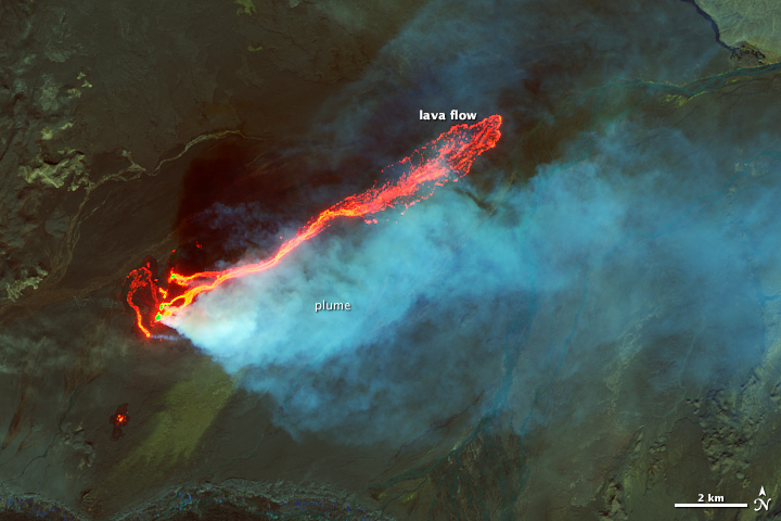
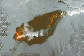
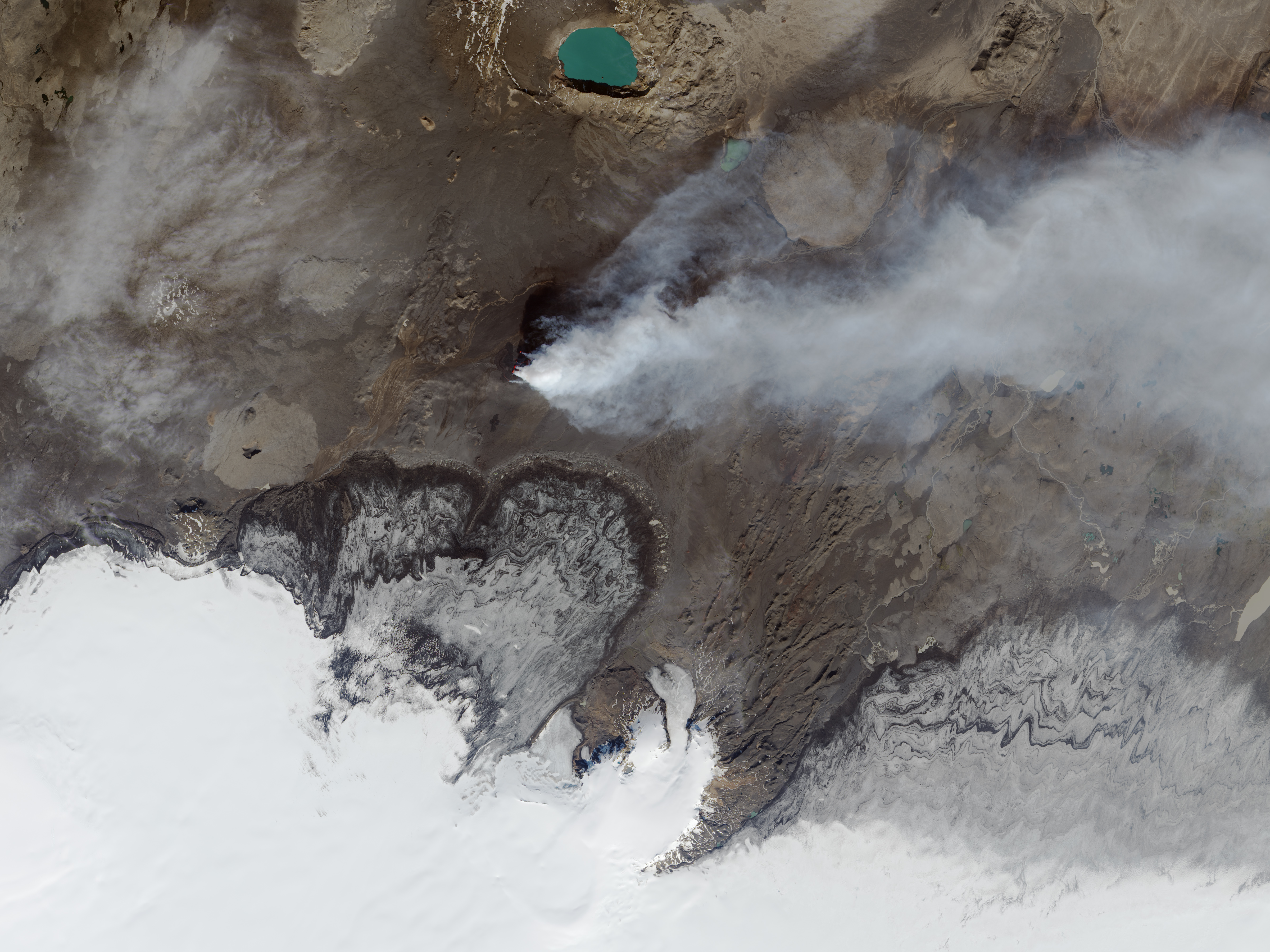
As an island in the moist, atmospherically turbulent North Atlantic, Iceland is often shrouded in cloud cover and hard to observe from space. And lately, the island is making some of its own cloud cover, as the Earth has split open between the Bardarbunga and Askja volcanoes and spewed lava and hot gas. The view of the Holuhraun lava field has been spectacular from the ground and from low-flying aircraft. Infrared imaging makes the view spectacular from space, too.
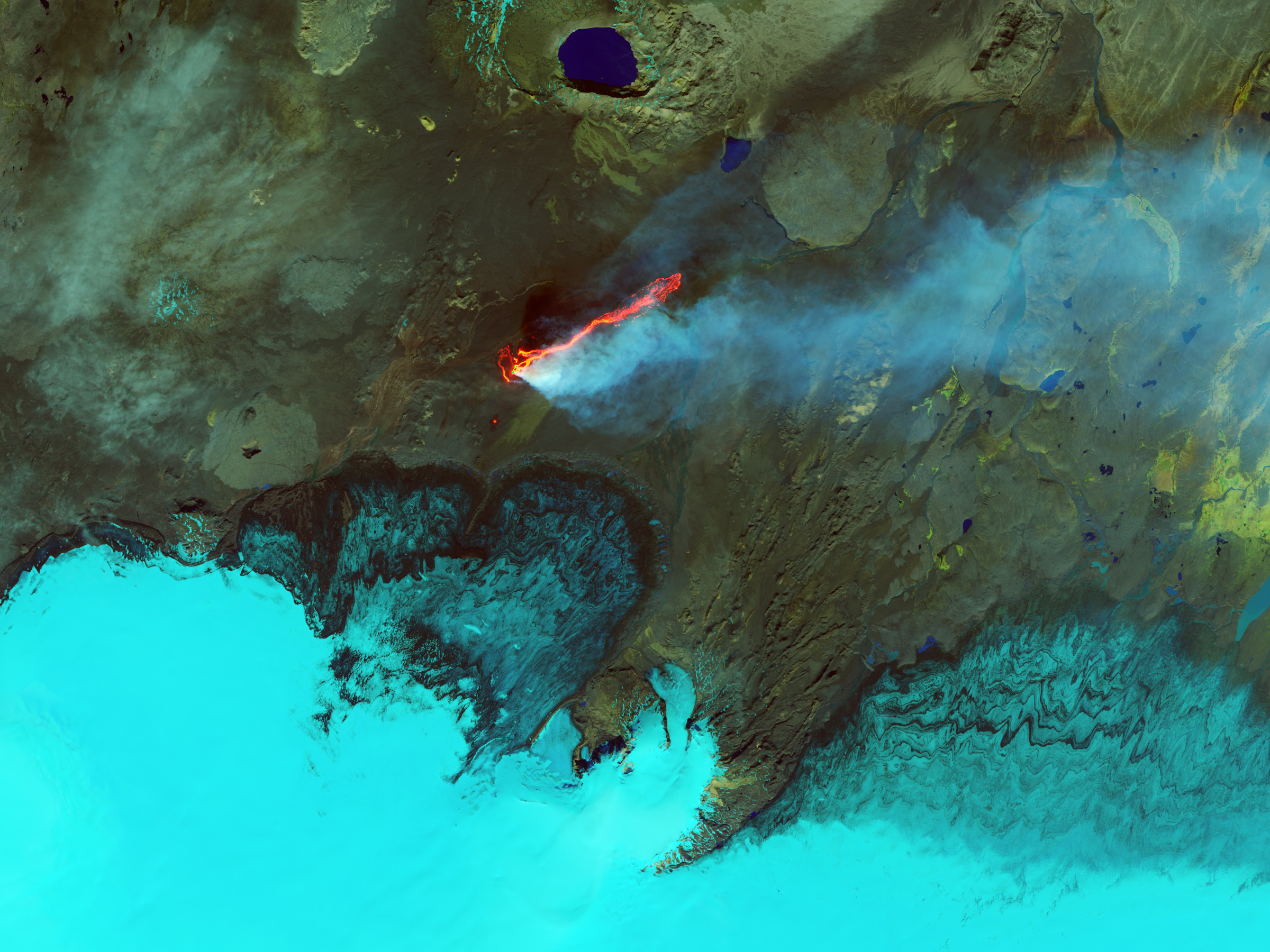
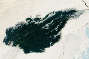
On September 6, 2014, the Operational Land Imager (OLI) on Landsat 8 captured this view of the ongoing eruption. The false-color images combine shortwave infrared, near infrared, and green light (OLI bands 6-5-3). Ice and the plume of steam and sulfur dioxide appear cyan and bright blue, while liquid water is navy blue. Bare or rocky ground around the Holuhraun lava field appears in shades of green or brown in this band combination. Fresh lava is bright orange and red. (Download this large image to see the same area in natural color.)
“Thermal imagery can be used to determine the extent of the lava flows and the heat loss,” noted Ashley Davies, a Jet Propulsion Laboratory scientist and leader of NASA’s Volcano Sensor Web team. Infrared imagery can help scientists estimate the effusion rate—the rate at which lava is pouring out of the Earth—as well as the sulfur dioxide content of the plume. “And high resolution imagery of this kind allows us to model the dynamics of the emplacement process. In this case, individual vents can be seen feeding separate lava flows that combine into a main channel feeding an expanding lava flow field.”
By some accounts, Holuhraun has spewed more lava this month than any Icelandic volcano since the 19th century. As of September 9, 2014, the new lava flow was 16 kilometers (10 miles) long and covered about 20 square kilometers (8 square miles), according to the University of Iceland.
The plume from Holuhraun is rich with sulfur dioxide (SO2), a rotten-smelling gas that can cause respiratory problems in humans and animals. A blue haze of SO2 and aerosols has been observed downwind over several towns and villages in eastern Iceland. Scientists and other observers working near the eruption site have been evacuated several times and cautioned to keep gas masks handy due to noxious gases and shifting winds. Elevated levels of SO2 have been detected as far as Ireland, Greenland, and Scandinavia.
The University of Iceland and Iceland Met Office have been providing regular updates on Holurhaun and Bardarbunga via Twitter and on their web site.
NASA Earth Observatory image by Jesse Allen, using Landsat data from the U.S. Geological Survey. Caption by Mike Carlowicz.


