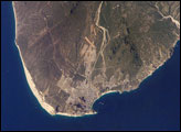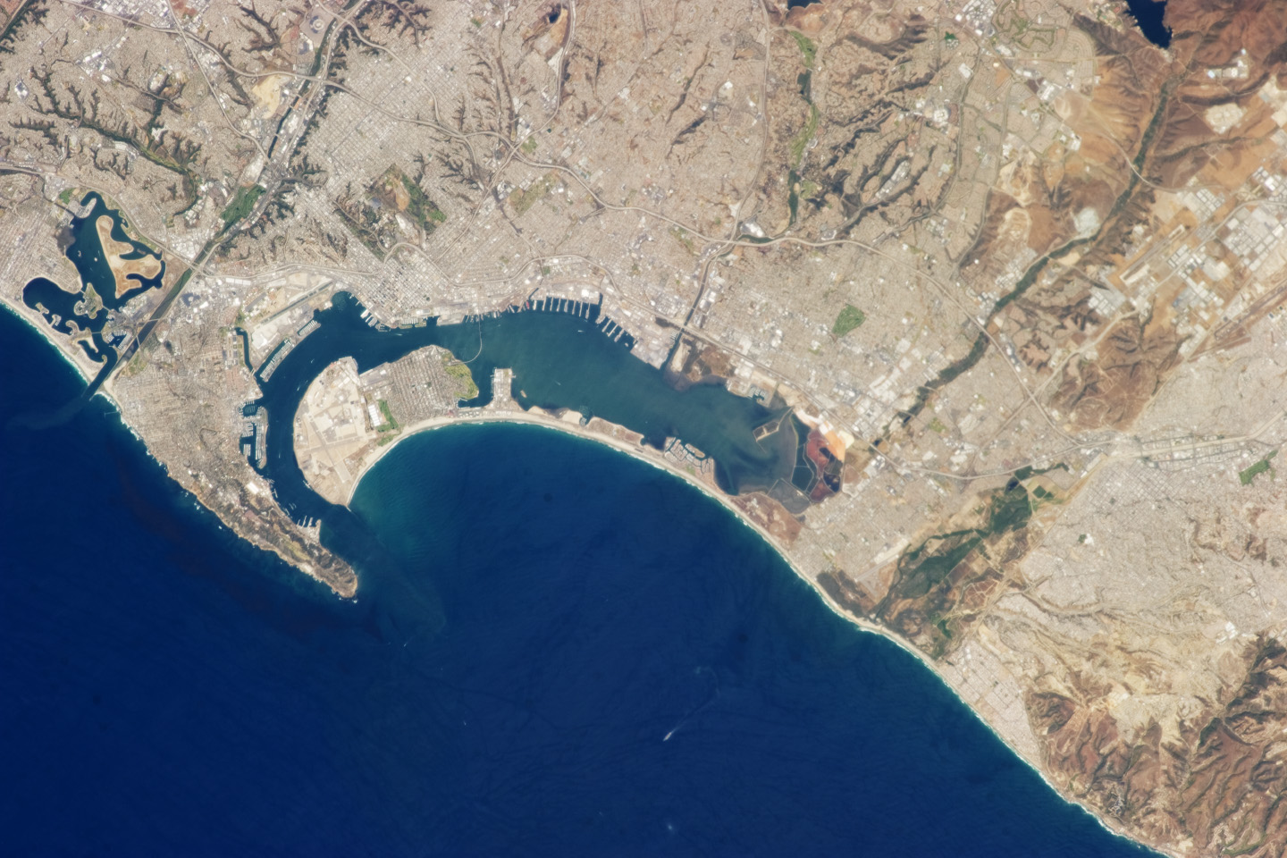
The metropolitan areas of San Diego, California, and Tijuana, Baja California, together form an international conurbation that crosses the USA-Mexico border at the northern end of the Baja Peninsula near the city of San Ysidro. In this photograph taken by an astronaut on the International Space Station, urban and suburban areas appear light gray, speckled with white rooftops that indicate large industrial and commercial buildings. Vegetated areas—parks, golf courses, and the foothills of nearby mountains—appear green, in contrast to the tan and dark brown of exposed soils and bedrock in highland areas.
The city of San Diego was founded in 1769 by Franciscan friar JunÃpero Serra. While the valley of Tijuana was explored at this time, the city would not be founded until 1889. Today, the San Diego-Tijuana conurbation also includes the cities of Chula Vista, Carlsbad, San Marcos, and National City in the United States, and Tecate and Rosarito Beach in Mexico. The combined population of the region is approximately 5 million according to 2010 census information from both the USA and Mexico.
The city of Coronado, California, situated on an artificial peninsula across the bay from San Diego, is both a popular beach resort and the location of a U.S. Navy air station and training facilities. Point Loma defines the western boundary of San Diego Bay and is part of the city of San Diego. While the northern half of the Point Loma peninsula hosts various residential communities, the southern half is federal land occupied by U.S. Navy installations, the Fort Rosecrans National Cemetery and the Cabrillo National Monument that marks the landing of the first European on the west coast of the United States.
Astronaut photograph ISS035-E-27265 was acquired on April 23, 2013, with a Nikon D3S digital camera using a 400 millimeter lens, and is provided by the ISS Crew Earth Observations experiment and Image Science & Analysis Laboratory, Johnson Space Center. The image was taken by the Expedition 35 crew. It has been cropped and enhanced to improve contrast, and lens artifacts have been removed. The International Space Station Program supports the laboratory as part of the ISS National Lab to help astronauts take pictures of Earth that will be of the greatest value to scientists and the public, and to make those images freely available on the Internet. Additional images taken by astronauts and cosmonauts can be viewed at the NASA/JSC Gateway to Astronaut Photography of Earth. Caption by William L. Stefanov, Jacobs/JETS at NASA-JSC.