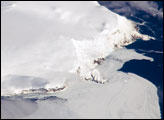
The Earth Observatory has published its last Image of the Day on this website. Please join us on our new home at science.nasa.gov/earth/earth-observatory.
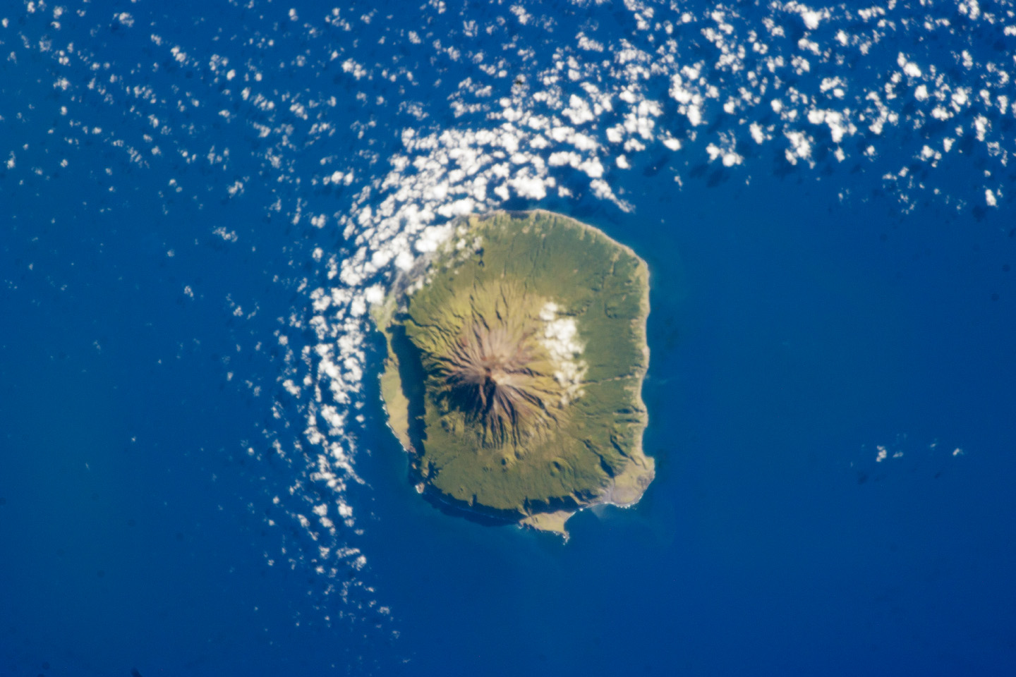
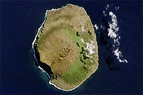
The island of Tristan da Cunha is located in the southern Atlantic Ocean—more than 3,700 kilometers (2,300 miles) from the coastline of Antarctica, approximately 2,800 kilometers (1,700 miles) to the southern tip of Africa, and more than 3,000 kilometers (1,900 miles) from the east coast of South America. The island forms part of the British Overseas Territory of Saint Helena, Ascension, and Tristan da Cunha. The shoreline of the 13 kilometer (8 mile) wide island is marked on most sides by steep cliffs, with lower beach areas on the southern and north-northwestern sides. The island is notable for its bird population and includes important breeding grounds for petrels, albatrosses, penguins, and shearwaters.
Tristan da Cunha is a shield volcano, a volcanic structure with a low, broad profile and composed of silica-poor lavas (such as basalt). The upper surface of this low base appears dark green in this astronaut photograph. Steeper brown to tan colored slopes mark the central cone of the volcano at the island’s center. The summit crater, Queen Mary’s Peak, sits at an elevation of 2,060 meters (6,760 feet) above sea level. While geologic evidence indicates that eruptions have occurred from the central crater, lavas have also erupted from flank vents along the sides of the volcano and from smaller cinder cones.
The last known eruption of Tristan da Cunha took place in 1961–1962 and forced the evacuation of the only settlement on the island, Edinburgh of the Seven Seas, on the northern coastline (obscured by clouds in this image). The town is considered to be the most remote permanent settlement on Earth, with its nearest neighbor located 2,173 kilometers (1,347 miles) to the northeast on the island of St. Helena.
Astronaut photograph ISS034-E-41528 was acquired on February 6, 2013, with a Nikon D3S digital camera using a 400 millimeter lens, and is provided by the ISS Crew Earth Observations experiment and Image Science & Analysis Laboratory, Johnson Space Center. The image was taken by the Expedition 34 crew. It has been cropped and enhanced to improve contrast, and lens artifacts have been removed. The International Space Station Program supports the laboratory as part of the ISS National Lab to help astronauts take pictures of Earth that will be of the greatest value to scientists and the public, and to make those images freely available on the Internet. Additional images taken by astronauts and cosmonauts can be viewed at the NASA/JSC Gateway to Astronaut Photography of Earth. Caption by William L. Stefanov, Jacobs/ESCG at NASA-JSC.