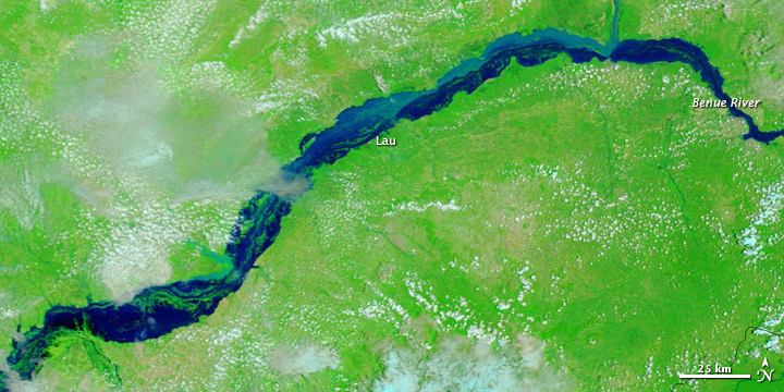
Between early July and early September 2012, flooding claimed an estimated 137 lives in Nigeria and forced thousands more to relocate, according to Reuters. In addition to the challenges posed by heavy rains, Nigerians had to cope with the release of water from the Lagdo Dam in neighboring Cameroon, which further swelled the Benue River. Flooding from the dam release was blamed for 30 deaths in Nigeria, Agence France-Presse reported.
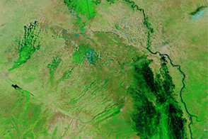
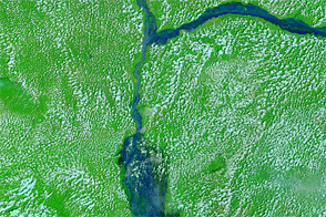
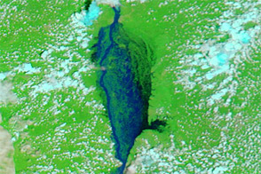
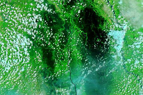
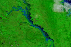
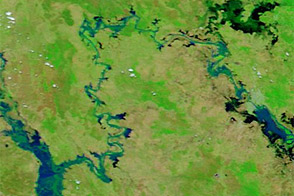
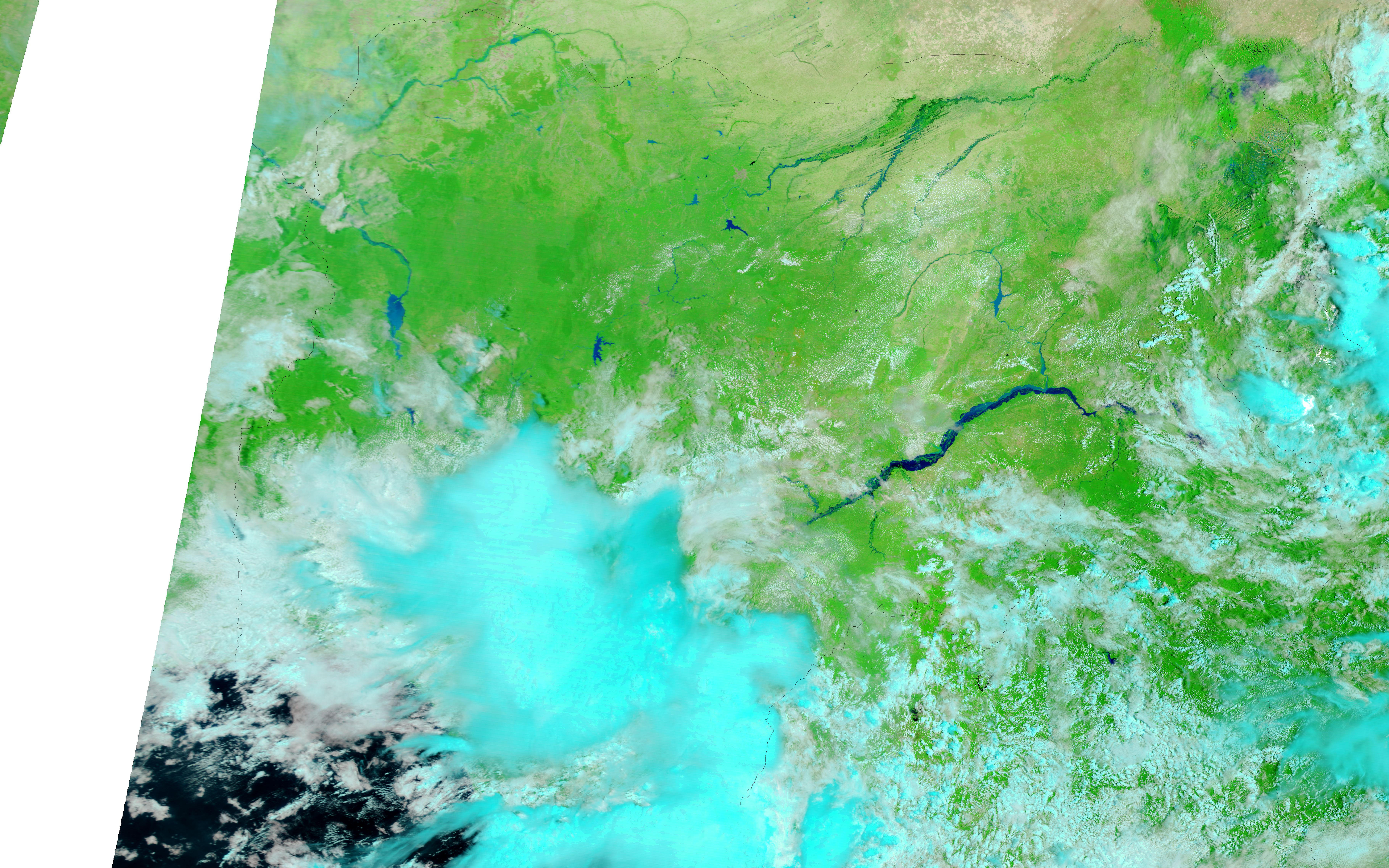
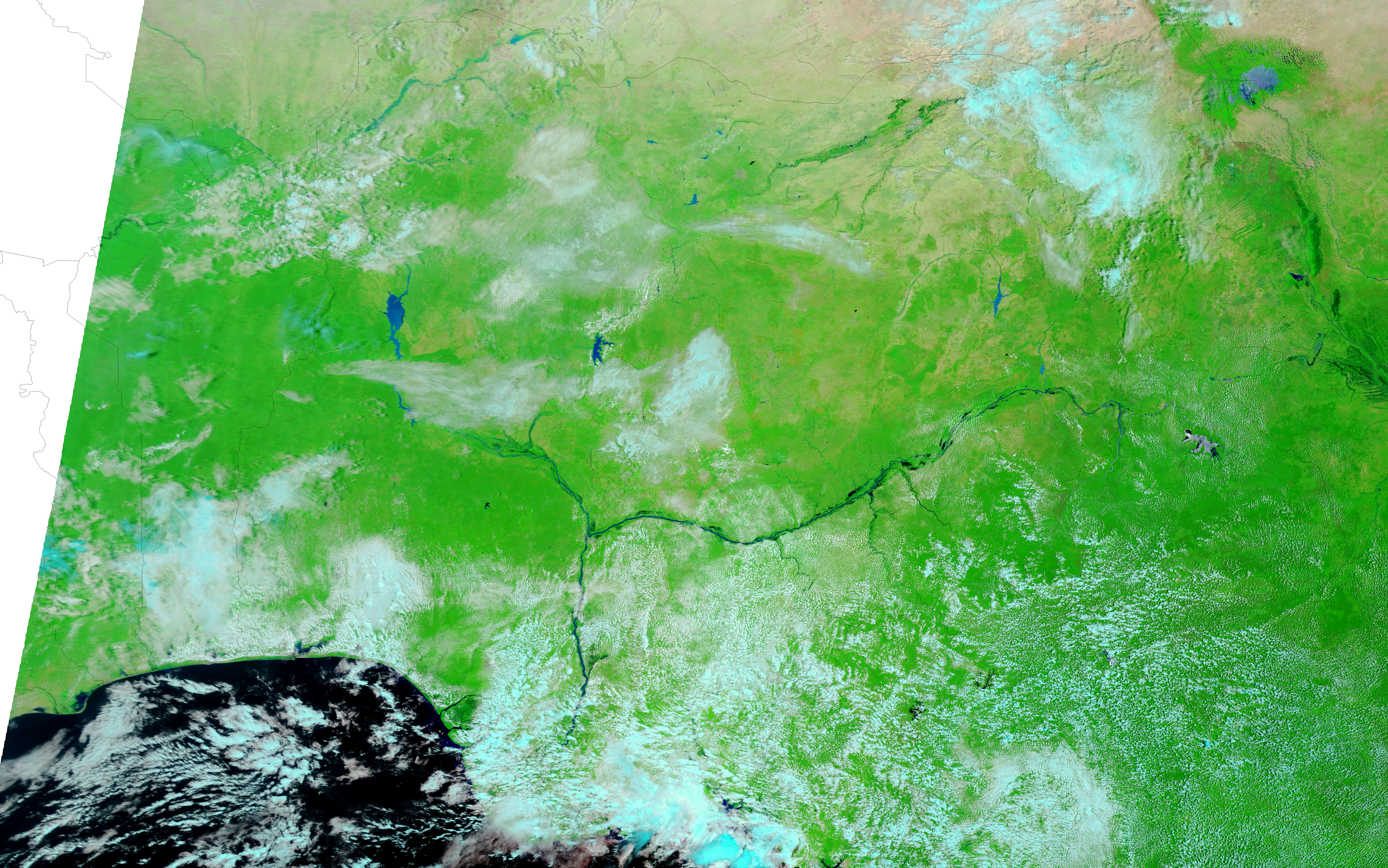
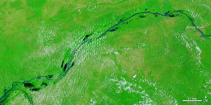
These images show a stretch of the Benue River in eastern Nigeria, around the city of Lau. The Moderate Resolution Imaging Spectroradiometer (MODIS) on NASA’s Terra satellite captured the top image on September 8, 2012. For comparison, the bottom image shows the same area nearly three years earlier, on September 23, 2009. These images use a combination of visible and infrared light to better distinguish between water and land. Water varies from electric blue to navy, vegetation is bright green, and clouds range in color from nearly white to pale blue-green.
In 2009, the Benue River was a relatively thin river bordered by small, isolated water bodies. Three years later, the river had spilled over its banks, engulfing the small lakes on either side. Flood waters often carry heavy loads of sediment, and such sediment might account for the relatively light shades of blue along part of the river.
Despite thousands of displaced residents, no major damage to agriculture and industry had yet been reported, Reuters stated.
NASA image courtesy LANCE MODIS Rapid Response Team at NASA GSFC. Caption by Michon Scott.
alert message