The Earth Observatory has published its last Image of the Day on this website. Please join us on our new home at science.nasa.gov/earth/earth-observatory.
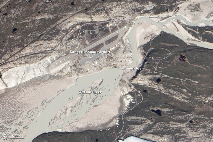

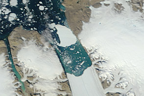
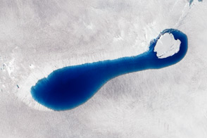
Greenland has been a recurring source of headlines in July 2012, with the calving of a new iceberg off the Petermann Glacier and surface melting across nearly all of the Greenland Ice Sheet. Now there are new satellite images of flooding in Kangerlussuaq, a key air transportation hub.
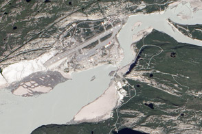
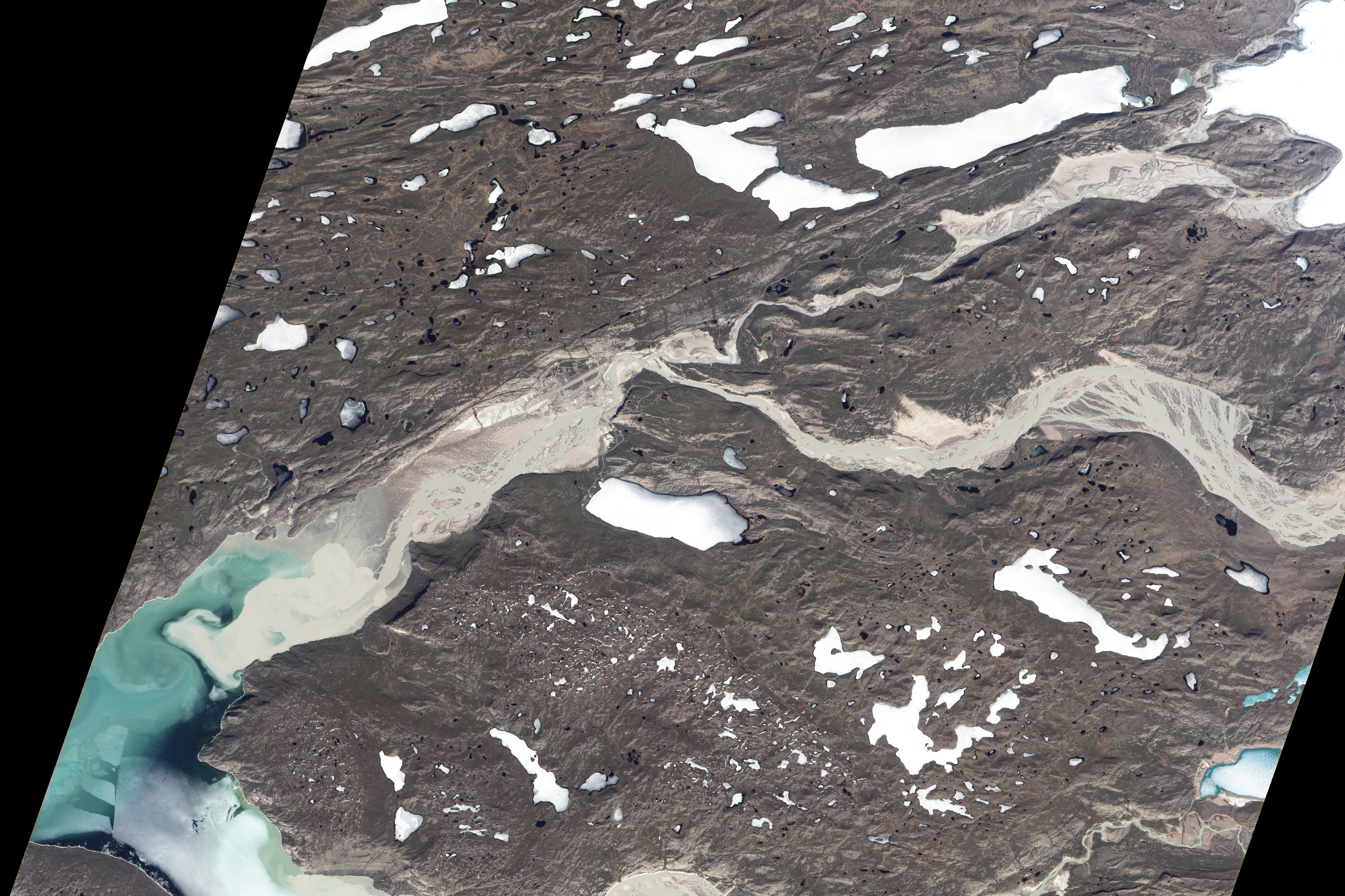
Located in southwestern Greenland roughly 125 kilometers (75 miles) from the coast, Kangerlussuaq, or Kanger, hosts one of the island’s busiest commercial airports and is a frequent departure point for scientific research flights, including the NASA IceBridge program. Near the airport, the Watson River flows through town.
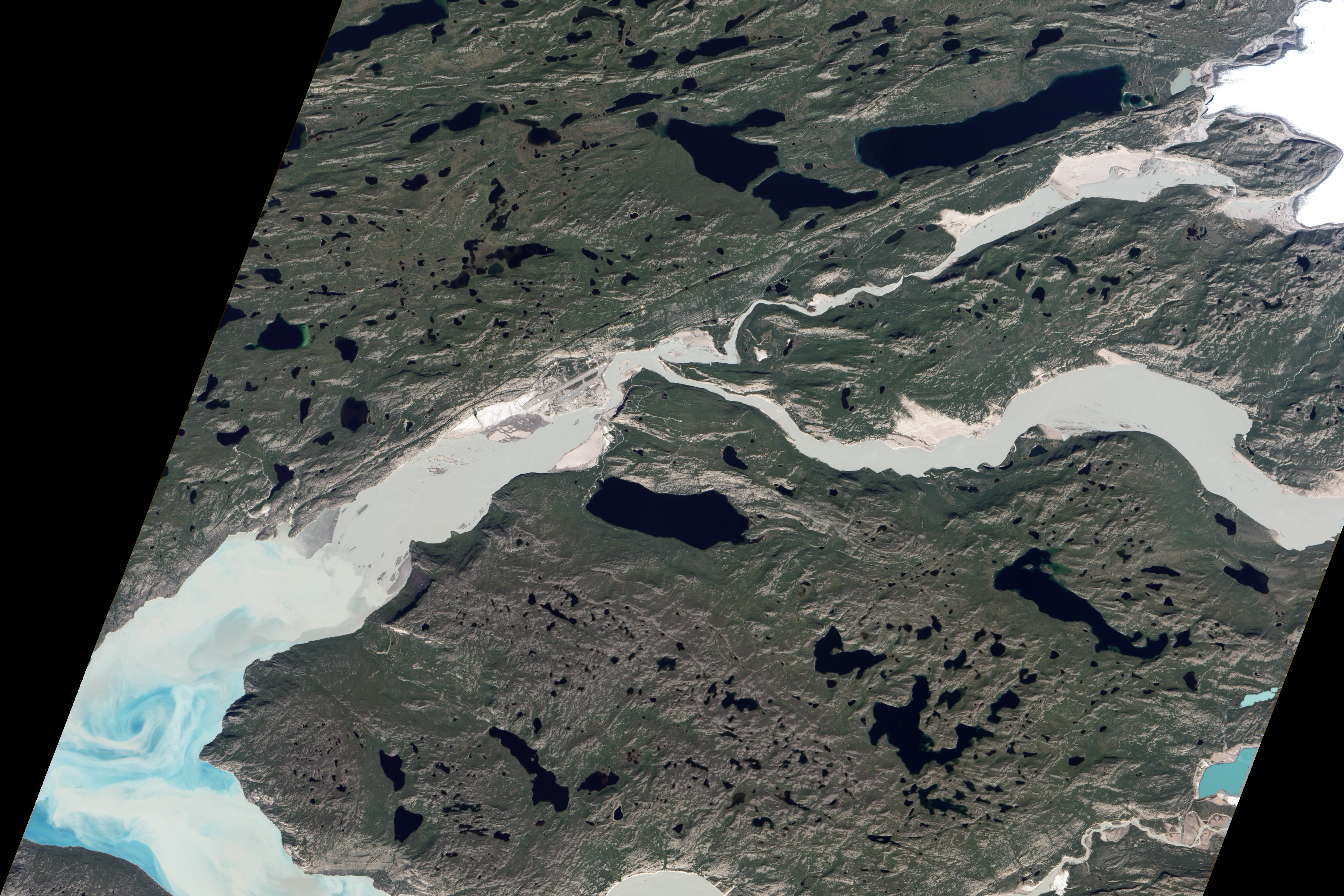
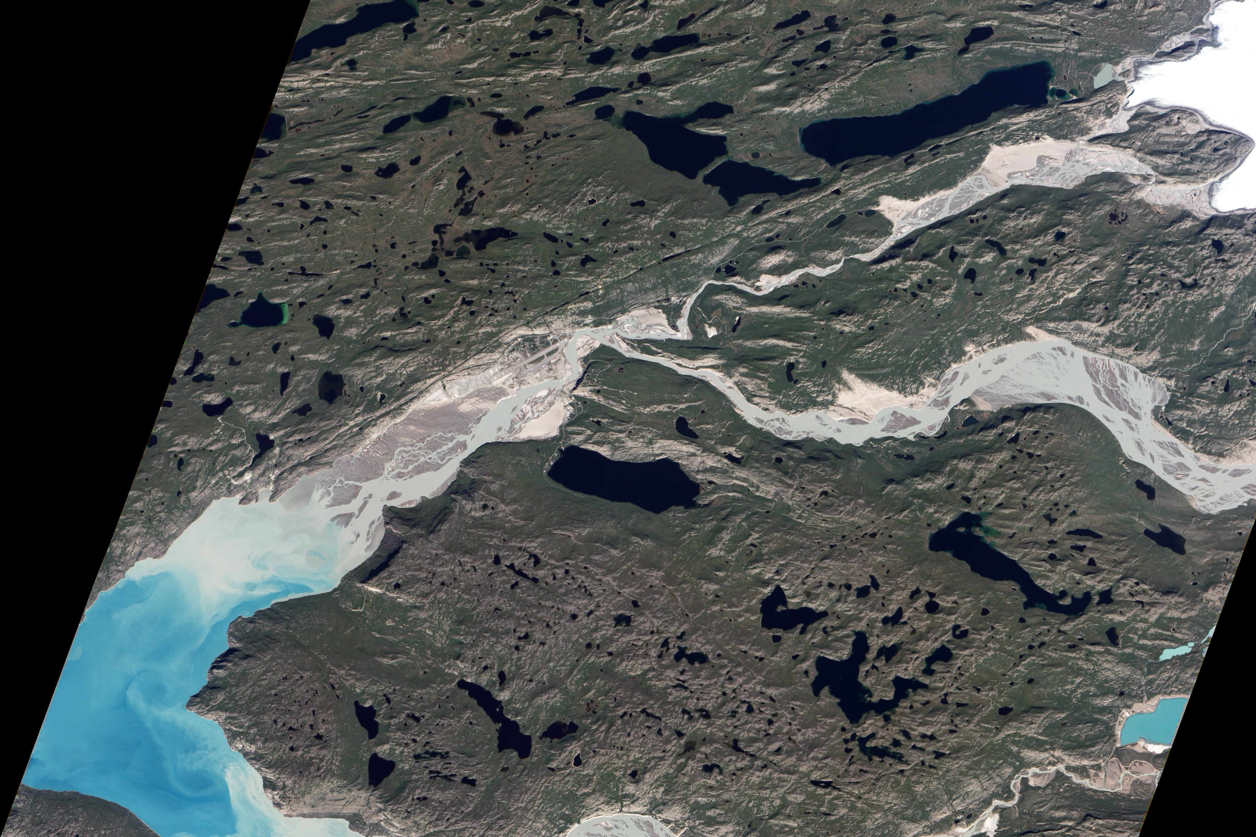
The Advanced Land Imager (ALI) on NASA’s Earth Observing-1 (EO-1) satellite observed the flooded river on July 12, 2012 (bottom). For comparison, the top image shows the same area on May 31, 2012. On July 12, river levels are discernibly higher throughout the image; downstream from Kangerlussuaq, braided channels have merged into a single water body. In both images, the river’s light blue-green-gray color likely results from glacial flour suspended in the water. (A third image—attached as a 3MB download—shows the river levels receding again by July 25.)
A bridge spans the river at a narrow point southeast of the airport, and allegedly dates from the 1950s. Jason Box of the Byrd Polar Research Center at Ohio State University remarked: “In previous high-melt years, I suspected the bridge’s years were numbered.” Having recently returned from a trip to Greenland, Box noted an increase in the intensity of spring and summer melt over the past dozen years.
”Water rises every year, but I've never before observed it at this level of discharge,” said Richard Forster, a University of Utah professor who has done extensive fieldwork in Greenland. ”It was also about two weeks prior to the normal seasonal peak. It was most likely due to melt on the ice sheet—rather than an ice-dammed lake bursting or glacial lake drainage—as the high discharge was maintained for so long.”
“It has been a phenomenal year for melt” added Ted Scambos, lead scientist at the National Snow and Ice Data Center. “Even though melt water mostly refroze in place in the upper part of the Greenland Ice Sheet, lower down the melt runs off the ice sheet into rivers and creeks and into the ocean.”
Around the same time that ALI captured the July 12 image, observers on the ground marveled at the high water around the bridge, which reportedly “ate a big loader tractor like candy.” By July 21, flood waters had washed out parts of the bridge, according to video footage published by The Guardian.
NASA Earth Observatory image created by Jesse Allen and Robert Simmon, using Advanced Land Imager data from the NASA EO-1 team. Caption by Michon Scott


