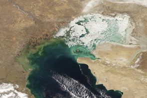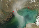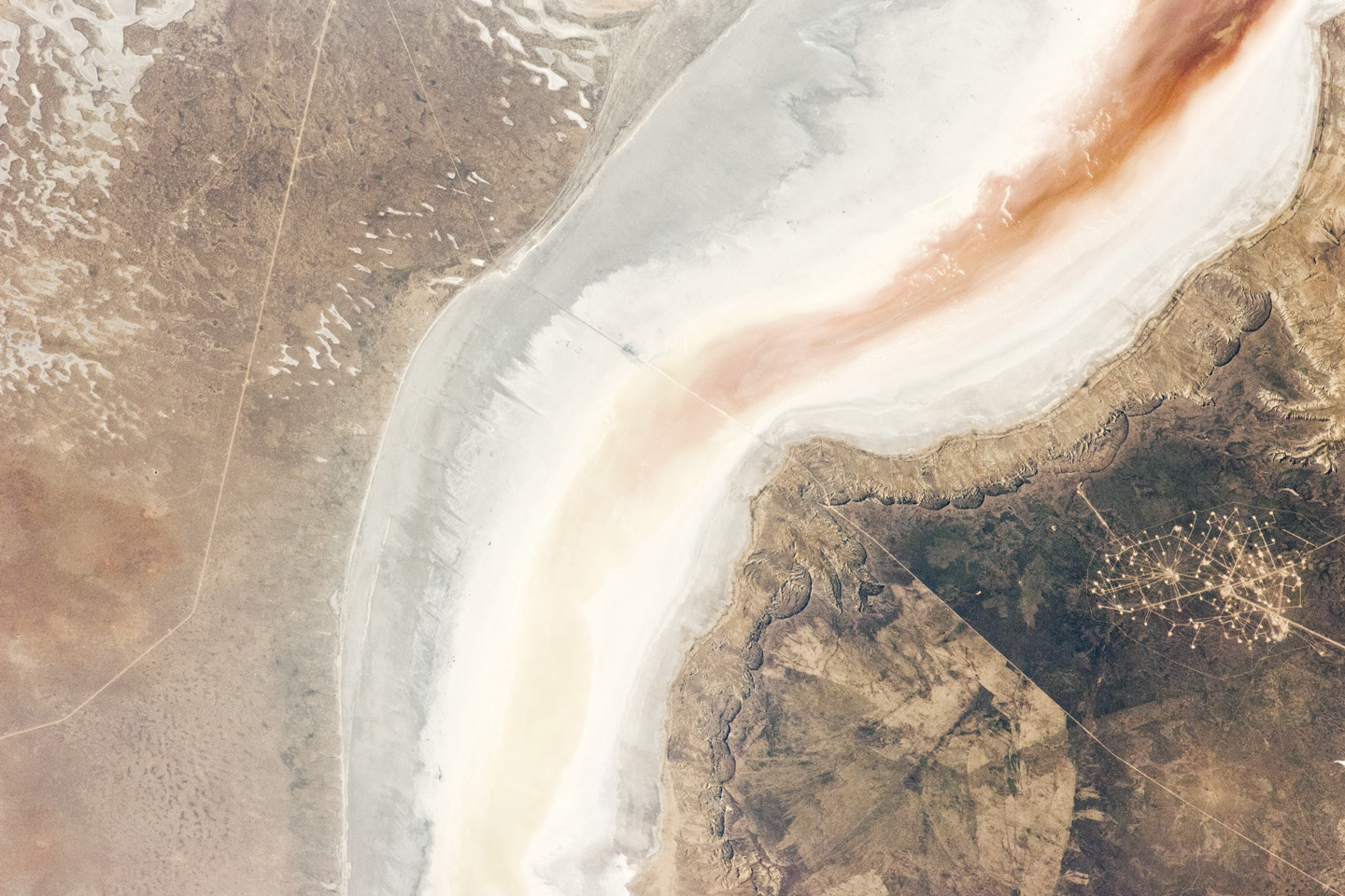
The Sor Kaydak is a salt marsh that leads into the northeastern bulb of the Caspian Sea. This land depression is occasionally inundated by water from the Caspian Sea, as both the marsh and the Sea lie at the same elevation—29 meters below global sea level. They are separated by a low bar of land that is just 1–2 meters high. The central 50 kilometers of the 180 kilometer-long marsh depression is shown in this astronaut photograph from the International Space Station.
Water in the marsh takes on different colors—from brown to pink to light green, moving northeast to southwest—as a result of the interplay of water depth and the resident organisms such as algae. Algae color varies depending on water temperature and salinity.
Irregular gray areas (top left) are wet zones between low sand dunes. These inter-dune flats are whitened with salt that comes from the evaporation of Caspian Sea water. (The Sea is just beyond the top left of the image.) The jagged line following the colored water is the limit of the wetting zone (or perimeter), an irregular zone influenced by wind and the depth of water in the marsh.
Small cliffs mark the eastern margin of the depression that contains Sor Kaydak. Above the cliffs, a plateau—about 200 meters above the salt marsh, 160 meters above global sea level—extends eastward for hundreds of kilometers. Here the plateau is occupied by a dense pattern of well heads, which appear as a geometric pattern of tan dots. By contrast, the west margin (image left) rises less than 10 meters above the marsh.
The straight line visible at image center is a pipeline built to take oil to a terminal on the Caspian shore 100 kilometers northwest of the area shown here.
Astronaut photograph ISS031-E-30896 was acquired on May 11, 2012, with a Nikon D2Xs digital camera using a 180 mm lens, and is provided by the ISS Crew Earth Observations experiment and Image Science & Analysis Laboratory, Johnson Space Center. The image was taken by the Expedition 31 crew. It has been cropped and enhanced to improve contrast, and lens artifacts have been removed. The International Space Station Program supports the laboratory as part of the ISS National Lab to help astronauts take pictures of Earth that will be of the greatest value to scientists and the public, and to make those images freely available on the Internet. Additional images taken by astronauts and cosmonauts can be viewed at the NASA/JSC Gateway to Astronaut Photography of Earth. Caption by M. Justin Wilkinson, Jacobs/ESCG at NASA-JSC.