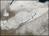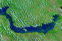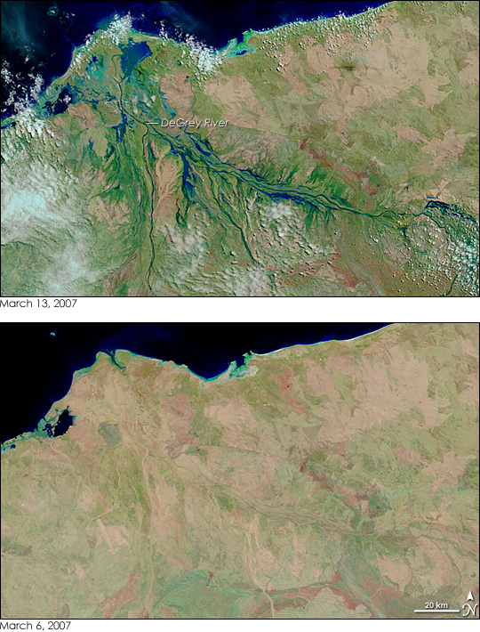
In the course of a week, the northern coast of Western Australia went from dry desert to riverine landscape under the onslaught of two successive tropical cyclones. Powerful Cyclone George roared ashore on March 8, 2007, with winds gusting up to 275 kilometers per hour (170 miles per hour). The storm caused extensive damage, including three deaths, reported the Australia Broadcasting Corporation News. The much weaker Cyclone Jacob came ashore just east of George’s landing point on March 12. The top image, captured on March 13, by the Moderate Resolution Imaging Spectroradiometer (MODIS) on NASA’s Terra satellite, shows the cumulative impact of the two storms on the DeGrey River basin.
The DeGrey River flows west through Western Australia before it turns north to empty into the Indian Ocean at Poissonnier Point east of the city of Port Hedland, the city most severely damaged by Cyclone George. On March 6, before both storms struck, the river was barely distinguishable in MODIS imagery. One week later, the river and its many tributaries cut a tangle of blue across the landscape. The heavy rain brought by the storms has also prompted plant growth. The land has gone from desert pink—the color of bare or sparsely vegetated land in this type of image—to the bright green of plant-covered land. The images were made with both infrared and visible light to highlight the presence of water on the ground. In this type of image, water is black or dark blue (where laced with sediment), and clouds are pale blue and white. Similar false-color and photo-like true color images are available daily from the MODIS Rapid Response Team.
NASA image courtesy the MODIS Rapid Response Team at NASA GSFC.