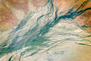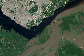

For conservation biologists, remote regions that have seen little human impact pose a dilemma. Such areas generally have the most intact wildlife, and therefore they are often the target of conservation efforts and research. Yet because they haven’t been extensively populated or paved, such areas haven’t usually been mapped well, either. Satellite images can help, but in the case of freshwater habitats, satellites have limitations. Most of the water moving over Earth’s land surfaces travels in channels too small to be seen from space.
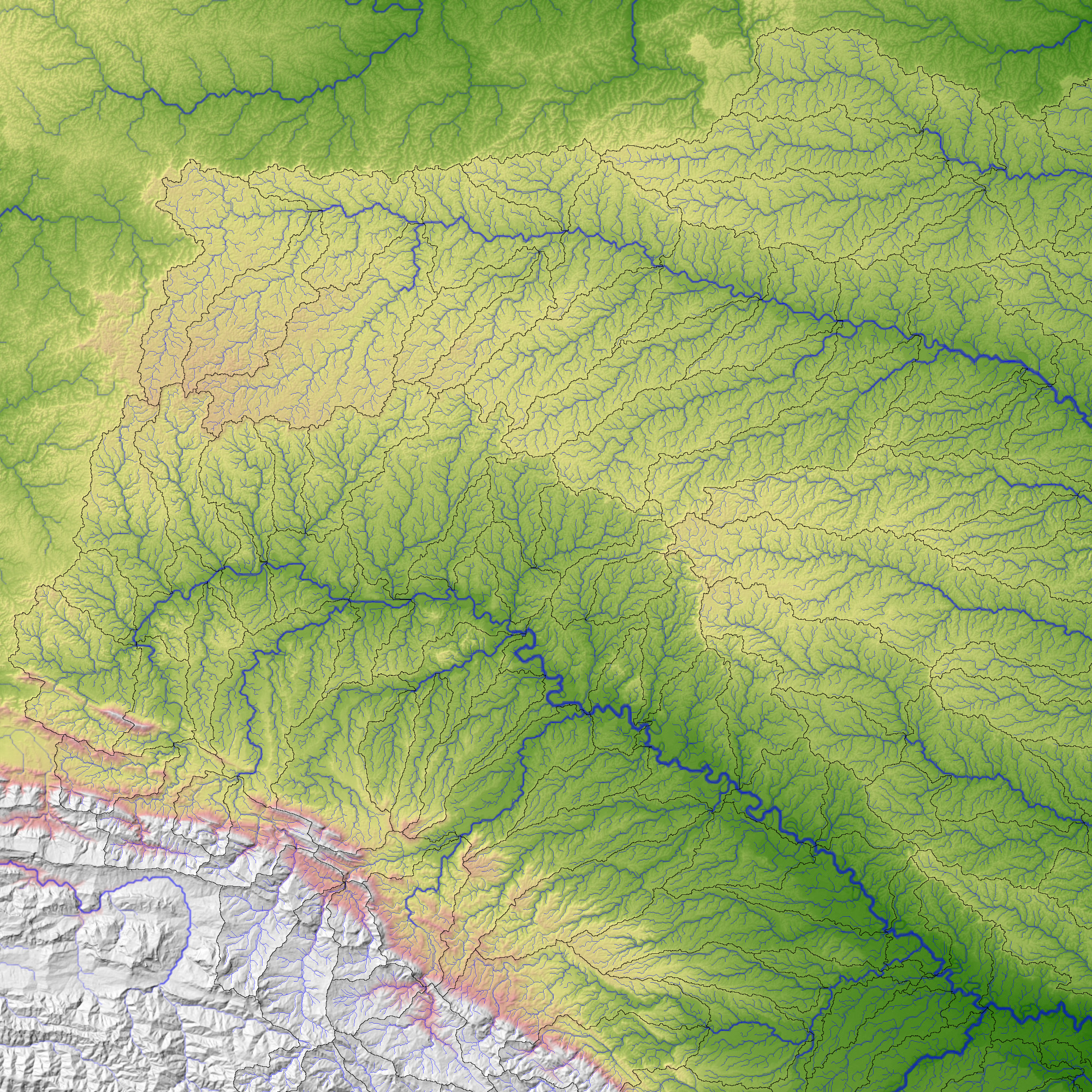
In 2004, a small group of freshwater conservation biologists at World Wildlife Fund who were studying the Madre de Dios River in the southwestern Amazon found a creative way to locate rivers. The team used high-resolution topographic maps based on radar data collected by the Space Shuttle Endeavour in 2000 to map how water would flow across the landscape. This image shows the result of their efforts, including elevation, river channels, and watershed boundaries. Elevation is color-coded, dark green showing the lowest elevation and pale pink showing the highest. Stream channels, marked in blue-green, overlie the elevation, and watershed boundaries are marked in gray.
Watersheds are the “bowls” that collect water that empties into rivers and streams. Because everything that happens on land can affect water, biologists need to pay as close attention to watersheds as to the water channels themselves. The Madre de Dios project quickly revealed that the space-based maps described watersheds and rivers in much greater detail than previous mapping products did. By combining the watershed maps with information on other characteristics such as vegetation and geology, the team was able to map species distribution in the area and to recommend corridors of protected areas that would best preserve the area’s biodiversity. The success of the Madre de Dios project inspired the team to scale the project up into a global digital watershed map, which they called HydroSHEDs. To read more about the creation of HydroSHEDS, read the Earth Observatory Feature Remote River Reconnaissance: Space Shuttle Observation Help Conservation Biologists.
NASA image created by Jesse Allen, using data provided courtesy of the World Wildlife Fund HydroSHEDS Project. Thanks to Bernhard Lehner, McGill University; Robin Abell, World Wildlife Fund; and Ned Gardiner, American Museum of Natural History, for image interpretation.