The Earth Observatory has published its last Image of the Day on this website. Please join us on our new home at science.nasa.gov/earth/earth-observatory.
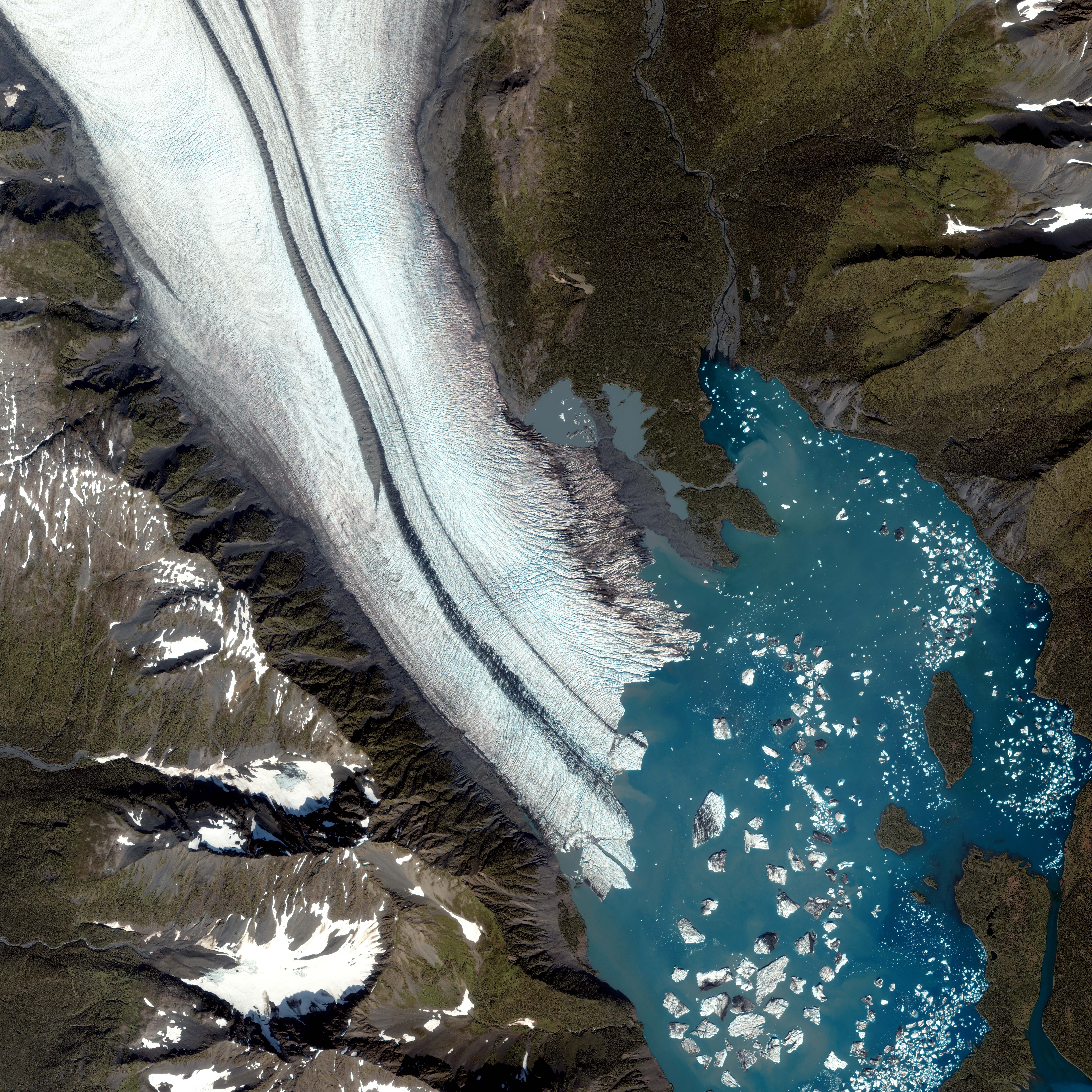
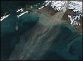
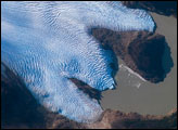
Although they move slowly, glaciers do move, and this movement alters the ice as it passes over land. Likewise, a moving glacier can carry with it evidence of geologic events it has witnessed. The Bear Glacier in the Kenai Peninsula along the Gulf of Alaska bears multiple clues about its past. The IKONOS satellite took this picture on August 8, 2005, capturing the glacier emptying into a nearby lake.
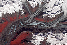
This image shows the ablation zone where the glacier is primarily losing ice. Pieces of the glacier that have broken off look like shards of white glass in the blue water. Upslope from the lake, the foot of the glacier is riddled with crevasses — cracks in the ice caused by the glacier’s movement over a rough surface. Such cracks are often deepened by melt water flowing over the glacier’s surface. Not far from the edge of the glacier, the crevasses grow especially deep, not just cutting into it diagonally, but also forming a crosshatch pattern. This may be caused by the glacier passing over a raised rock surface.
Down the middle of the glacier run dark gray “racing stripes.” As a glacier moves, it picks up dirt and debris from the rocks it passes. When two glaciers merge, as they have here, the dirt and debris they carry form parallel stripes, or medial moraines, on the ice surface. Besides the usual debris scraped off rocks by the glacier’s movement, the medial moraine on the left includes an unusually thick layer of sediment, which tapers to a tip roughly halfway down the glacier’s surface. This thick sediment may have resulted from an upslope landslide; as the glacier kept moving, it carried away evidence of this landslide.
Lakes forming at the tips of glaciers often have the characteristic blue-green color visible in this small lake. The color results from “glacial flour”: fine sediment ground off the rocks by the ice and carried down slope. The fine particles are very reflective, making water that would normally appear deep blue much brighter.
IKONOS satellite image courtesy GeoEye. Image interpretation courtesy Ted Scambos, National Snow and Ice Data Center; and Tad Pfeffer, Institute of Arctic and Alpine Research.
© All Rights Reserved: Use of IKONOS, GeoEye, QuickBird and WorldView imagery must be coordinated with Maxar.