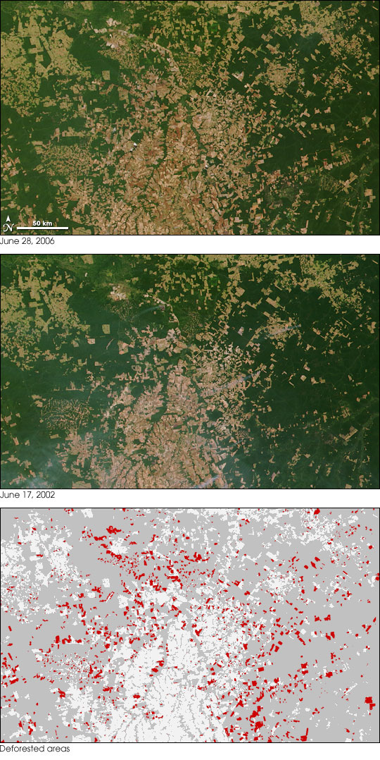
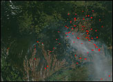
In the Brazilian state of Mato Grosso, verdant green Amazon Rainforest is broken up by broad tracts of pale green and tan deforested land. In 2005, the government of Brazil said that 48 percent of Amazon deforestation that took place in 2003 and 2004 occurred in Mato Grosso.
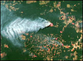
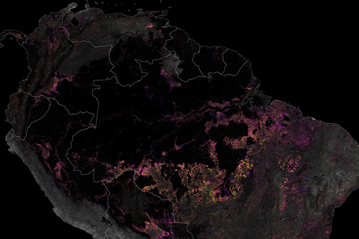
The transformation from forest to farm is evident in the photo-like images, taken by the Moderate Resolution Imaging Spectroradiometer (MODIS) on NASA’s Terra satellite. The top image was taken on June 28, 2006, while the middle image is from June 17, 2002. The bottom map shows the difference in deforested areas over the time period, with some of the largest cleared areas marked in red. On this map, areas that were non-forested (either naturally or already deforested) in 2002 are light gray, while areas that remained forested in 2006 are darker gray.
Although some deforestation is part of the country’s plans to develop its agriculture and timber industries, other deforestation is the result of illegal logging and squatters. The Brazilian government uses MODIS images such as these to detect illegal deforestation. Because the forest is so large and is difficult to access or patrol, the satellite images can provide an initial alert that tells officials where to look for illegal logging.
These images were produced by the MODIS Rapid Response Team, which provides both the 2006 and 2002 images in a variety of resolutions, including MODIS’maximum resolution of 250 meters per pixel.
NASA images courtesy the MODIS Rapid Response Team at Goddard Space Flight Center. Map by Robert Simmon.
alert message


