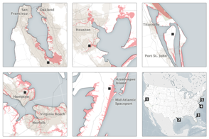
Rising or falling sea level can reshape the world’s coastlines and affect some of the most densely populated areas on Earth. Not surprisingly, scientists want to understand sea level as thoroughly as possible. They have discovered that the ocean’s behavior is not uniform all over the world; neither are the factors that affect sea level. When sea level rises, it can do so for a few reasons. It can rise due to thermal expansion—the tendency of warm water to take up more space than cooler water. It can rise due to the addition of water, for instance from melting glaciers. It can also rise due to changes in salinity; fresh water is less dense than salt water and therefore takes up slightly more space than an equal mass of salt water.
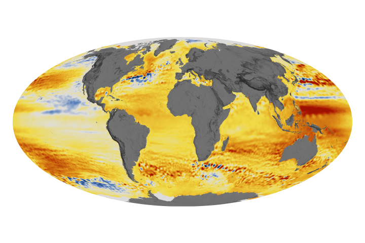
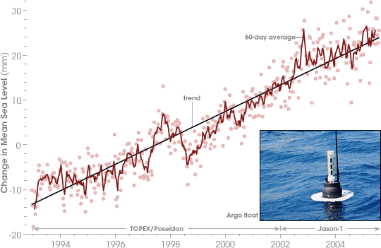
Besides understanding the causes of sea level changes, scientist want to accurately gauge the rate of sea level rise. Relying on data from satellites and floats (mechanical devices drifting in the ocean), a group of oceanographers announced in June 2006 that sea level rose, on average, 3 millimeters (0.1 inches) per year between 1993 and 2005. This graph shows the increase in mean sea level, measured in millimeters. Researchers attributed about half of that increase to melting ice and the other half to thermal expansion as the ocean absorbs excess energy.
To measure sea level, oceanographers at NASA’s Jet Propulsion Laboratory relied on satellite measurements of sea surface height (which increases as temperature increases) taken by TOPEX/Poseidon and later by Jason-1. Complementing the Jason-1 satellite data were temperature and salinity measurements from the Argo float program. By using measurements from a variety of sources, oceanographers can form a clearer picture of the ocean’s behavior in different parts of the world.
Another tool useful in the study of sea level is NASA’s Gravity Recovery and Climate Experiment (GRACE). GRACE precisely measures surface height not only of the world’s ocean, but also the giant bodies of ice that feed it. If ice mass height drops and ocean level rises, GRACE can measure both changes simultaneously. GRACE observations determined that from 2002 to 2005, Antarctic ice lost enough mass to raise global sea level by 1.5 millimeters (0.05 inches).
President George W. Bush declared June 4-10, 2006, National Oceans Week, encouraging Americans to learn more about the ocean and sustain it for future generations. See the White House Press Release for more information.
Graph adapted by Robert Simmon from Leuliette, E., Nerem, R., and Mitchum, G. (2004). Calibration of TOPEX/Poseidon and Jason altimeter data to construct a continuous record of mean sea level change. Marine Geodesy, 27(1-2), 79-94.