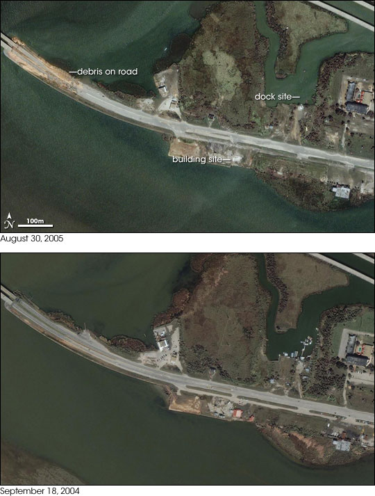


Though not as devastated as New Orleans and coastal Mississippi, Mobile, Alabama, also suffered when Hurricane Katrina came ashore on August 29, 2005. The city was declared a disaster area after floods swamped area. Flood waters reached a depth of 11 feet in downtown Mobile, according to the Associated Press, matching the city’ worst floods since records began 90 years ago. Evidence of flooding was still obvious on August 30, when the top image was taken by the Ikonos satellite. Debris is piled on and against the bridge in the upper left corner of the image.
Other scars left by the storm are evident in the comparison between the top image and the lower image, taken on September 18, 2004. Just below the center of the image, a red-roofed building has disappeared. The docks on the small canal in the upper right side of the image are also gone.
Image copyright DigitalGlobe