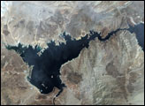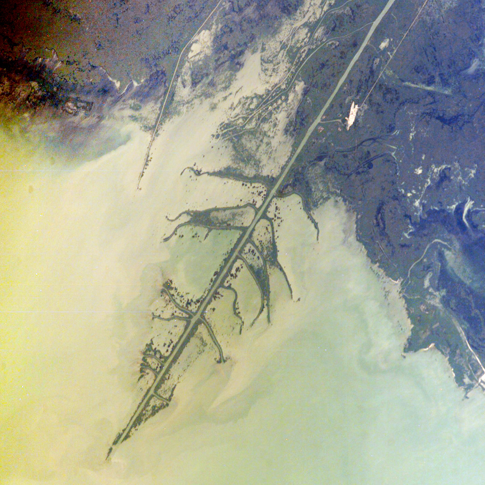
The Ural River is one of the two major rivers (the other is the Volga) that empty into the northern coast of the Caspian Sea, creating extensive wetlands. This image shows details of the Ural’s tree-like (or “digitate”) delta. This type of delta forms naturally when wave action is low, and sediment content in the river is high. New distributary channels form in the delta when the river breaches natural levees formed by sediment deposition.The long main channel of the river in this image and several of the distibutary channels are too regular to be entirely natural, however. Like the famous Mississippi River delta in the United States, the Ural River delta has been significantly modified to reduce flooding and divert water.
The dark regions running along the coast are the wetlands, which support high biodiversity due to the unique environment and relative isolation of the Caspian Sea. The coastal wetlands are especially important to migrating birds as an important stop-over along the Asian flyway.
The Ural River’s trek to the Caspian is long —roughly 2,400 kilometers (1,500 miles) southward from the Ural Mountains in Russia to empty into the northern Caspian Sea in Kazakhstan. Although the current sea level of the Caspian is more than 26 meters below global mean sea level, the water levels have risen roughly 2 meters since 1980. This increase has caused flooding of much of the coastal region, including the Ural Delta, and it endangers these coastal wetland environments. The coastal flooding has also impacted the oil exploration infrastructure bordering the Caspian coastline.
Astronaut photograph ISS009-E-18679 was acquired August 17, 2004 with a Kodak 760C digital camera with an 400 mm lens. The image is provided by the ISS Crew Earth Observations experiment and the Image Science & Analysis Group at the Johnson Space Center. The International Space Station Program supports the laboratory to help astronauts take pictures of Earth that will be of the greatest value to scientists and the public, and to make those images freely available on the Internet. Additional images taken by astronauts and cosmonauts can be viewed at the NASA/JSC Gateway to Astronaut Photography of Earth.