The Earth Observatory has published its last Image of the Day on this website. Please join us on our new home at science.nasa.gov/earth/earth-observatory.
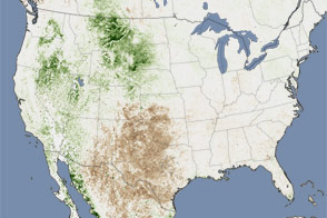
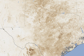
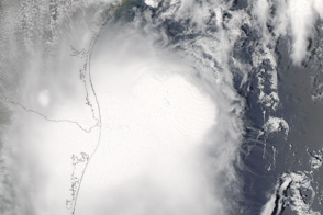
By July 2011, Texas and New Mexico had completed the driest six-month period on record. Average rain between January and June was more than eight inches (203 millimeters) below average in Texas and 3.5 inches (89 millimeters) below average in New Mexico. Record warm temperatures also persisted in Texas between April and June. The lack of rain and the warm temperatures added up to exceptional drought.
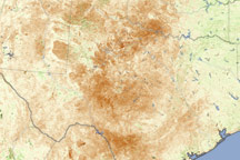
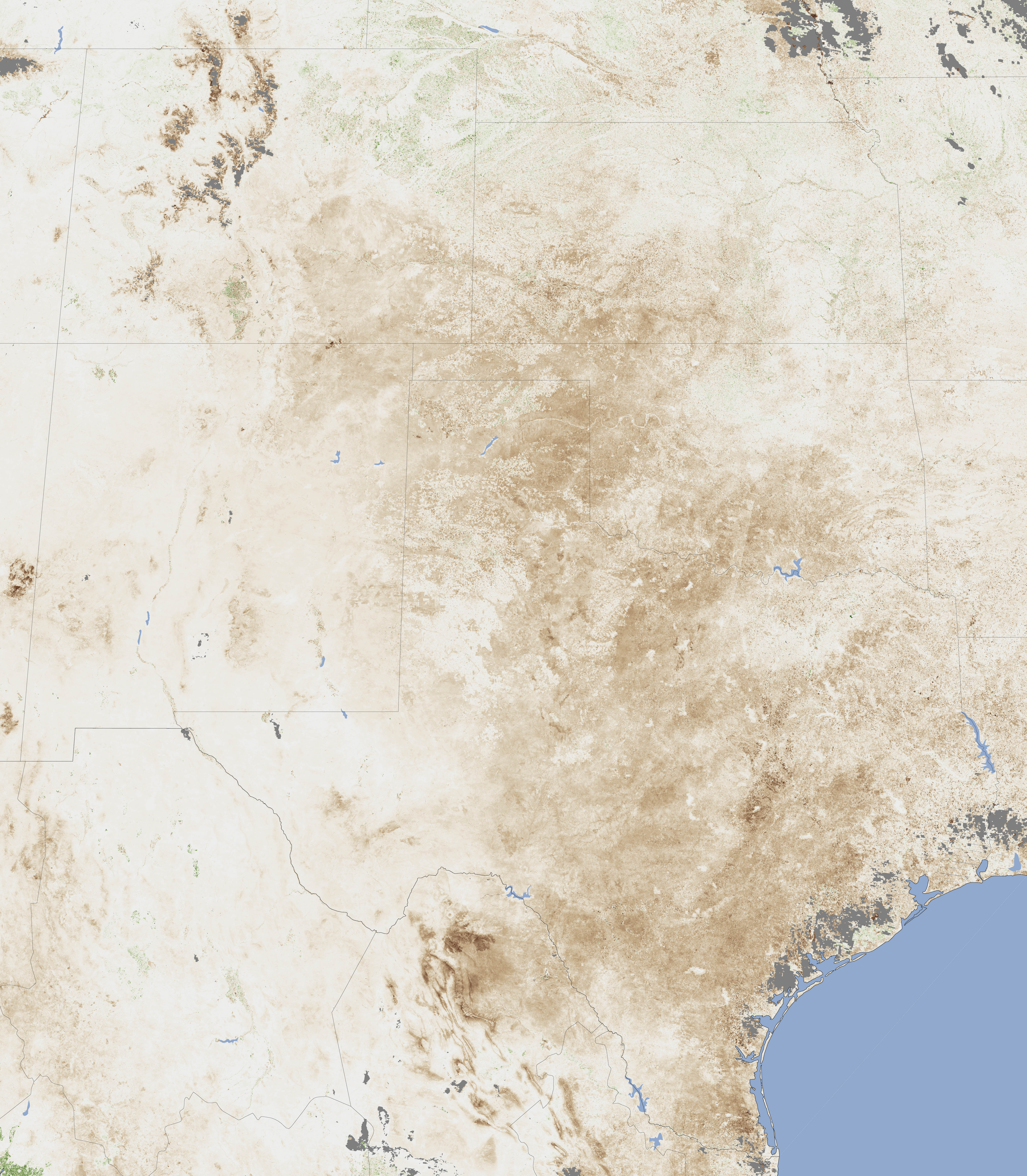
This image shows the impact of drought on plants throughout Texas, New Mexico, and Oklahoma. Made with data from the Moderate Resolution Imaging Spectroradiometer (MODIS) on the Terra satellite, the image compares plant growth between June 26 and July 11, 2011, with average conditions for the period. The image is dominated by brown, showing that plants were growing less than average throughout Texas and New Mexico.
The image supports an assessment by the U.S. Drought Monitor, which states that 94 percent of the range and pastureland in Texas was in poor or very poor condition in June 2011. In Oklahoma, 78 percent of range and pastureland was in poor condition.
Though drought is not a disaster that strikes all at once, it is nonetheless a devastating event that can cause death, disease, and loss of money and property. For these reasons, drought is termed the creeping disaster. So far farmers in Texas have lost 30 percent or more of their crops and pasture in 2011. The loss led the U.S. Department of Agriculture to declare a natural disaster in 213 Texas counties and additional counties in Arkansas, Louisiana, New Mexico, and Oklahoma. The declaration qualifies farmers in these regions for low-interest loans to cover their losses.
NASA Earth Observatory image created by Jesse Allen, using data from Jennifer Small and Assaf Anyamba, NASA GIMMS Group at Goddard Space Flight Center. Caption by Holli Riebeek.