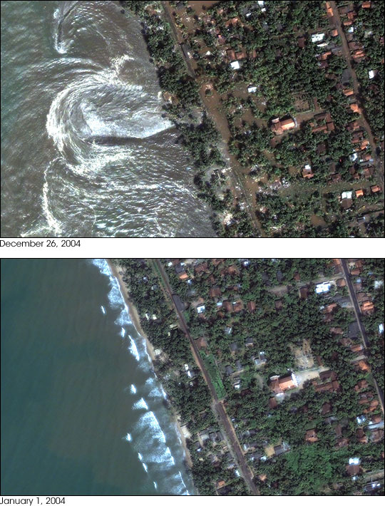


On December 26, 2004, tsunamis swept across the Indian ocean, spawned by a magnitude 9.0 earthquake off the coast of Sumatra. Aside from Indonesia, the island nation of Sri Lanka likely suffered the most casualties, with the death toll reported at 21,715 on December 29th.
DigitalGlobe's Quickbird satellite captured an image of the devestation around Kalutara, Sri Lanka (top), on December 26, 2004, at 10:20 a.m. local time—about an hour after the first in the series of waves hit. (A Quickbird image taken on January 1, 2004 (lower), shows the normal ocean conditions.) Water is flowing out of the inundated area and back into the sea, creating turbulence offshore. Some near-shore streets and yards are covered with muddy water. It is possible that the image was acquired in a “trough” between wave crests. Imagery of nearby beaches shows that the edge of the ocean had receded about 150 meters from the shoreline.
More images are available on the DigitalGlobe web site.
Images Copyright DigitalGlobe