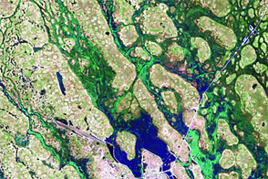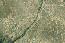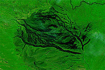

Since 2010, rainfall has been above average in many parts of sub-Saharan African—including Angola, Namibia, Tanzania, Cameroon, Congo, and Madagascar—according to the Climate Prediction Center of the U.S. National Weather Service. Persistent rains have flooded ephemeral rivers such as the Kuiseb in Namibia and the Boteti in Botswana, which have both reached record highs. Even the driest parts of southern Africa have seen exceptional rains and floods.
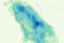
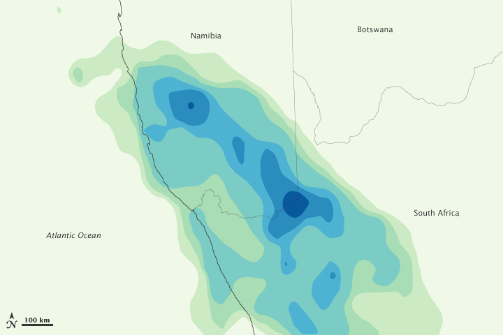
In early May 2011, more rain fell in one day in the Namib desert than typically falls in an entire year. The map above depicts rainfall for Namibia and South Africa on May 5, 2011. The estimates were made from the Multi-satellite Precipitation Analysis, based on data from the Tropical Rainfall Measuring Mission (TRMM). Shown in shades of green and blue, rainfall estimates range from 20 millimeters (0.8 inches) to greater than 70 millimeters (2.8 inches). In much of the Namib desert near the coast, less than 20 millimeters of rain fall in a year.
The photo depicts what is likely a “shelf cloud” associated with a high-precipitation supercell thunderstorm on the Central Namib west coast, one of the driest regions in Africa. The cloud spreads out at ground level due to a strong downdraft, which produces an advancing wedge of condensed water. Essentially, as large amounts of rain fall, the large and heavy rain droplets pull the air down with them. The curl at the bottom occurs because the down-drafting winds hit the Earth’s surface and spread out.
The bullseye precipitation pattern depicted in the top image occurs because these storms are short-lived and dump large amounts of rain very quickly in one area. The storm soaked the Namib Sand Sea and desert gravel plain east of Walvis Bay.
Government officials and international relief agencies estimated that several hundred thousand residents had been displaced or disrupted by flooding in Namibia. At least 62 people have died. “Dongas” (ditches) caused by the heavy rains have caused havoc on the roads, and some officials worried about a possible increase in water- or mosquito-borne diseases due to standing water.
During the most recent storm in southern regions, Francois Snyders of the Namibian Ministry of Environment and Tourism told The Cape Times that the Fish River area “got 50 millimeters of rain, which is more than the annual rainfall for the canyon.” Two dams, the Hardop and the Naute, were over capacity and had to open sluice gates.
NASA Earth Observatory image by Jesse Allen, using near-real-time data provided courtesy of TRMM Science Data and Information System at Goddard Space Flight Center. Photograph and background information courtesy of Dr. Frank Eckardt, University of Cape Town, South Africa. Caption by Michael Carlowicz and Heather Hyre.
Image of the Day Atmosphere Land Severe Storms
In early May 2011, more rain fell in one day in parts of Namibia and South Africa than typically falls in an entire year.
Image of the Day for May 12, 2011
Unusually heavy rains in 2011 flooded parts of Angola, Namibia, and other southern African nations.
