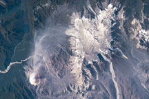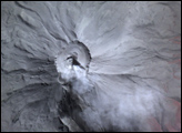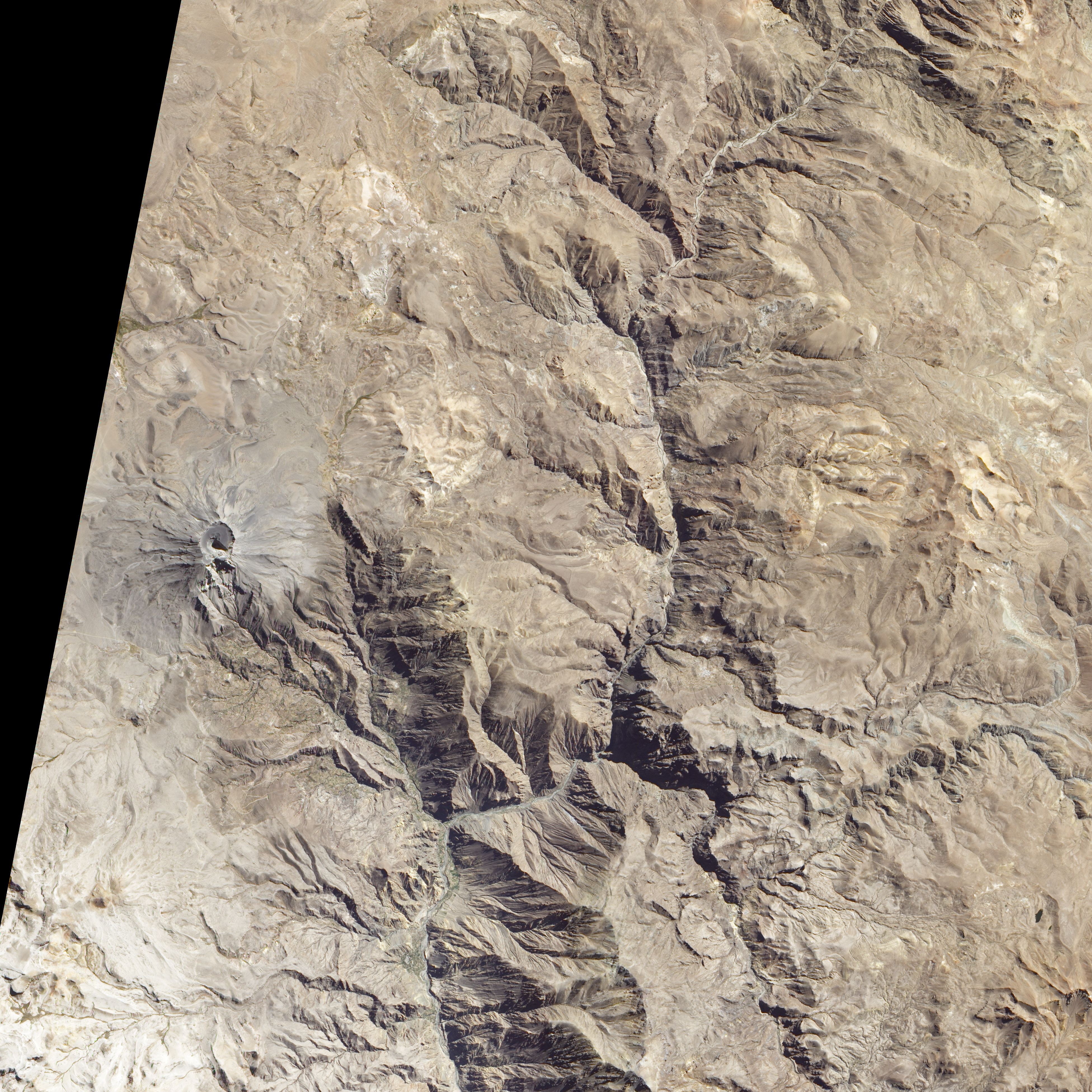
Free of vegetation, the gray and white lava-covered peak of the Ubinas Volcano looks like it could be located on the Moon or some other extraterrestrial body. The Advanced Land Imager (ALI) on NASA’s EO-1 satellite captured this true-color image of the Peruvian volcano on July 24, 2010.
The barren summit hints at recent volcanic activity, and in fact, Ubinas is Peru’s most active volcano. Apart from venting ash frequently, Ubinas has erupted many times since 1550. The last eruption started on March 25, 2006. As a result of its frequent activity, the steeply sloped peak is coated with lava. A canyon on the southern slope is evidence of a collapse in the volcano’s past.
A small circular caldera crowns the volcano. A little more than a kilometer across, the caldera is defined by walls that range from 80 to 300 meters high. Dark-colored ash and tiny volcanic rocks (lapilli) carpet the crater floor. An ash cone rises from the center of the crater, casting a dark triangular shadow. Within the shadow of the ash cone lies a white, funnel-shaped inner crater that is 200 meters deep.
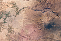
Ubinas is one of many volcanoes that dot the high desert plateau east of Lake Titicaca in southern Peru. In the Central Volcanic Zone in the Andes, mountains and volcanoes grow as the Nazca plate, part of Earth’s crust under the southeast Pacific Ocean, sinks beneath the South American plate. The pressure of the collision wrinkles the South American plate, pushing the Andes Mountains up. As the material in the Nazca plate melts deep in the Earth, some rises to the surface through weak areas in the South American plate. Along with South America’s other volcanoes, Ubinas is part of the Pacific Ring of Fire, a chain of volcanoes around the Pacific Ocean that formed because of tectonic activity.
NASA Earth Observatory image by Robert Simmon, using ALI data from the NASA EO-1 team. Caption by Holli Riebeek.
alert message