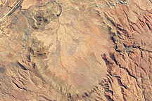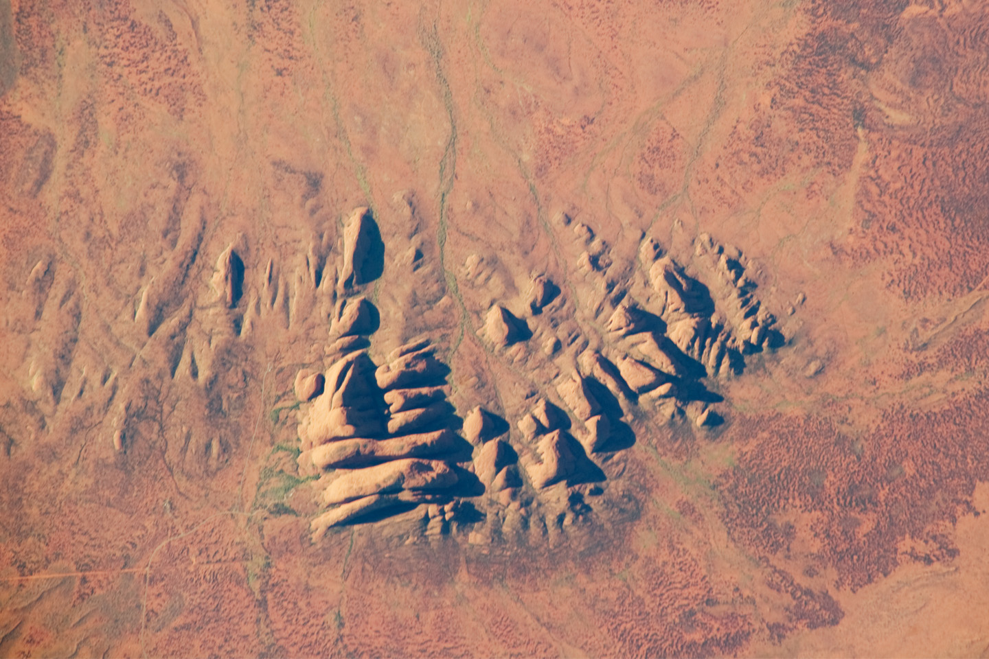
Located in the Northern Territory of Australia, Uluru-Kata Tjuta National Park hosts some of the world’s most spectacular examples of inselbergs, or isolated mountains. The most famous of these inselbergs is Uluru (also known as Ayers Rock). An equally massive inselberg located approximately 30 kilometers (20 miles) to the northwest is known as Kata Tjuta. Like Uluru, this is a sacred site to the native Anangu or Aboriginal people. An English-born explorer named the highest peak Mount Olga, with the entire grouping of rocks informally known as “the Olgas.” Mount Olga has a peak elevation of 1,069 meters (3,507 feet) above sea level, making it 206 meters (676 feet) higher than Uluru.
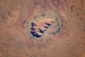
In this astronaut photograph, afternoon sunlight highlights the rounded summits of Kata Tjuta against the surrounding sandy plains. Sand dunes are visible at image lower left, while in other areas (image bottom and image right) sediments washed from the rocks have been anchored by a variety of grasses and bushes adapted to the arid climate. Green vegetation in the ephemeral stream channels that drain Kata Tjuta (image top center) provides colorful contrast with the red rocks and surrounding soils. Large gaps in the rocks (highlighted by shadows) are thought to be fractures that have been enlarged due to erosion.
Kata Tjuta is comprised of gently dipping Mount Currie Conglomerate, a sedimentary rock that includes rounded fragments of other rock types (here, primarily granite with less abundant basalt and rhyolite in a coarse sandy matrix). Geologists interpret the Mount Currie Conglomerate as a remnant of a large fan of material rapidly eroded from mountains uplifted approximately 550 million years ago. Subsequent burial under younger sediments consolidated the eroded materials to form the conglomerate exposed at the surface today.
Astronaut photograph ISS023-E-29806 was acquired on April 30, 2010, with a Nikon D3 digital camera fitted with an 800 mm lens, and is provided by the ISS Crew Earth Observations experiment and Image Science & Analysis Laboratory, Johnson Space Center. The image was taken by the Expedition 23 crew. The image in this article has been cropped and enhanced to improve contrast. Lens artifacts have been removed. The International Space Station Program supports the laboratory as part of the ISS National Lab to help astronauts take pictures of Earth that will be of the greatest value to scientists and the public, and to make those images freely available on the Internet. Additional images taken by astronauts and cosmonauts can be viewed at the NASA/JSC Gateway to Astronaut Photography of Earth. Caption by William L. Stefanov, NASA-JSC.