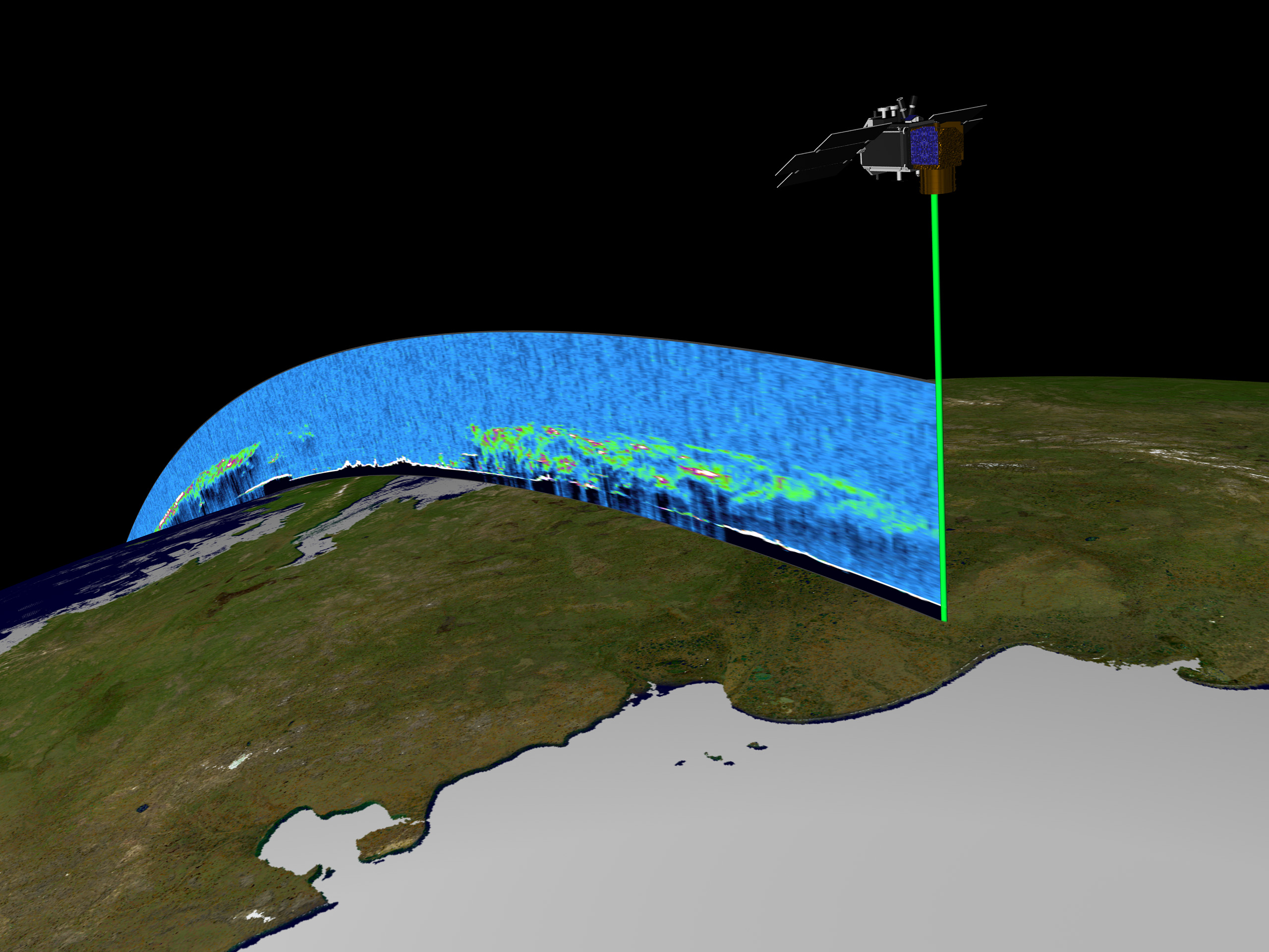
Orbiting the Earth at nearly 17,000 miles (27,360 km) per hour, NASA’s Ice, Cloud and land Elevation Satellite (ICESat) is collecting spectacular new three-dimensional measurements of the Earth’s surface and atmosphere. These data are helping scientists understand how climate changes are affecting Earth’s environment. Its onboard Geoscience Laser Altimeter System (GLAS) instrument beams pulses of green and infrared light straight down toward the Earth 40 times per second and then collects the reflected light in an onboard one-meter telescope. Such measures enable scientists to map the elevations of ice sheets and land surfaces all over the world at an unprecedented level of accuracy. The GLAS sensor is also providing the most accurate space-based measures of the heights of clouds and aerosol plumes. (Click to read the full NASA press release, entitled ICESat Captures Earth in Spectacular 3-D Images.)
This artist’s rendering, and animation (8.2 MB MPEG), features a model of the ICESat satellite (upper right) transmitting a green beam of laser light toward a true-color surface map of the Earth. The features in the vertical slice of atmosphere behind the satellite’s flight path are actual GLAS measurements. The various colors in this slice of atmosphere show the height and thickness of clouds and aerosols. The thickness increases as the color graduates from blue (low values), to green (intermediate values), to orange and finally to white (very high values). Note the “shadows” under the thickest portions of the clouds.
ICESat was launched on January 12, 2003. It is the latest in a series of NASA Earth observation spacecraft designed to study the environment of our home planet and how it may be changing. NASA’s Earth Science Enterprise is dedicated to understanding the Earth as an integrated system and applying Earth System Science to improve prediction of climate, weather and natural hazards from the unique vantage point of space.
Image courtesy NASA