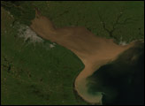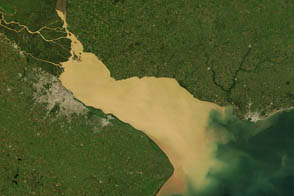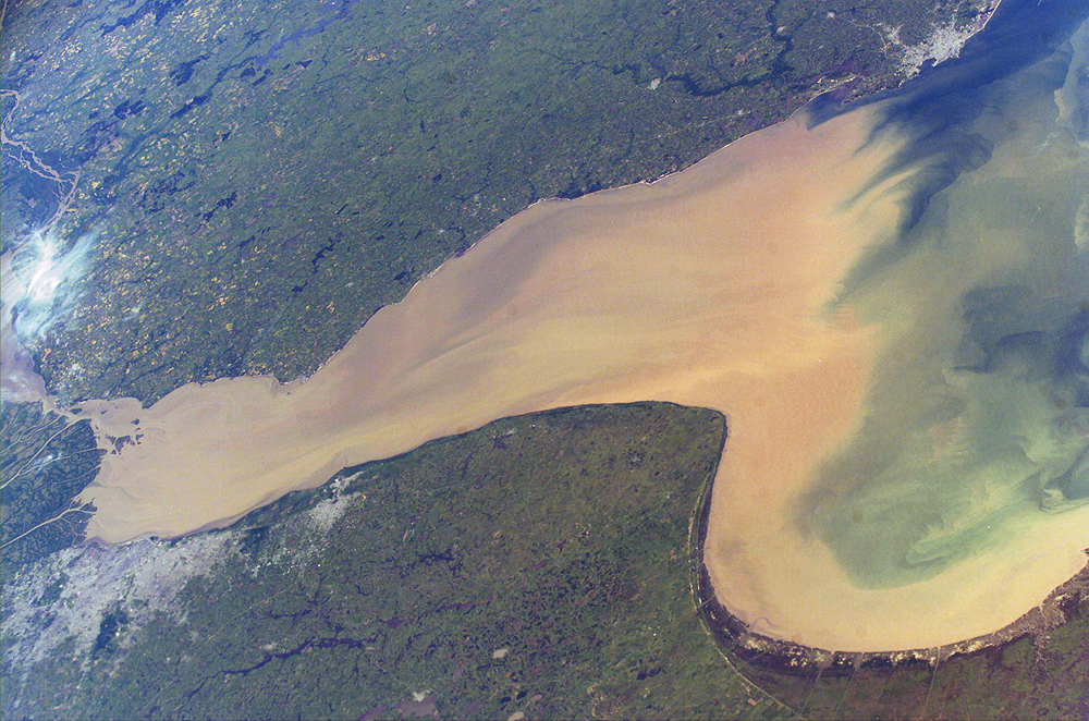
Rio de la Plata is the muddy estuary of the Paraná and Uruguay Rivers, and forms part of the border between Argentina and Uruguay. The rich estuary supports both capital cities of Buenos Aires and Montevideo.
The Paraná is South America’s second longest river, and drains much of the southeastern part of the continent. The extensive delta of the Paraná nearly reaches across the mouth of the Uruguay River. The rivers’ fertile soils support extensive agriculture, including livestock, in the region surrounding the cities.
This image provides a snapshot of the complicated mixing in the Rio de la Plata between the fresh river waters and the water of the South Atlantic. The thick sediment plume of the Paraná and Uruguay Rivers serves as a marker for the fresher water masses. It can be traced far out into the South Atlantic Ocean. The nutrients in the fresh water plume often feed large plankton blooms offshore.
Astronaut photograph ISS008-E-5983 was taken November 14, 2003, with a Kodak DCS760 digital camera equipped with an 80 mm lens and provided by the Earth Observations Laboratory, Johnson Space Center. The International Space Station Program supports the laboratory to help astronauts take pictures of Earth that will be of the greatest value to scientists and the public, and to make those images freely available on the Internet. Additional images taken by astronauts and cosmonauts can be viewed at the NASA/JSC Gateway to Astronaut Photography of Earth.
alert message