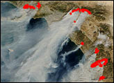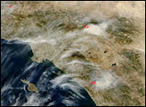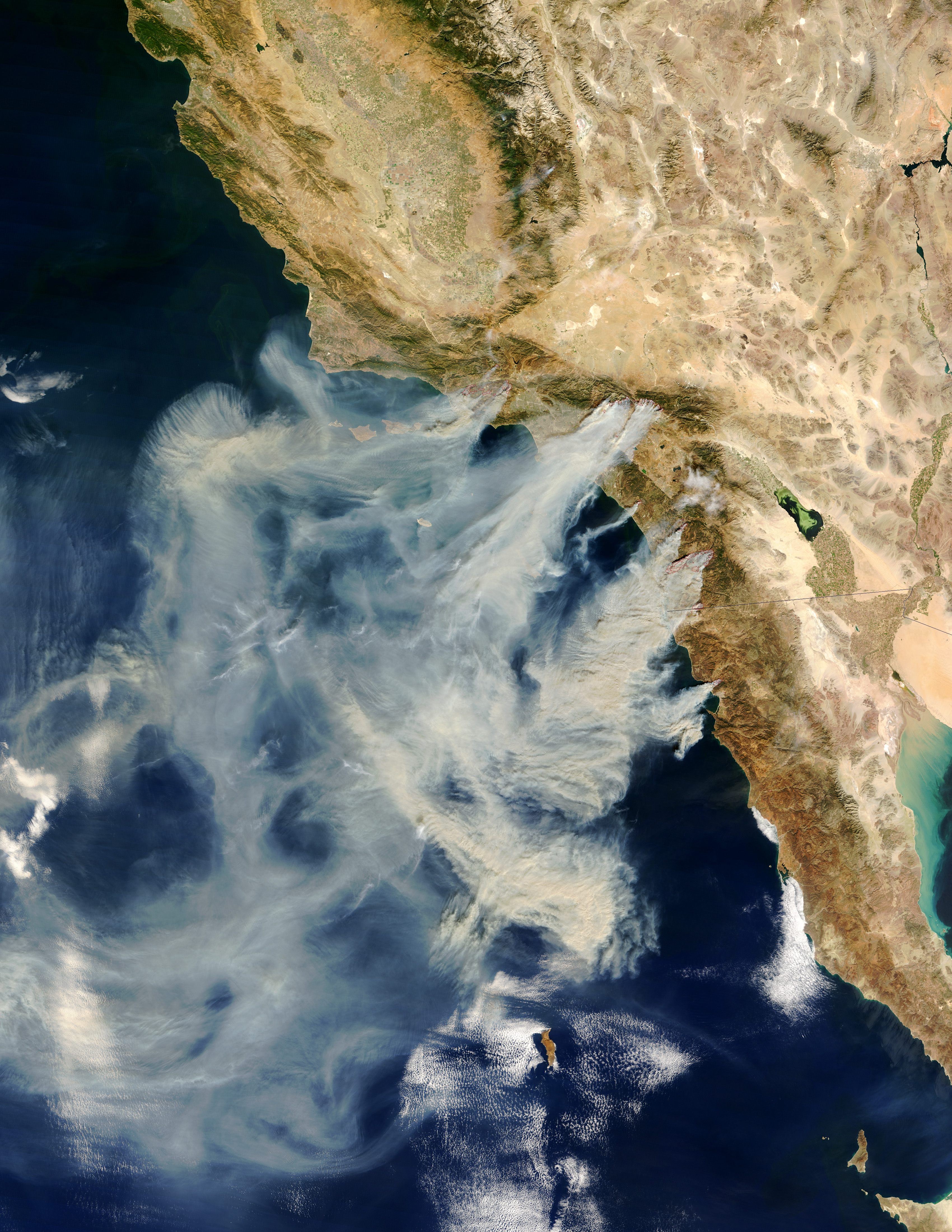
Several massive wildfires were raging across southern California over the weekend of October 25, 2003. Whipped by the hot, dry Santa Ana winds that blow toward the coast from interior deserts, at least one fire grew 10,000 acres in just 6 hours. The Moderate Resolution Imaging Spectroradiometer (MODIS) on the Terra satellite captured this image of the fires and clouds of smoke spreading over the region on October 26, 2003. The red polygons indicate precisely where the fires are burning, or have recently burned. (Compare this scene with one captured by the MODIS instrument aboard the Aqua satellite just one day before.)
In and around Simi Valley are the Piru, Verdale, and Simi Incident Fires; the next cluster—to the right of Los Angeles—is the Grand Prix (left) and Old (right) Fires. Closer to San Diego is the Roblar 2 Fire burning in the Camp Pendleton marine base. The Paradise Fire is encroaching on Escondido. The smoke of the massive Cedar Fire is completely obscuring the coastal city of San Diego. Finally, at the California-Mexico border is the Otay Fire. At least 13 people have lost their lives because of these fires, several of which appear to have been caused by carelessness and arson. Thousands have been evacuated across the region and hundreds of homes have been destroyed.
Image courtesy Jacques Descloitres, MODIS Rapid Response Team at NASA GSFC