

Satellites often detect fires in North Korea in April. As snow retreats in the spring, many farmers use fire to clear away last year’s crop debris and to fertilize the soil for the coming season. Such fires generally remain small and produce only modest amounts of smoke. But sometimes they escape the control of their handlers and push into forests on the country’s mountainous terrain.
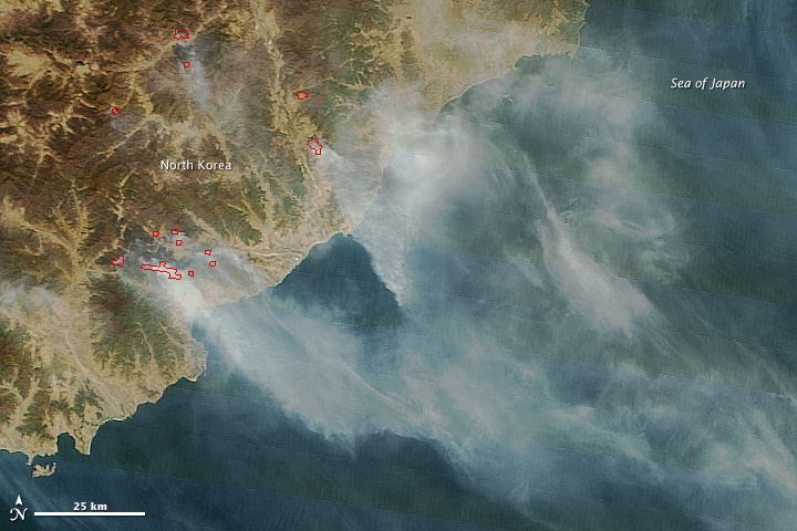
As in several recent years, control was lost in April 2015. When the Moderate Resolution Imaging Spectroradiometer (MODIS) on Terra passed over North Korea on April 27, 2015, the satellite observed several large fires burning in the eastern part of the country. Actively burning areas, detected by the thermal bands of MODIS, are outlined in red. Fields and grasslands, mainly in coastal plains and river valleys, appear light brown. Forests at lower elevations appear green; at higher elevations, forests are still brown at this time of year.
Many of the larger, smokier fires appear to be burning in forested highlands near cultivated river valleys. MODIS first began to detect the fires in significant numbers on April 23. By April 27, the number of fires had increased and many had grown significantly smokier. MODIS also observed a sizable plume drifting east over northern Japan.
North Korea faced a serious drought in the summer of 2014. While reasonably warm and wet weather was a late-season boon to crops in November, a dry winter followed. Dried out forests have raised concerns about potential food shortages in the spring.
NASA image courtesy Jeff Schmaltz, LANCE/EOSDIS MODIS Rapid Response Team at NASA GSFC. Caption by Adam Voiland.