
Detailed fire maps, produced in minutes with data from a NASA airborne sensor, enabled firefighters in Alabama to limit the spread of wildfires and save buildings.
Published Apr 29, 2025
A high-elevation camp in the Colorado Rockies served as a training area for specialized high mountain troops who later fought in World War II.
Published Apr 28, 2025
A sprawling natural amphitheater interrupts the green slopes of this mountainous area.
Published Apr 27, 2025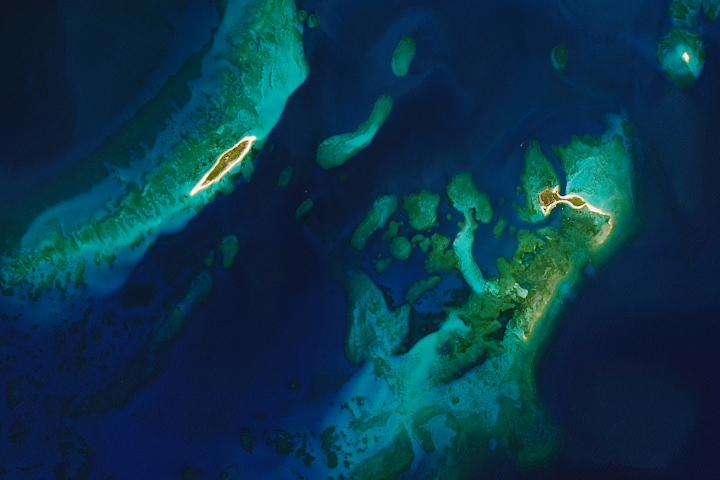
The national park west of mainland Florida includes a smattering of islands, but the vast majority of the park’s acreage lies underwater.
Published Apr 26, 2025
Fires in these coastal forests can rejuvenate ecosystems but also threaten large numbers of people and homes in the densely populated state.
Published Apr 25, 2025alert message
