It wasn’t built for Earth science, but the contributions were inevitable.
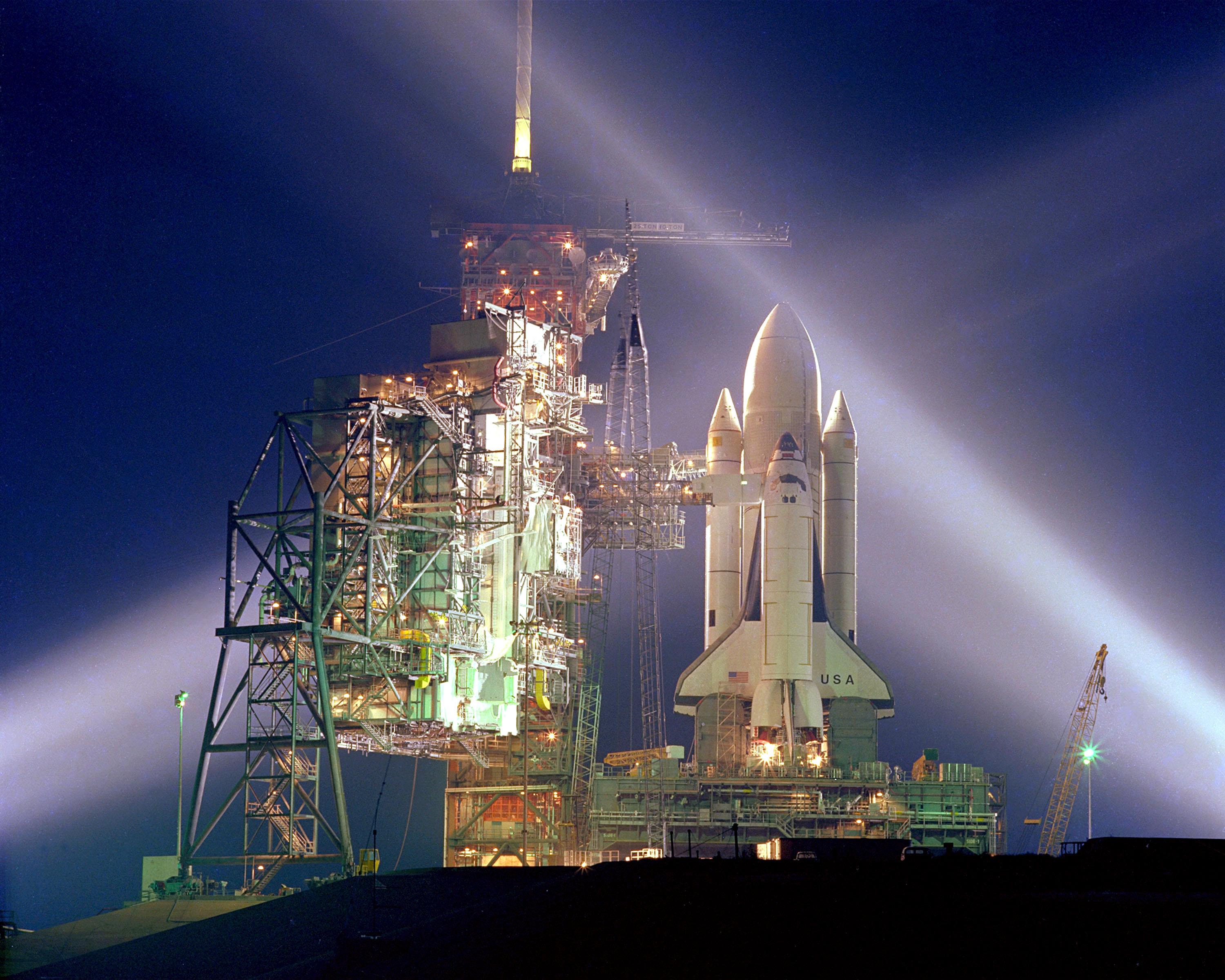
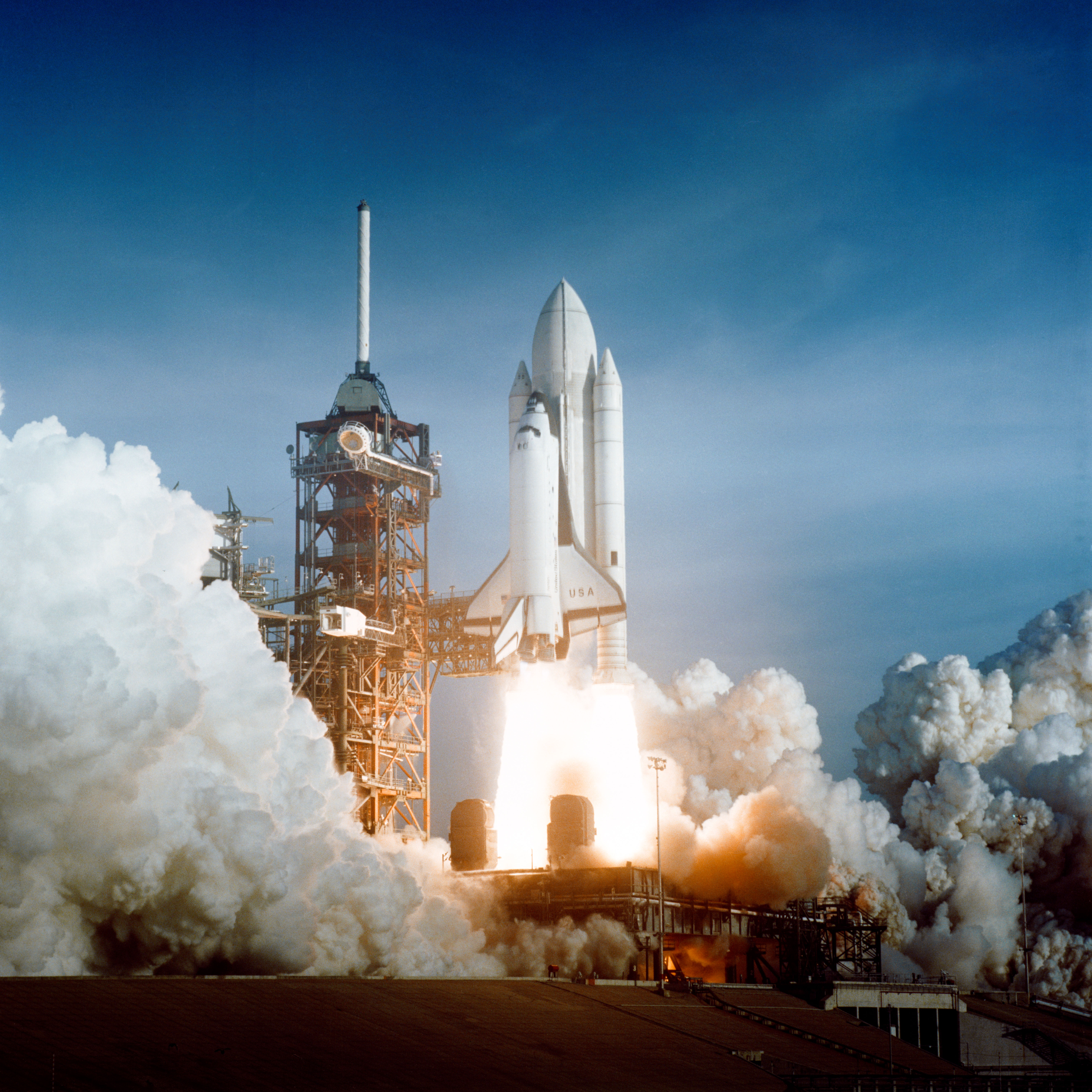
When the Space Shuttle Columbia first rocketed into space on a pillar of fire in April 1981, it was the maiden voyage of the world’s first re-useable spacecraft. Launched nine years after the last Apollo voyage to the Moon and six years after the joint Apollo-Soyuz Test Project, the shuttle was built to ferry humans and cargo into low-Earth orbit. It was part space plane, part rocket-propelled pick-up truck, and part orbiting launch platform.
But as the Earth science team at NASA’s Johnson Space Center likes to say: Every shuttle mission is a mission to planet Earth.
Jack Kaye, associate director for NASA’s Earth Science Division, put it this way in a recent book entitled Wings In Orbit:
The Space Shuttle launched major satellites that helped revolutionize our study of the Earth. Its on-board experiments provided discoveries and new climatologies never before available...It provided for multiple flight opportunities for highly calibrated instruments to help verify results from satellites...Shuttle flights provided for on-orbit demonstration of techniques that helped pave the way for subsequent instruments and satellites...The shuttle enabled international cooperation.
NASA’s Space Shuttle program comes to an end this month with the launch of Atlantis. Over the years, Earth Observatory has featured many images, data sets, and human insights from the Space Shuttle program. The following pages pay homage to those achievements and the unique view of Earth that America’s "space transportation system," or STS, has delivered for thirty years.
(NASA photograph STS134-S-062.)
In the 1980s and early 1990s, NASA embraced a “systems” approach to studying Earth science. Where land- and ocean-based scientists could make observations in great depth from individual points, space-based sensors could examine entire regimes of Earth with a broader but shallower view—the global ocean surface, plant cover over all continents, the composition of the atmosphere both horizontally and vertically. Scientists could ultimately piece together the micro and macro scales for a deeper understanding of how the planet works.
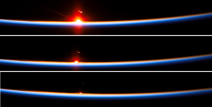
Sunset from STS-107. (Astronaut photographs STS107-E-05072, STS107-E-05075, and STS107-E-05080.)
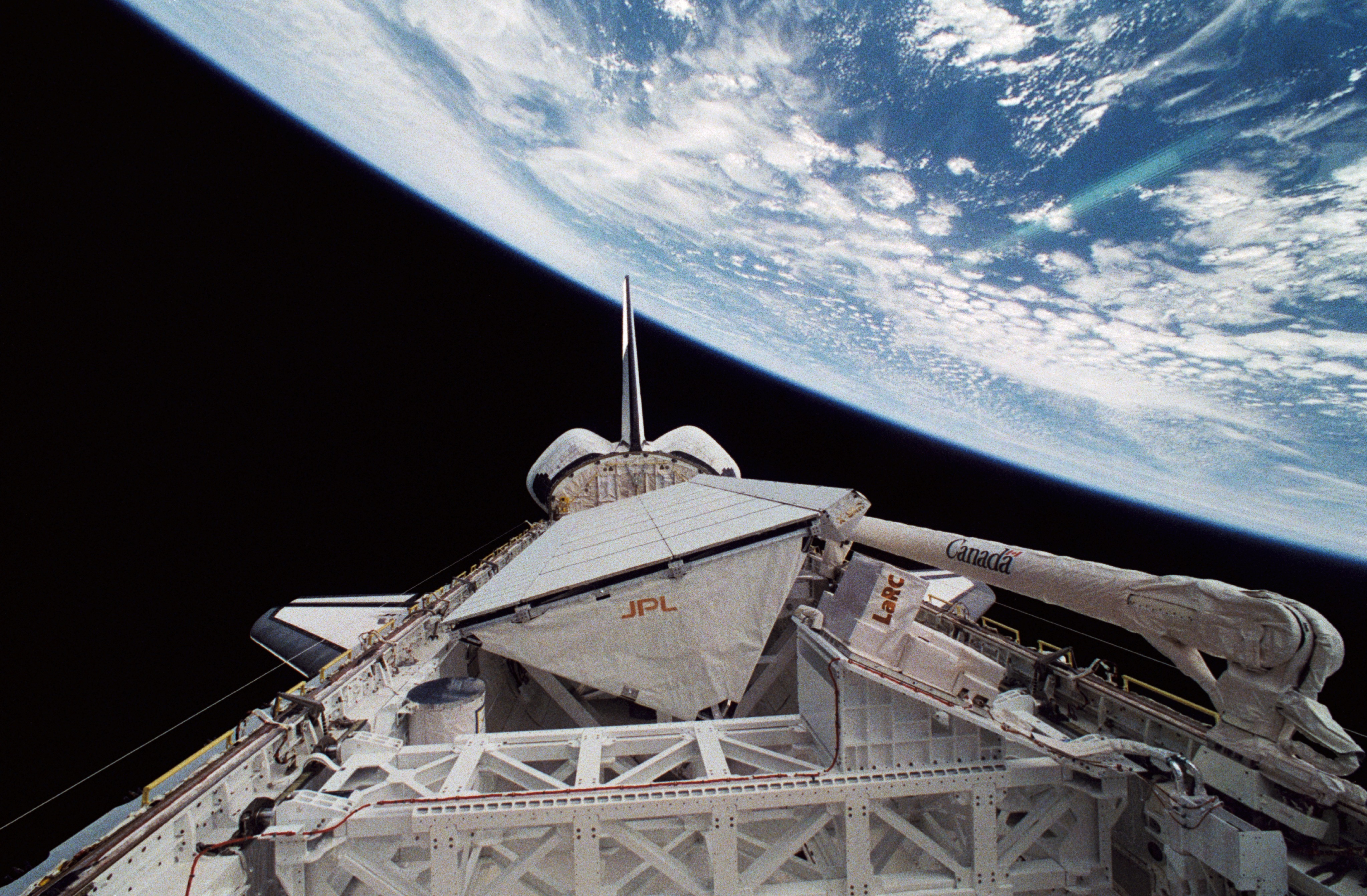
Equipped with a 60-foot-long payload bay, a nimble robotic arm, and two to seven pairs of human hands and eyes (depending on the size of the crew), the Space Shuttle became an orbiting laboratory and observatory for Earth system science. The shuttle could not observe continuously for months to years, as satellites might. But the human touch and the frequent flights did allow some intensive and diverse studies.
For instance, the Space Shuttle played a key role in measuring solar irradiance—the amount of radiant energy arriving at the top of Earth’s atmosphere from the Sun. A key driver of global climate and of atmospheric chemistry, the Sun’s output must be measured from above the water vapor, gases, and particles of the atmosphere, which absorb, scatter, and reflect sunlight before it can reach the ground.
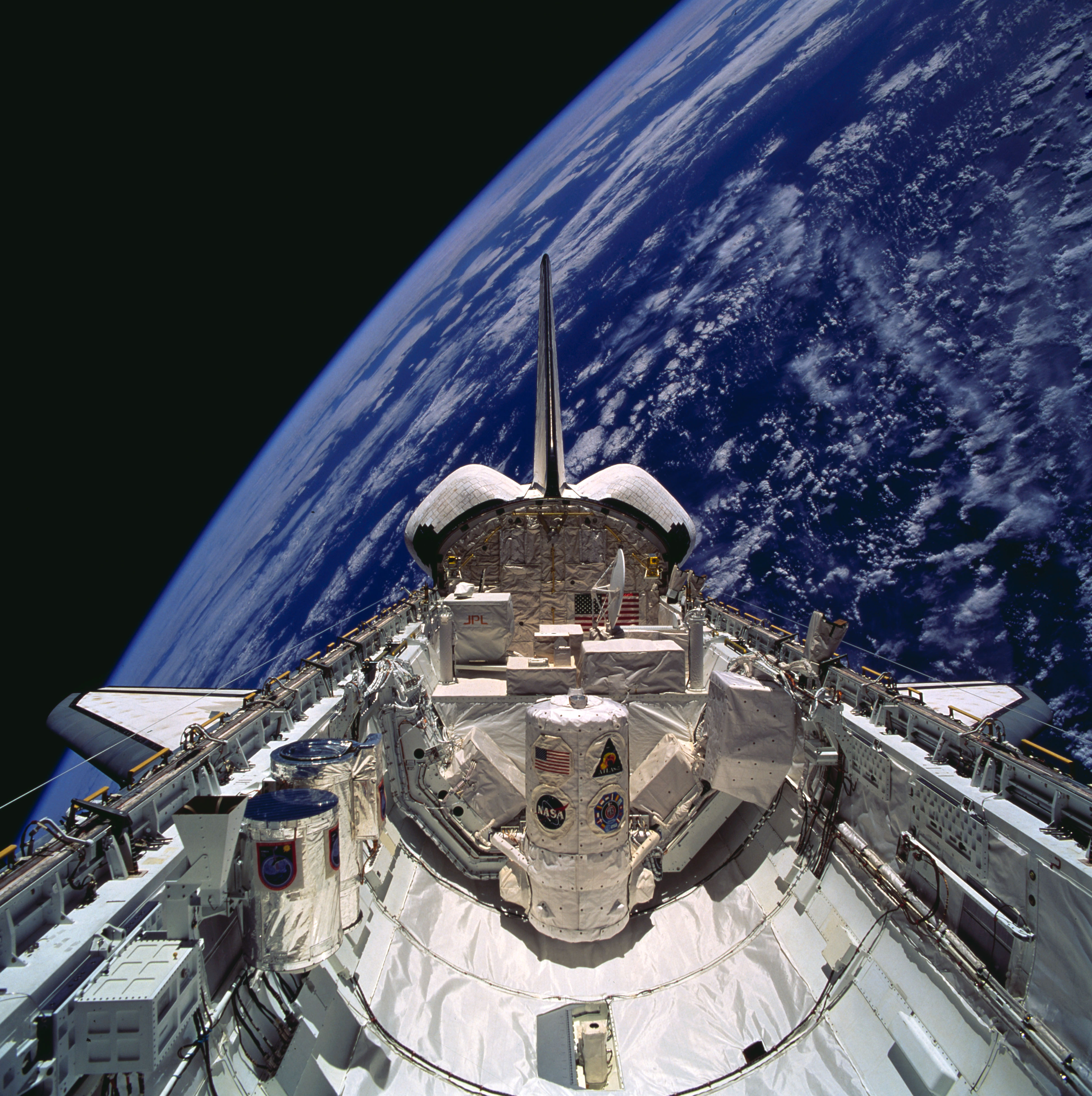
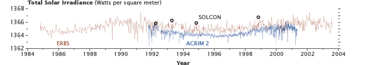
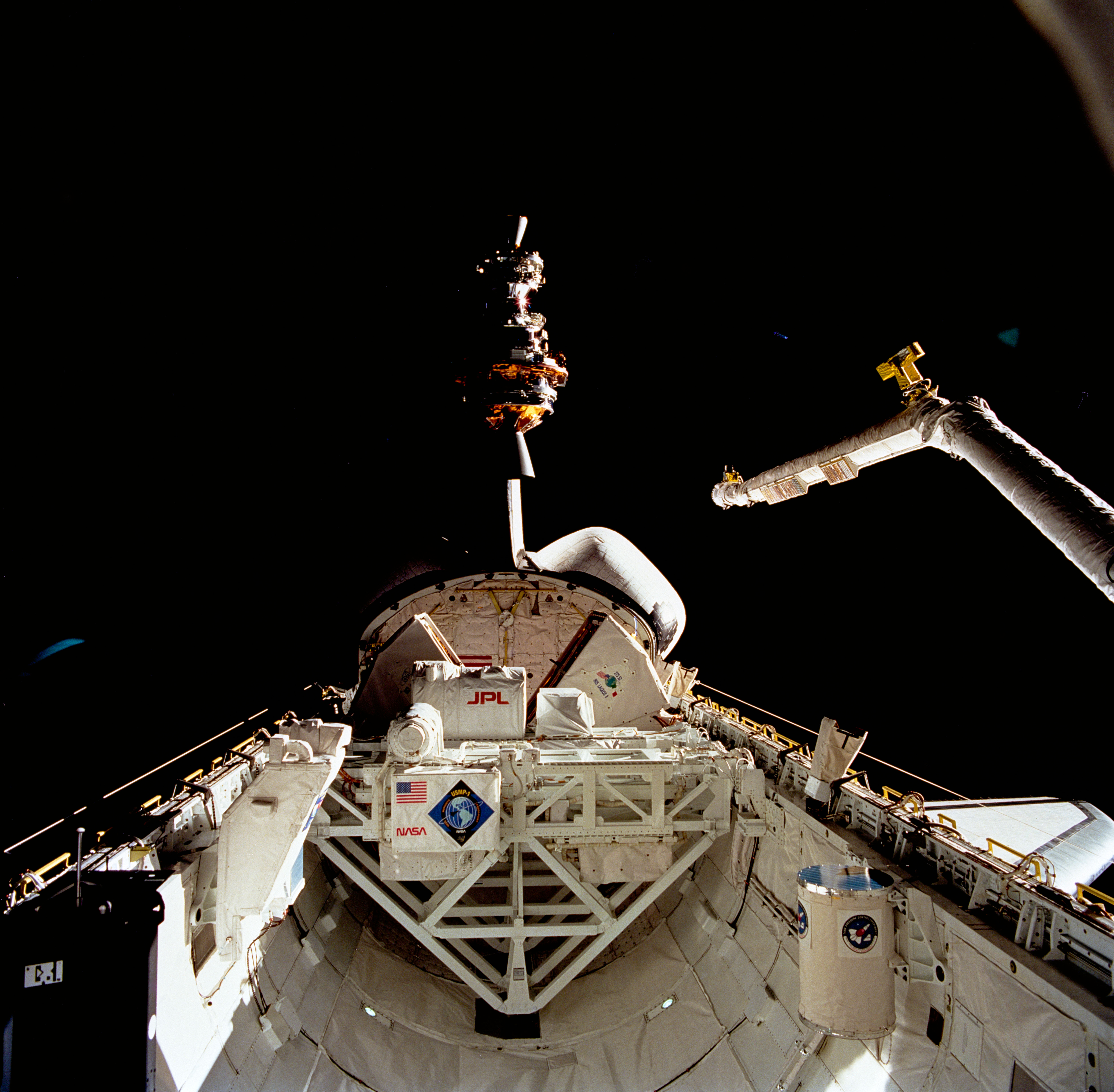
Payload bay of STS-66, including ATLAS-3 (with SOLCON) and SSBUV (left), and graph of total solar irradiance, measured by ERBS, ACRIM 2, and SOLCON. (Astronaut photograph STS066-129-005, graph adapted from Mekaoui et al., 2010.)
In the three flights of the Atmospheric Laboratory for Applications and Science, or ATLAS (middle photo), four of the 14 experiments measured the Sun’s output. Solar sensors were also flown independently on several shuttle missions.
One of those instruments was the Measurement of Solar Constant (SOLCON, middle image above). As shown in the plot of solar irradiance, SOLCON measurements served as a check on the quality of data coming from satellite-based sensors (ERBS and ACRIM), which degrade over time (because of conditions in space) and need to be recalibrated.
This satellite-complementing work was a common theme for other Space Shuttle sensors such as the Shuttle Solar Backscatter Ultraviolet Spectrometer (flown eight times), the Atmospheric Trace Molecule Spectroscopy experiments, and the Shuttle Ozone Limb Sounding Experiment, all of which observed stratospheric ozone and the chemistry and dynamics of our thin, blue atmosphere (top image).
You have a scientific instrument that has never been tested in space. You need to experiment and tinker and calibrate to get everything just right. You must make sure your gear can survive the extremes of a launch and of orbit. You have managers with limited dollars to spend and a wise instinct to be cautious with them.
What do you do? You build a prototype and fly it on the Space Shuttle. Over three decades, the shuttle served as a critical testbed for remote sensing instruments that would eventually fly on satellites. In fact, many of the technologies in NASA’s Earth Observing System made their maiden flights in the back of NASA’s space pick-up truck.
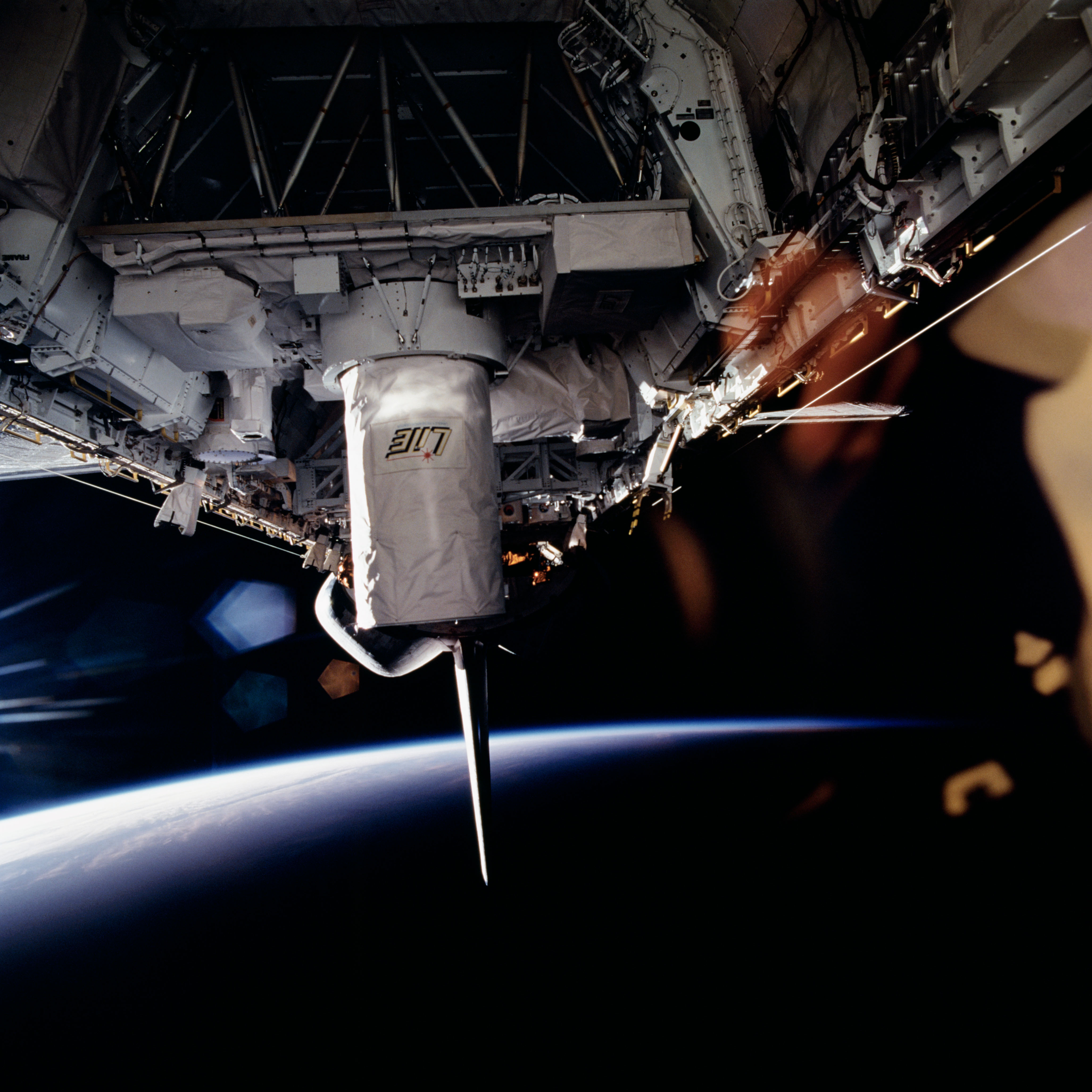
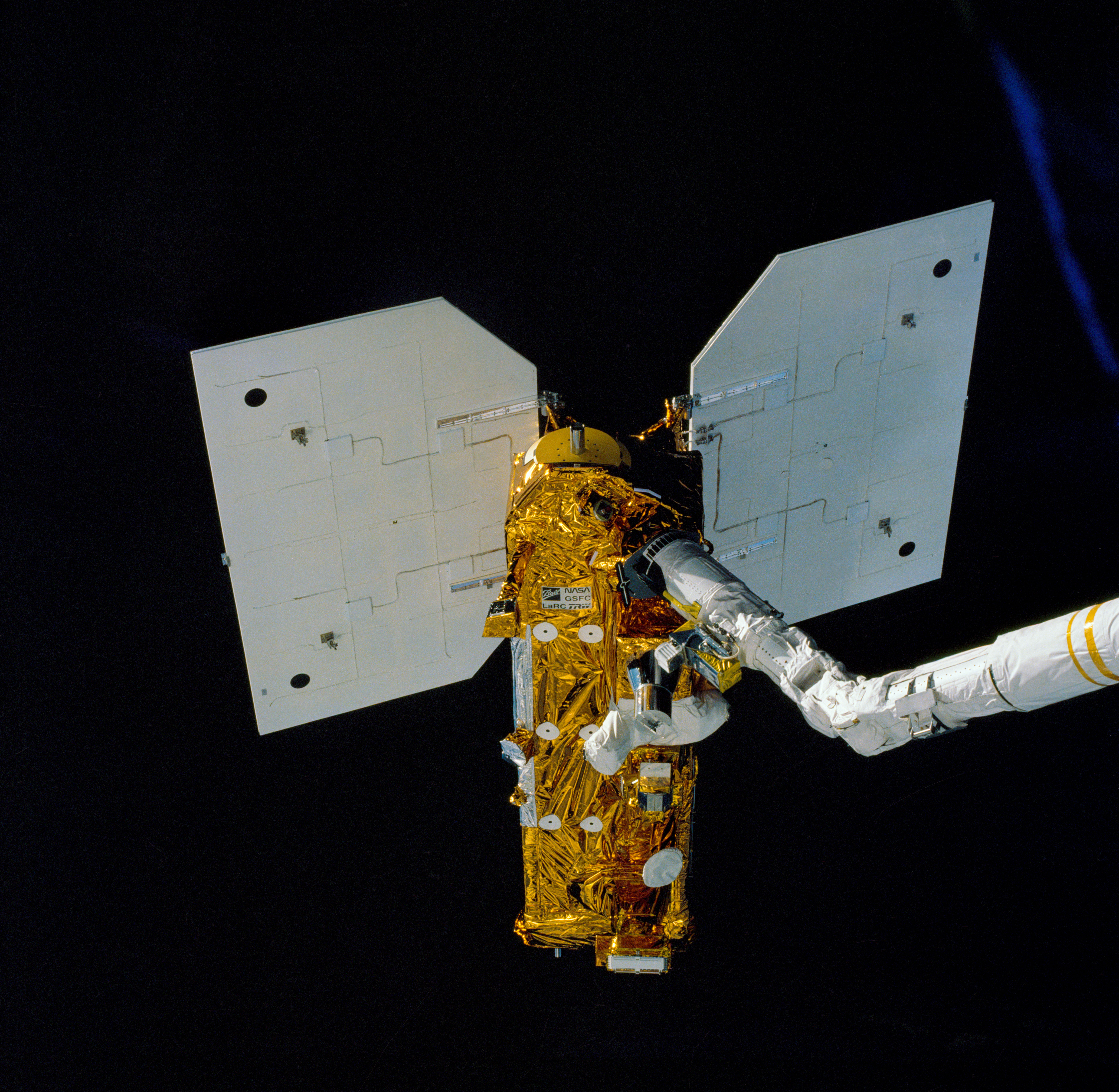
Photograph of the Lidar In-space Technology Experiment aboard STS-64. (Astronaut Photograph STS064-72-093)
The poster child for instrument testing is the Lidar In-space Technology Experiment, or LITE, carried into space in September 1994 on shuttle Discovery. The goal was to see if laser detection and ranging, or lidar, could help scientists study clouds, pollutants, and airborne particles from the vantage of space. Lidar shoots a quick burst of laser light at a target and observes the reflection and scattering of the light, which varies with different types of particles. (Radar does the same thing with radio waves.)
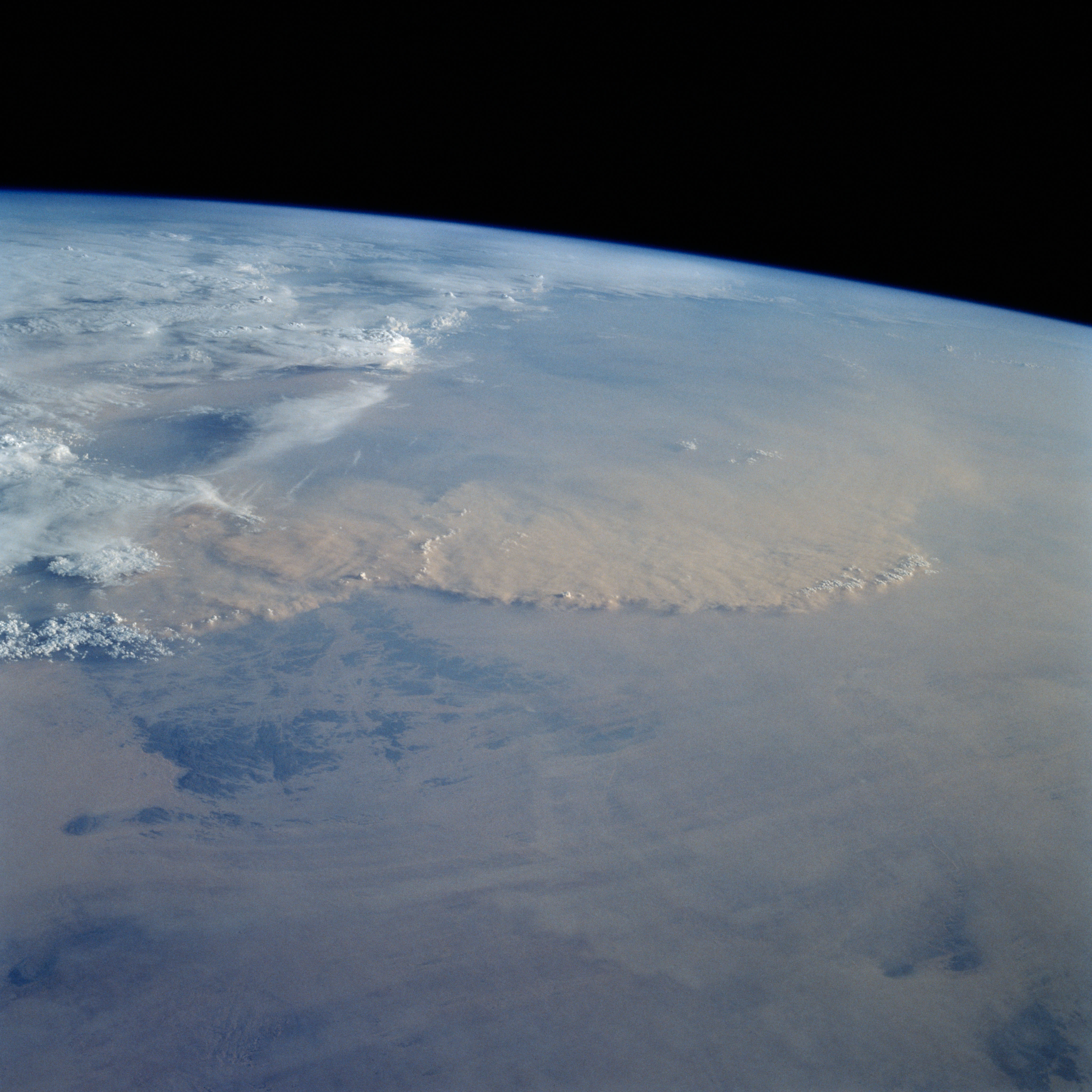
Dust over the Sahara. (Astronaut Photograph STS049-92-71.)
Could the instrument distinguish water clouds from dust storms, like the one spied by astronauts in May 1992 (above) over the Sahara Desert? Could it separate ice particles from volcanic ash, or pollution from forest fire smoke? Could it show the altitude of those floating particles?
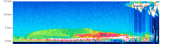
Profile of dust above the Sahara Desert from the Lidar In-space Technology Experiment. (Image courtesy Aerosol Research Branch, NASA Langley Research Center.)
In 53 hours of testing over 11 days, LITE provided answers to all of those questions, giving atmospheric scientists their first detailed, global view of the vertical structure of clouds and aerosols from the middle stratosphere down to the Earth’s surface. It also found one of those Saharan dust storms, as shown in the data plot above.
More importantly, LITE paved the way for future space lidar missions, such as the Ice, Cloud, and land Elevation Satellite (ICESAT) and the Cloud-Aerosol Lidar and Infrared Pathfinder Satellite Observation (CALIPSO).
The five space shuttles have carried a lot of cargo into space; 179 payloads weighing a combined total of 3,513,638 pounds (1593 metric tons), to be precise. Along with most of the pieces of the International Space Station, the shuttles have carried 99 satellites for launch from low-Earth orbit. It was a way to get two launches (sometimes three) for the price of one.
Three satellites stand out for their role in Earth science: the Earth Radiation Budget Satellite, the Upper Atmosphere Research Satellite, and the Laser Geodynamic Satellite 2.
Launch of the Earth Radiation Budget Satellite from STS-41-G. (NASA photograph STS41G-49-019.)
Launched from Challenger in October 1984 (top image), the Earth Radiation Budget Satellite was designed to investigate how energy from the Sun is absorbed and re-radiated by the planet, also known as the energy budget. The mission lasted 21 years, collecting key data on weather and climate, atmospheric ozone depletion, and the effects of fossil fuel burning.
Launch of the Upper Atmosphere Research Satellite from STS-48. (NASA photograph MSFC-9254338.)
The seven-ton Upper Atmosphere Research Satellite (UARS) (middle photo) was carried into space by shuttle Discovery in September 1991. UARS housed ten instruments to collect data on a variety of chemicals—including carbon dioxide, ozone, chlorine, methane, nitrogen oxides, and chlorofluorocarbons (CFCs)—and the processes that create, destroy, and mix them in the stratosphere, a region scarcely studied before the launch.
Launch of the Laser Geodynamic Satellite 2 from STS-52. (NASA photograph STS052-80-030.)
October 1992 brought the launch of the Laser Geodynamic Satellite 2 (LAGEOS) from a spinning solid fuel rocket (bottom image). A follow-on to LAGEOS 1, launched in 1979, the golf-ball shaped satellite was a simple aluminum sphere covered in tiny reflectors. Scientists could flash a pulse of laser light from the ground to the satellite to measure the geoid, or the shape of the Earth, and the movement of the planet’s tectonic plates.
“One of the Space Shuttle’s enduring science legacies is the near-global topographic mapping of the Earth with innovative radar remote sensing technologies,” wrote Kam Lulla and Michael Kobrick in Wings In Orbit. “The shuttle also served as an important engineering test bed for developing the radar-based mapping technologies that have ushered in a quiet revolution in mapping sciences.”
Radio detection and ranging, or radar, bounces rapid pulses of microwaves off of surfaces and records the echoes to create an image, in daylight or the dark of night. The wavelengths are longer than visible light, allowing radar to penetrate clouds, dust, and haze. And when radar is moving along a track line, it is possible to combine the echoes received at various positions to create a sort of “radar hologram.” All of these traits make radar ideal for mapping the surface of our planet—a process that was very difficult to standardize before NASA and other space agencies took a look from space.
Starting with the second-ever Space Shuttle mission, the NASA Jet Propulsion Laboratory and partners from Germany and Italy flew five radar mapping experiments: Shuttle Imaging Radar A (1981) and B (1984), Space Radar Laboratory 1 (1994) and 2 (1994), and the Shuttle Radar Topography Mission (2000). Astronauts used the shuttle’s robotic arm like a boom, stretching the radar out of the cargo bay (top image) and into an unobstructed view of Earth.
From the very first flight with a single-frequency instrument, the shuttle imaging radars proved themselves useful in mapping geologic structures, exposing faults, fractures, and buried features that were hard to detect from the ground or with visible-light imaging. They also proved themselves sensitive to changes in roughness, allowing researchers to distinguish between vegetation and human-made structures.
The middle image above—acquired from shuttle Endeavour in April 1994—shows the scars of an asteroid or comet impact in the midst of the Sahara Desert in northern Chad. The concentric rings of Aorounga impact crater, which spans about 17 kilometers (10.5 miles), were buried and filled over thousands to millions of years by sandy sediments. The Spaceborne Imaging Radar-C (SIR-C) and X-band Synthetic Aperture Radar (X-SAR) of Space Radar Laboratory 1 was able to see through the debris to the rocky formation below.
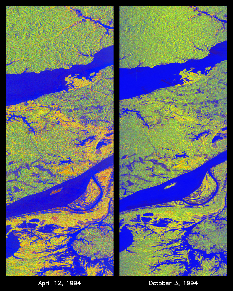
The bottom pair of images show the Manaus region of Brazil, in the Amazon River watershed. As viewed by space radar in April 1994 (left) and October 1994, green areas are heavily forested, while blue areas are either cleared forest or open water. The yellow and red areas are flooded forest or floating meadows, with the flood extent much greater in April. Such images demonstrate the utility of radar for penetrating thick vegetation and for viewing regions with frequent cloud cover.
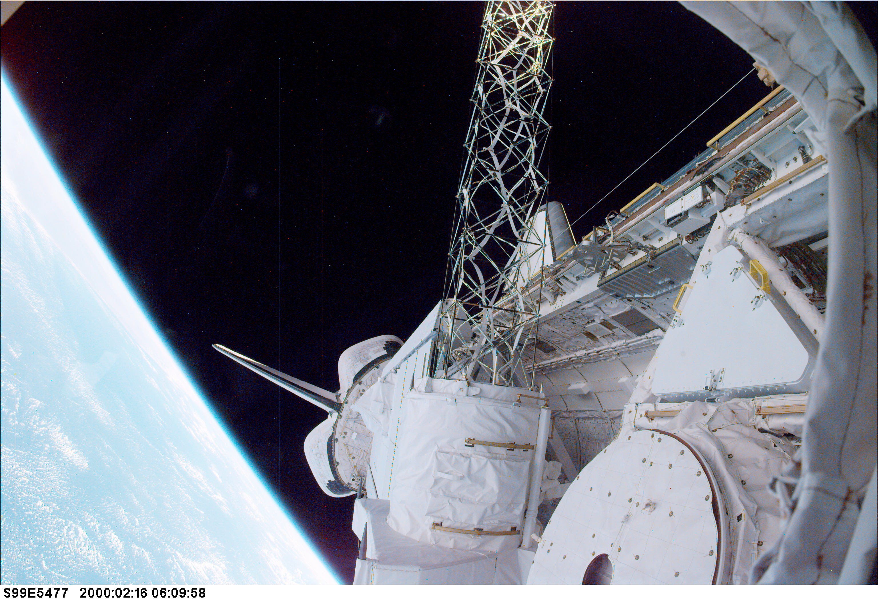
(NASA photograph STS99-E-5477.)
The crowning piece of the radar mapping efforts came in February 2000 on the shuttle Endeavour. Conceived by scientists at NASA’s Jet Propulsion Laboratory—in collaboration with the U.S. National Imagery and Mapping Agency (now the National Geospatial-Intelligence Agency) and the German and Italian space agencies—the Shuttle Radar Topography Mission (SRTM) collected 9 terabytes (9 trillion bytes) of data on the shape and features of the surface of the Earth.
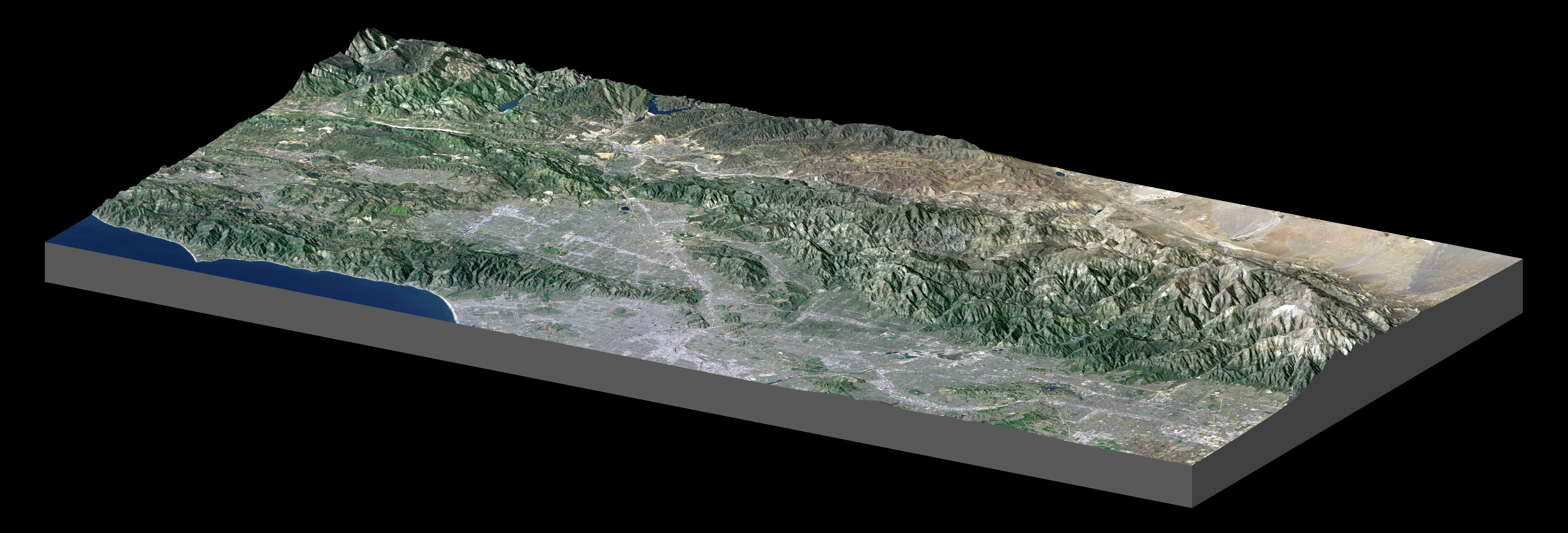
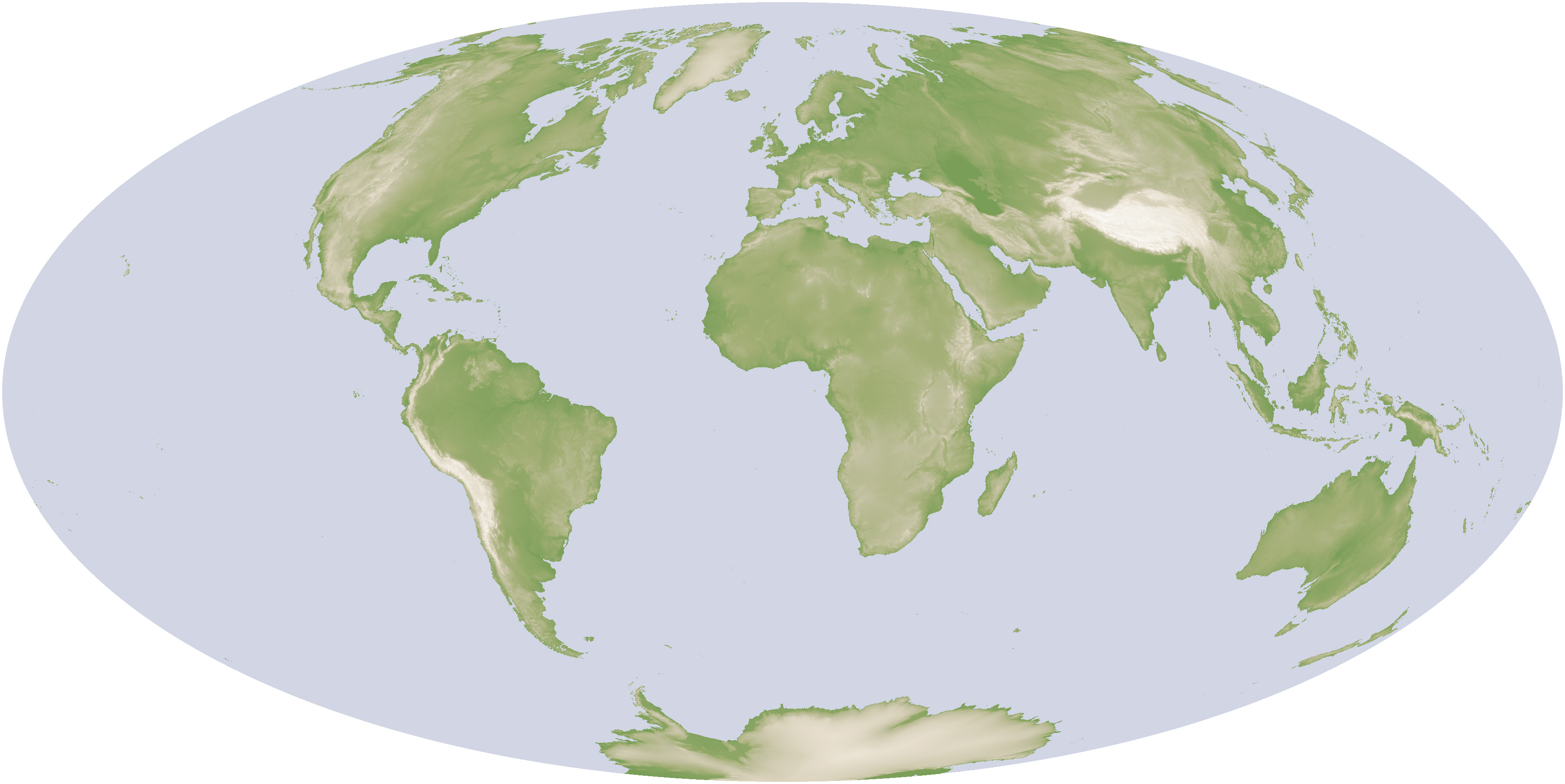
Map of Los Angeles (PIA04967) from SRTM, and global topography map based on SRTM, Radarsat, and USGS data. [NASA Earth Observations (NEO).]
That SRTM radar data became the basis for the first high-resolution map of Earth’s topography. It was a uniform, standardized look at land elevation that offered a three-dimensional view of our world.
The middle image, a shaded relief map of the Los Angeles and the nearby mountains, demonstrates the powerful combination of SRTM elevation data with natural- and false-color visible imagery from the Landsat 7 satellite (acquired May 4, 2001). Downtown Los Angeles gives way to the San Gabriel Mountains, the Sam Andreas Fault, and the Mojave Desert. At the full image resolution, features on the ground as small as 15 meters (49 feet) across can be distinguished.
The third image is a digital elevation model of the entire Earth. Mappers and Geographic Information Systems professionals around the world have come to rely on SRTM data, and the U.S. Geological Survey estimates that an SRTM-derived product is downloaded from its servers every second of the day.
For all of the novel and sophisticated technology that has been flown on the space shuttles, the most underrated instrument to fly in space is the human eye.
“Humans are smart, trainable sensors,” says Kam Lulla, former chief scientist for Earth observation in the Human Exploration Science Office at NASA’s Johnson Space Center. Astronauts have unique sensing capabilities, including the knowledge to identify and interpret changes and features on the planet, and the ability to react to events and conditions—from changing the angle, width, or focus of a camera shot to adjusting for sunlight. “We take NASA’s astronauts, who are already very smart, accomplished people, and we work to make them Earth-smart. We train their minds for science in orbit.”
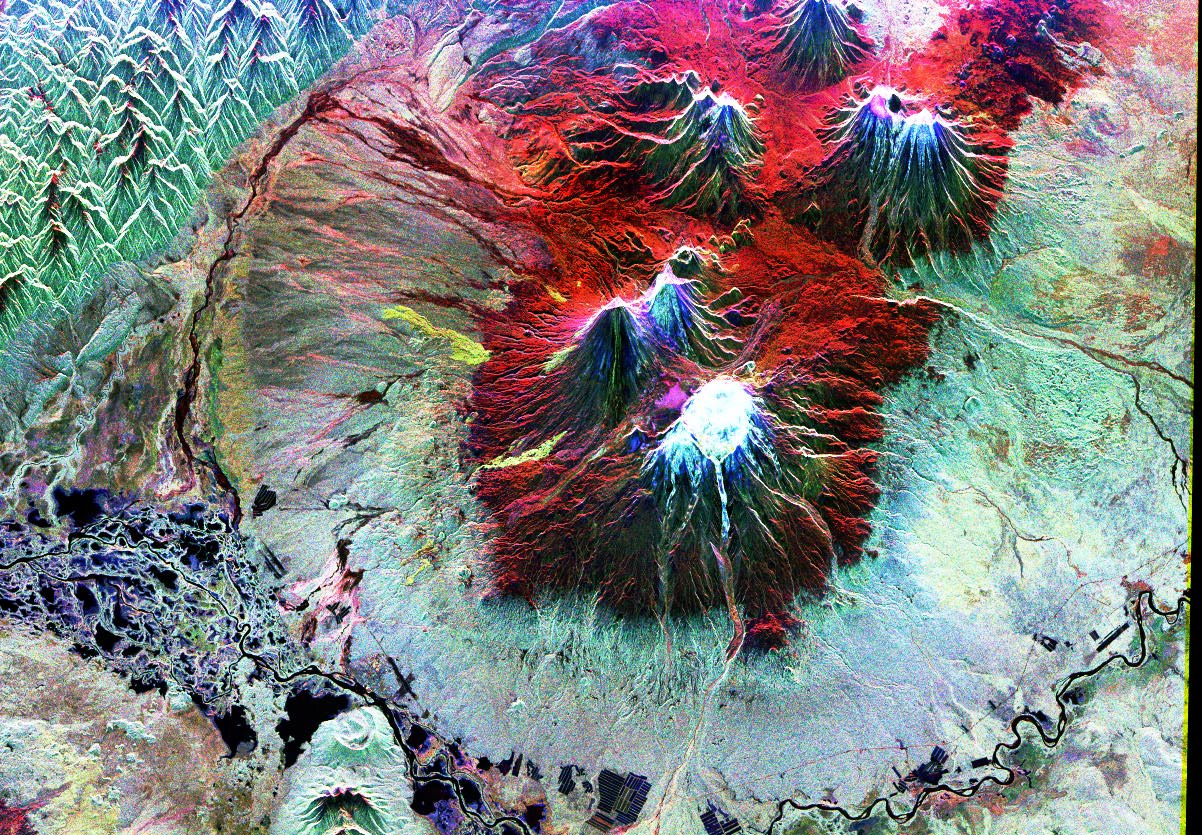
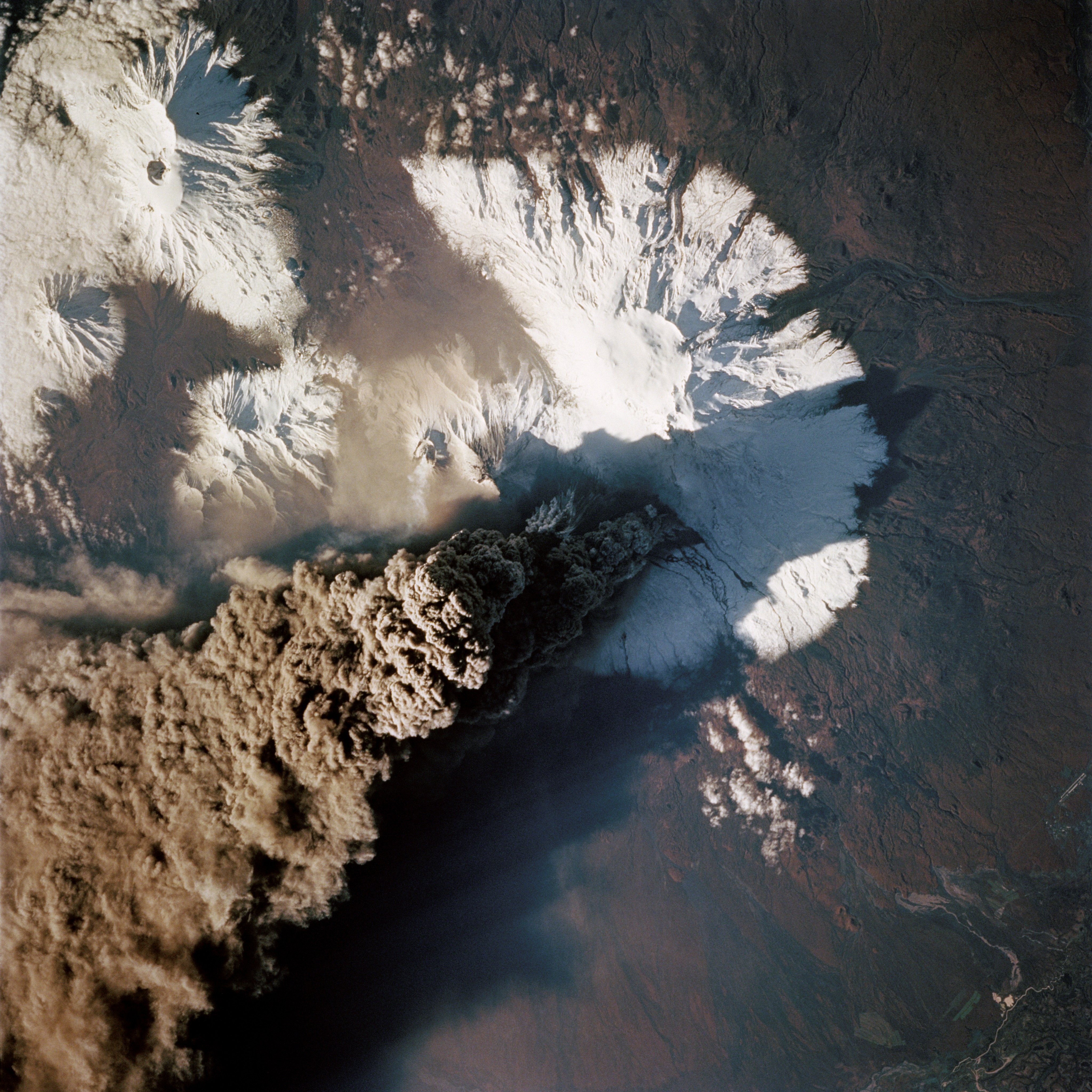
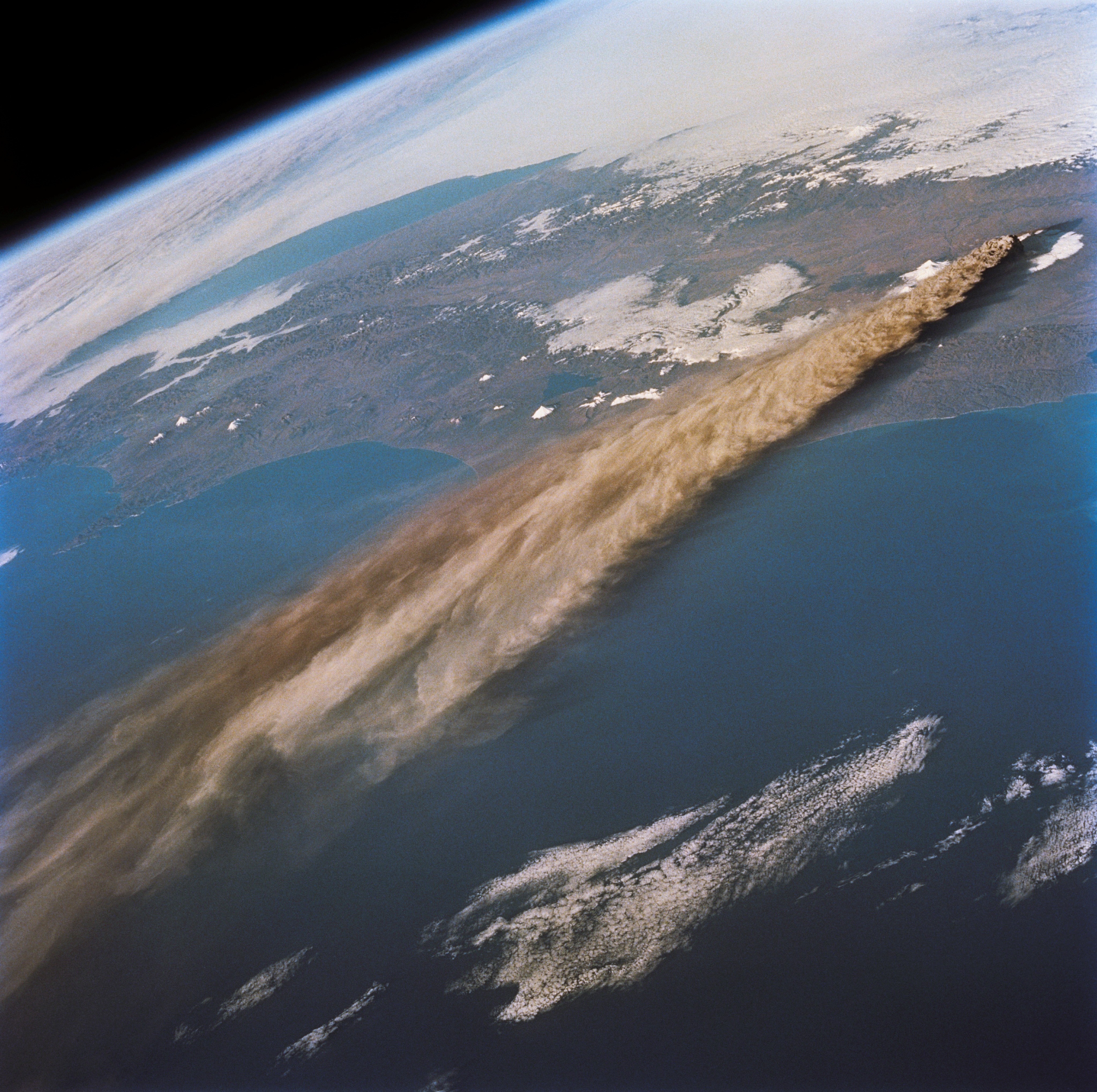
The images on this page show the blending of high-technology with high-mindedness. In 1994, the Spaceborne Imaging Radar-C / X-band Synthetic Aperture Radar (SIR-C/X-SAR) collected the land surface data to build the top image of Klyuchevskaya (Klyuchevskoi) volcano on Russia’s Kamchatka Peninsula. The volcano, one of the world’s most active, is the blue, triangular peak in the lower center of the image, while the bright red area delineates snow cover. Two other active volcanoes are also visible: Bezymianny, the circular crater above and to the right of Klyuchevskaya, and Tolbachik, the large volcano with a dark summit crater near the upper right edge.
While the Space Radar Laboratory 2 was busy collecting data, the astronauts on Endeavour did their own observing. They picked up still- and video cameras and captured dramatic footage, just hours after the eruption started on September 30, 1994. With the eruption near its peak, the crew got a “nadir,” or straight down view (middle image) of the black plume and of the ash falling on the mountainsides. Some time later, they used a 70-millimeter lens to look back at the extent of the plume, which reached altitudes of 15,000 meters (50,000 feet).
“Photographs from the Space Shuttle are punctuated snapshots of distinct places on Earth,” says Cindy Evans, an Earth scientist and long-time trainer and ground-based guide to astronauts. “They are framed by a human eye and perspective, and they are accessible to anyone. These images speak to people.”
From the sunrises to the city lights, from the lush greens to the bright whites, astronauts have seen and shared many visions of Earth’s beauty.
They’ve also had gripping view of some of the world’s disasters, natural and unnatural. In 1991, the astronauts on six shuttle missions—Atlantis (STS-37, STS-43, and STS 44), Columbia (STS 40), and Discovery (STS-39 and STS-48)—had a view of an environmental horror.
In February 1991, near the end of the Persian Gulf War, Iraqi troops systematically destroyed and set fire to 750 oil wells across Kuwait. Approximately 4 to 6 million barrels of crude oil and 70 to 100 million cubic meters of natural gas burned each day for weeks. Images from the space shuttle astronauts were used by the Earth Observations Group at NASA Johnson Space Center to compile a map of the smoke plumes.
In the two images above from April 1991, black smoke plumes are still streaming into the skies around Kuwait City five weeks after the fires were set. The oily plumes extended three to five kilometers up into the atmosphere and hundreds of kilometers across the horizon.
In a wide-angle view from June 1991 (third image), a pall of smoke hovers in the distance over the Persian Gulf and the nations surrounding it. The plumes degraded the air quality in the region for months and generated various potentially hazardous gases. By November 1991 (bottom image), the last of the oil fires were put out, but the residue of oil and soot stained the desert near the Alburoan and Umm Gudair oil fields immediately south of Kuwait City.
Astronaut photography awoke many people—including scientists—to large-scale Earth events and planetary rhythms that few knew were going on. One of those events was the destruction of tropical rainforests by fire and blade.
(NASA photograph STS41D-40-22.)
The top image, taken August 31, 1984, from the shuttle Discovery, gives an oblique view of smoke billowing from multiple fires in the Amazon rainforest in Rondonia, Brazil. Farmers and ranchers opened up lands by setting fires in the dry season to make room for cattle and crops. Near the horizon, the Andes Mountains of Bolivia provide a natural barrier so that smoke does not reach the altiplano of southern Peru and Bolivia.
The continent-size scale of slash-and-burn forest clearing was largely revealed to ecologists by astronaut photography. Kam Lulla recalls more than one astronaut marveling at the vast extent of seasonal fires and smoke across the Amazon and many other tropical regions.
(NASA photograph STS046-88-23.)
The lower image, taken from shuttle Discovery on August 2, 1992, looks straight down on the forest to reveal the fishbone pattern of forest destruction. The first clearings in the forest are arrayed along the edges of roads. Over time, legal and illegal roads penetrate a remote part of the forest, and farmers migrate to the area to claim land along the road and clear some of it for crops.
Before astronauts rode into space, scientists and everyday citizens had hints that their world was changing. From space, the scale and the connectedness of the changes become clearer.
Observing Earth from space is one of the NASA’s longest-standing science experiments. Astronauts have used handheld cameras to photograph the Earth since the Mercury missions in the early 1960s, taking more than 800,000 photographs of Earth. Half of that total has come from the 135 flights of the Space Shuttle program.
“Astronauts are like tourists going to an exotic place, and we know they are going to take photos,” said Kam Lulla. “Early in the space program, NASA decided that if they were going to do this anyway, let’s get some science content out of it.” That was a wise decision.
For most of the Space Shuttle program, each crew was trained to visually recognize 25 to 50 locations of interest to the Earth science community. Sometimes natural events added to the target list. Sometimes the astronaut’s eyes found beauty and surprises below.
“Crew members become excited and eloquent spokespersons about the value of understanding Earth processes at a planetary scale,” writes Cindy Evans, one of the Earth scientists supporting the shuttle.
Astronauts are still being trained for the view from space. The Space Shuttle program is ending, but the International Space Station offers its own vantage point of the planet—and astronauts will still be heading there for another decade.
And there is still a next generation of astronauts—headed for the Moon, Mars, an asteroid, and points beyond—who will need to know what home looks like.
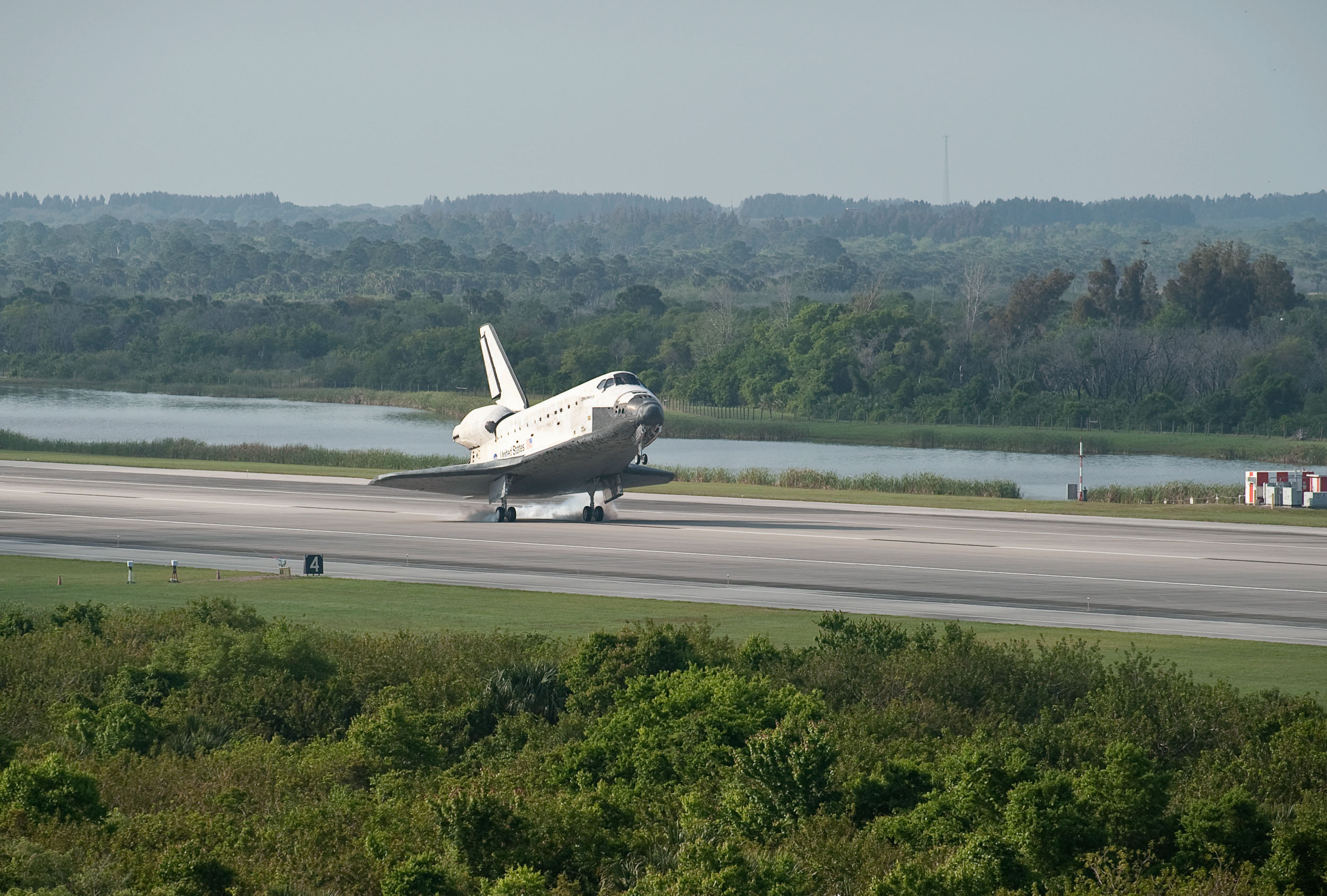
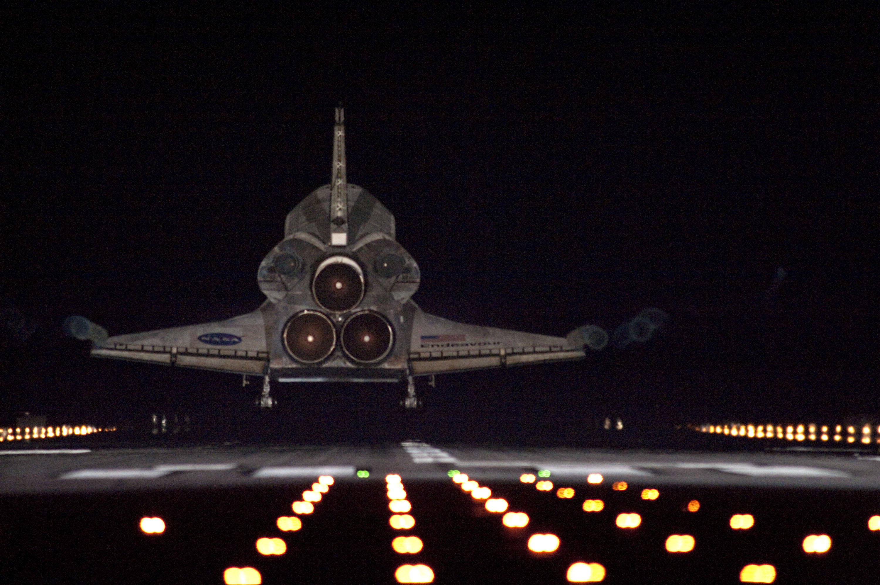
Smoke rises from Space Shuttle Discovery’s tires as it lands at Kennedy Space Center (above, top). Space shuttle Endeavour approaches Runway 15 on the Shuttle Landing Facility at Kennedy Space Center (above, lower). (NASA photograph STS131-S-086 (Bill Ingalls) and STS134-S-111.)
The Earth Observatory would like to offer special thanks to Kam Lulla, Will Stefanov, and Cindy Evans of NASA’s Johnson Space Center for significant contributions to this story. We also recommend reading Wings In Orbit: Scientific and Engineering Legacies of the Space Shuttle, 1971-2010, which brings together the scientific, engineering, and human achievements of the shuttle program.
alert message