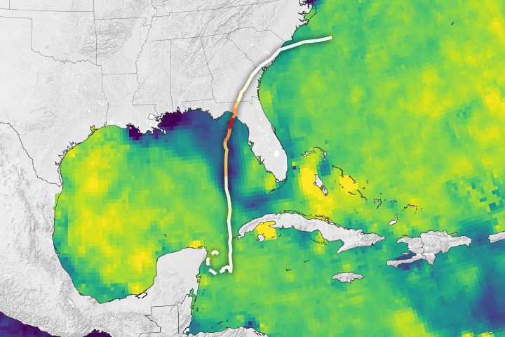
A new analysis suggests that a large freshwater plume in the hurricane’s path helped fuel its extraordinary growth.
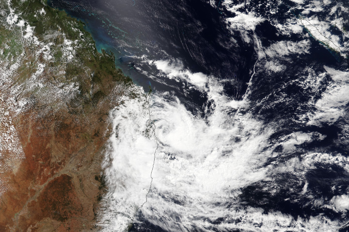
The tropical cyclone took a sharp turn toward Australia’s east coast, bringing flooding and other hazards to an area that rarely sees this type of storm.
Image of the Day Drought Fires Floods Severe Storms Human Presence Temperature Extremes
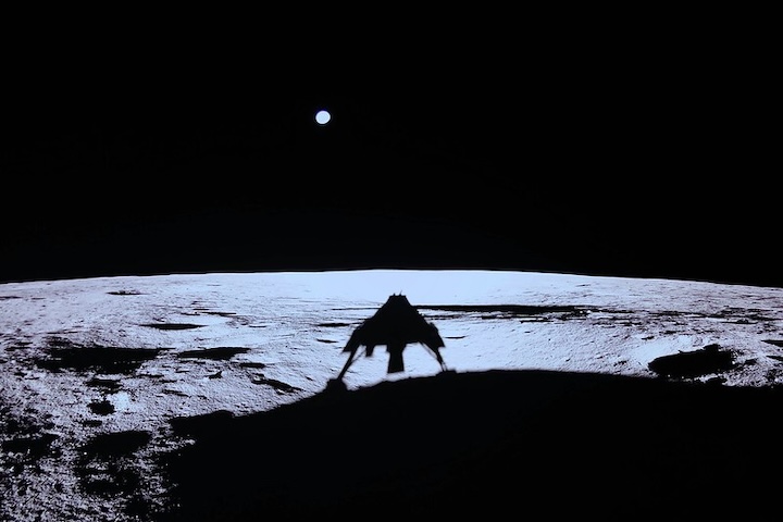
A digital camera on the Blue Ghost lander looked back at Earth and captured this ethereal image.
Published Mar 12, 2025
Your challenge is to tell us the location of the satellite image and why it is interesting.
Published Mar 11, 2025
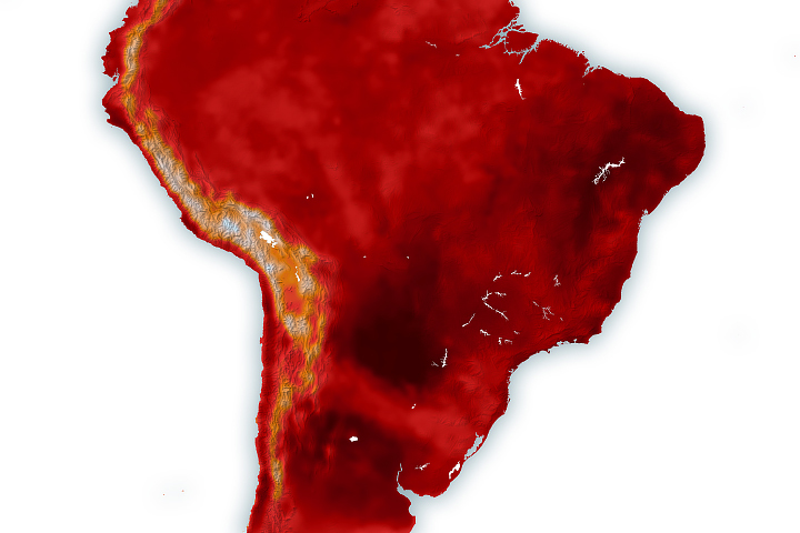
Using NASA data, researchers can track vegetation changes around the planet, not just in forests but also in grasslands and savannas like the Brazilian Cerrado.
Published Mar 11, 2025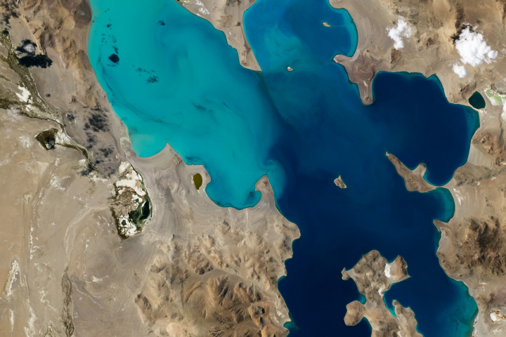
The turquoise waters of Ngangla Ringco add vivid color to the otherwise brown landscape in this part of the Tibetan Plateau.
Published Mar 9, 2025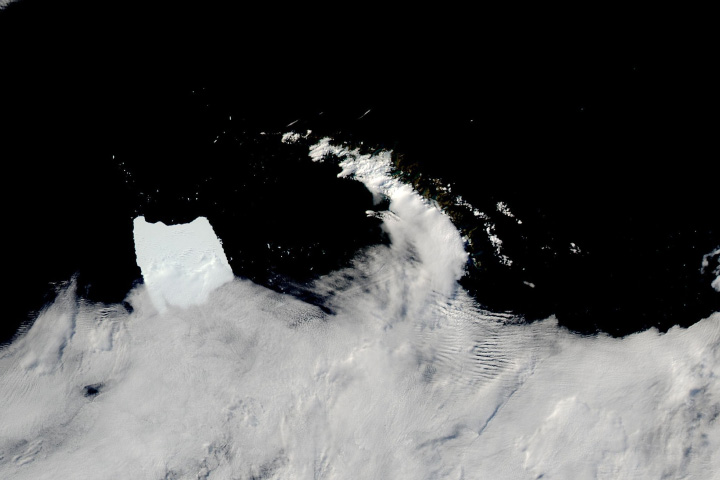
Antarctic iceberg A-23A has slowed its drift and appears stuck in the shallow waters off the British overseas territory.
Published Mar 7, 2025
A powerful mid-latitude storm fueled dust storms, tornadoes, blizzards, and downpours across the country.
Published Mar 5, 2025
Satellites have documented lakes on the “roof of the world” becoming larger and more numerous over the past three decades.
Published Mar 5, 2025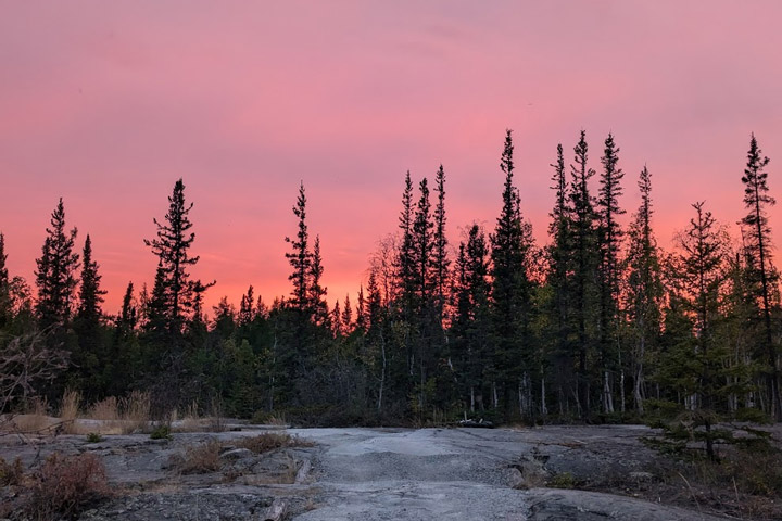
"Leaf-to-orbit" activities began as the campers arrived in Canada’s Northwest Territories.
Published Mar 4, 2025
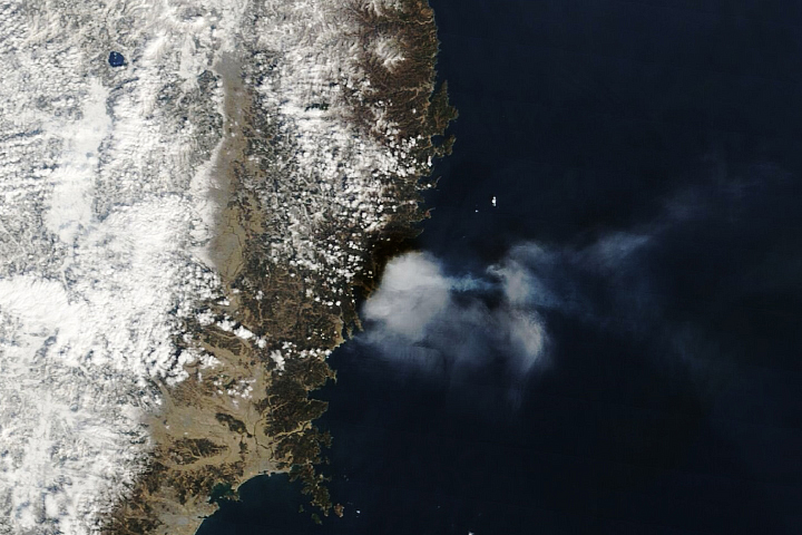
Following a record dry month, a fire near Ofunato spread to become the country’s largest in decades.
Published Mar 3, 2025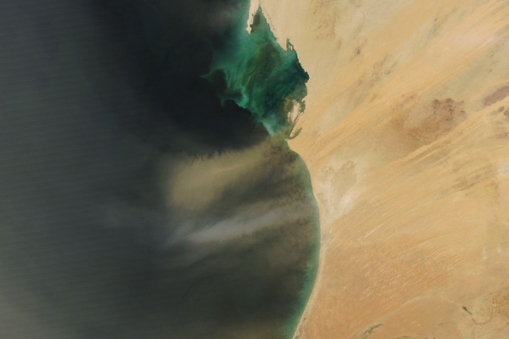
Airborne dust is common over the West African country, but its source can affect the appearance of plumes.
Published Mar 3, 2025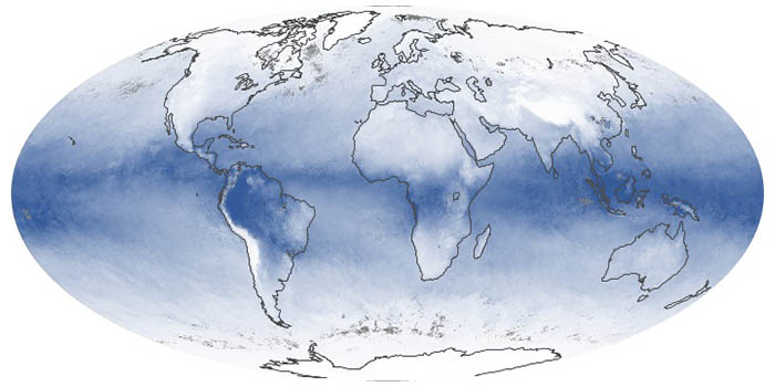
These maps show the average amount of water vapor in a column of atmosphere by month. Water vapor is the key precursor for rain and snow and one of the most important greenhouse gases in the atmosphere.
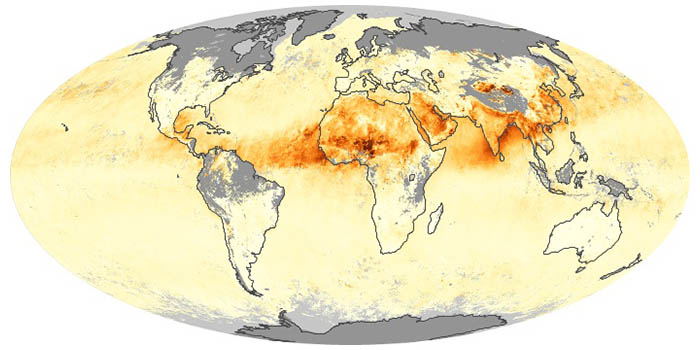
Airborne aerosols can cause or prevent cloud formation and harm human health. These maps depict aerosol concentrations in the air based on how the tiny particles reflect or absorb visible and infrared light.
Penguins outnumber people on this remote, mountainous island in the southern Atlantic Ocean.
Published Mar 2, 2025
NASA satellites document how our world—forests, oceans, human landscapes, even the Sun—changes over months, seasons, and years.
Published Apr 29, 2009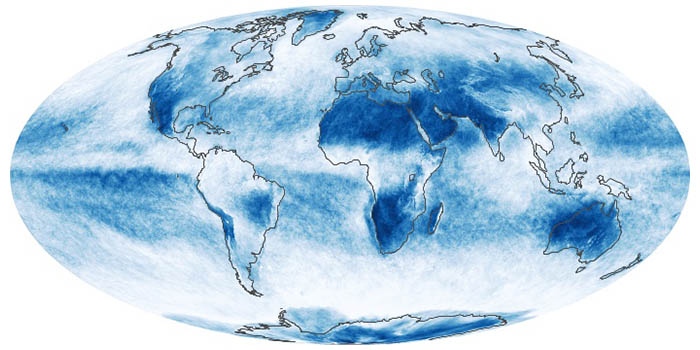
In addition to making rain and snow, clouds can have a warming or cooling influence depending on their altitude, type, and when they form. These maps show what fraction of an area was cloudy each month.
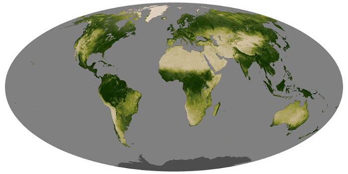
Greenness is an important indicator of health for forests, grasslands, and farms. The greenness of a landscape, or vegetation index, depends on the number and type of plants, how leafy they are, and how healthy they are.
February 2025 was a scorcher, with record temperatures in parts of Brazil and notable heat in Argentina.
Published Feb 28, 2025Image of the Day Heat Drought Fires Floods Severe Storms Temperature Extremes

12 months of high-resolution global true color satellite imagery.
Published Oct 13, 2005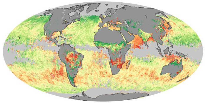
Sea salt, volcanic ash, dust, wildfire smoke, and industrial pollution are types of airborne aerosols. Natural aerosols tend to be larger than human-made aerosols. These maps show when and where aerosols come from nature, humans, or both.
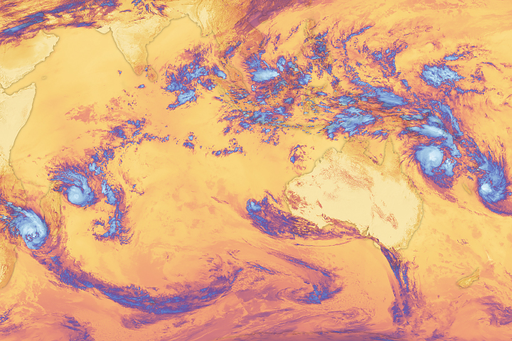
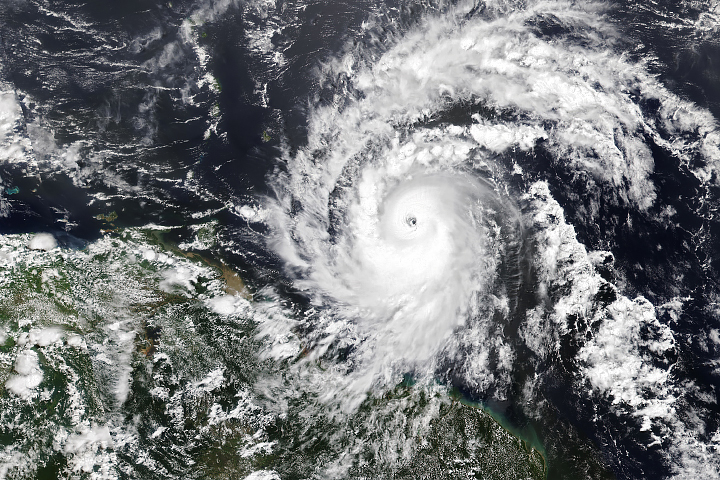
An unusual number of tropical storms churned across the planet’s southern oceans simultaneously in February 2025.
Published Feb 27, 2025Image of the Day Atmosphere Heat Water Drought Fires Floods Severe Storms Temperature Extremes
Have you ever wondered what it would be like to live in a different part of the world? What would the weather be like? What kinds of animals would you see? Which plants live there? By investigating these questions, you are learning about biomes.
Published Aug 28, 2020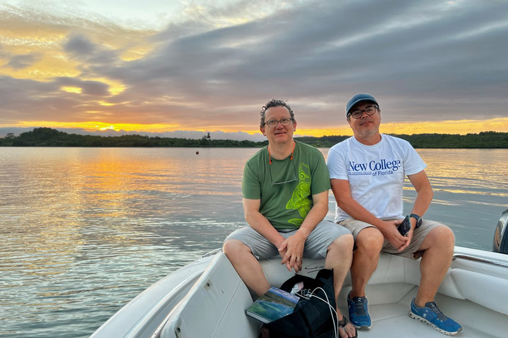
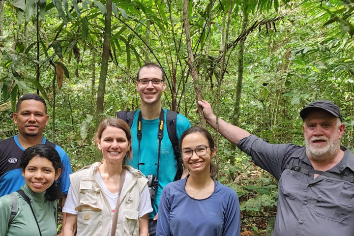
After 31 years, scientist Joaquin Chaves returned to the Pacific coast of Costa Rica for another international expedition.
Published Feb 27, 2025
A new camp in Canada’s Northwest Territories would allow youth to view wetland environments from a ‘leaf-to-orbit’ perspective.
Published Feb 25, 2025

Your challenge is to tell us the location of the satellite image and why it is interesting.
Published Feb 25, 2025

AVUELO's many moving parts has made time fly by by for the campaign’s project scientist.
Published Feb 21, 2025
What does AVUELO have in common with a Joni Mitchell song? The answer lies in the clouds.
Published Feb 19, 2025
Hurricane season in the basin runs from June 1 to November 30.
Published Jul 1, 2024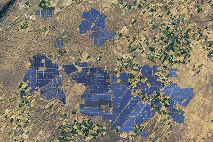
People have developed systems to harvest and store energy from sources such as wind, sunlight, and tidal action. Many of these installations are visible from orbit.
Published May 10, 2024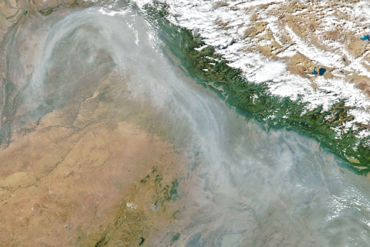
From ground-level ozone to particulate matter to nitrogen dioxide, an array of gasses and particles can affect the air people breathe, with implications for human health.
Published Apr 8, 2024
Satellite images of Earth at night have been a curiosity for the public and a tool of fundamental research for at least 25 years. They have provided a broad, beautiful picture, showing how humans have shaped the planet and lit up the darkness.
Published Apr 12, 2017
What do you do when presented with a new satellite image? Here's what the Earth Observatory team does to understand the view.
Published Nov 18, 2013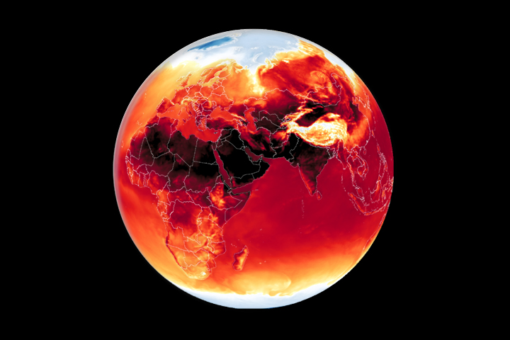
Warmer-than-average temperatures are showing up locally and globally, with consequences for people, landscapes, and ecosystems.
Published Mar 26, 2024
Whether sparked by lightning, intentional land-clearing, or human-caused accidents, wildland fires are burning longer and more often in some areas as the world warms.
Published Feb 27, 2024
Warmer-than-average temperatures are showing up locally and globally, with consequences for people, landscapes, and ecosystems.
Published Aug 15, 2023alert message