Global temperatures have soared in recent years and climate scientists are trying to understand why.
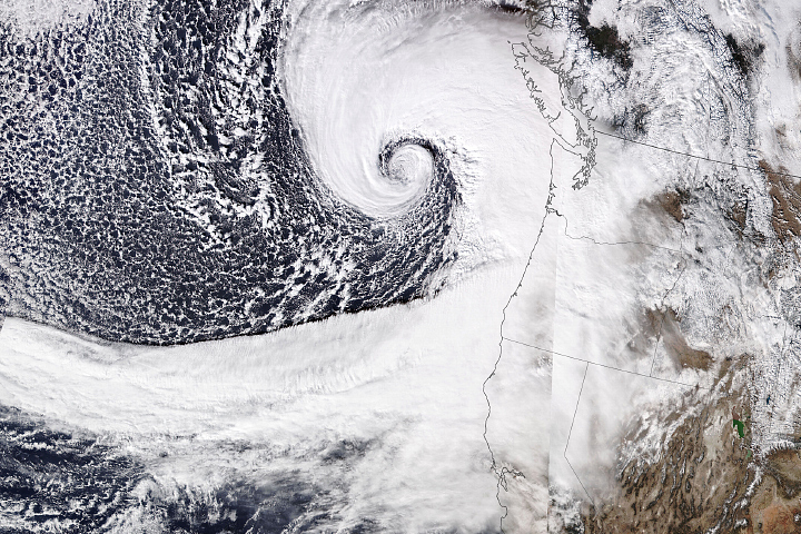
Damaging winds from the strong storm knocked out power for thousands of people in Washington state.
Image of the Day Atmosphere Severe Storms Temperature Extremes
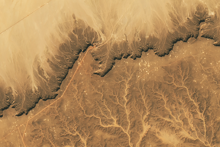
The Cretaceous sandstone of Libya’s Messak Settafet plateau shows signs of a modern oil field and Stone Age quarries and hunting sites.
Published Nov 26, 2024
A novel radar image reveals structural elements of Camp Century, an abandoned U.S. military base buried within the Greenland Ice Sheet.
Published Nov 25, 2024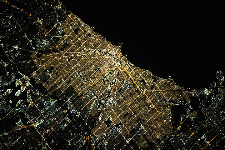
Orange, yellow, and white lights span Chicago at night, illuminating its gridded downtown and tracing its sinuous rivers and parks.
Published Nov 24, 2024
The amount of freshwater stored on land and underground has plummeted in the past decade, which might indicate that Earth’s continents have entered a persistently drier phase.
Published Nov 23, 2024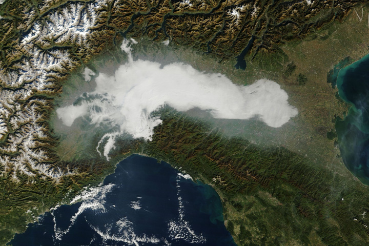
Research suggests that airborne particles called aerosols contribute to longer-lasting outbreaks of fog.
Published Nov 22, 2024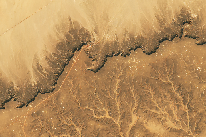
Your challenge is to tell us the location of the satellite image and why it is interesting.
Published Nov 19, 2024
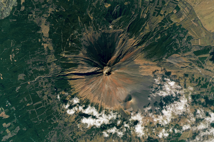
The volcano’s first snow of the season fell in early November 2024—the latest in a 130-year record—only to apparently vanish within a few days.
Published Nov 19, 2024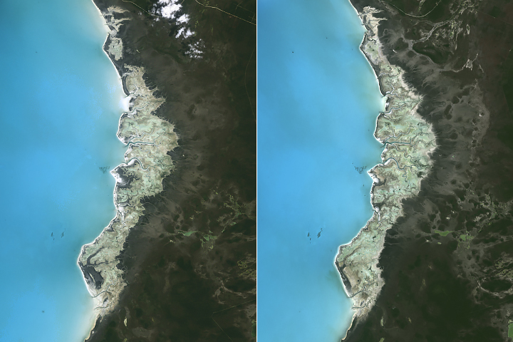
Rising seas have redistributed cyanobacterial mats blanketing part of Andros Island and restructured the island’s marshes and mudflats.
Published Nov 18, 2024
The exceptionally long high-mountain glacier in Central Asia ranges from snowy white near the mountain peaks to dusty brown at lower elevations.
Published Nov 17, 2024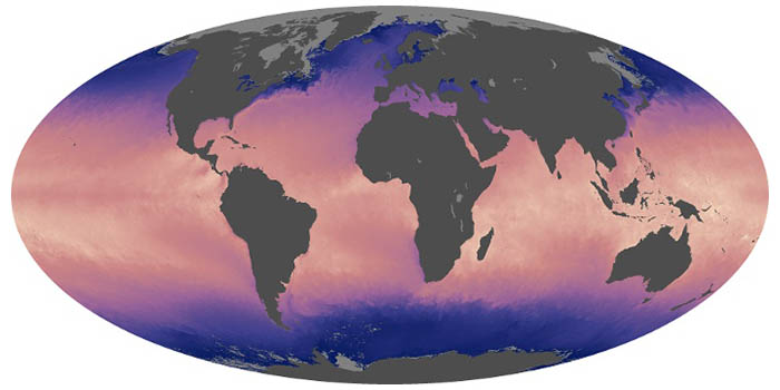
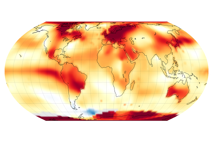
Ocean temperatures can influence weather, such as hurricane formation, and climate patterns, such as El Niño. These maps show the temperature at the surface of the world’s seas and oceans.
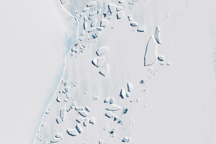
The blue underbellies of icebergs were spotted floating near the Amery Ice Shelf.
Published Nov 16, 2024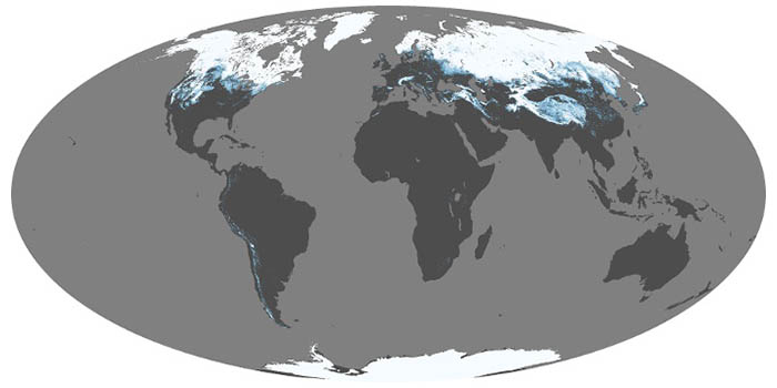
Snow and ice influence climate by reflecting sunlight back into space. When it melts, snow is a source of water for drinking and vegetation; too much snowmelt can lead to floods. These maps show average snow cover by month.
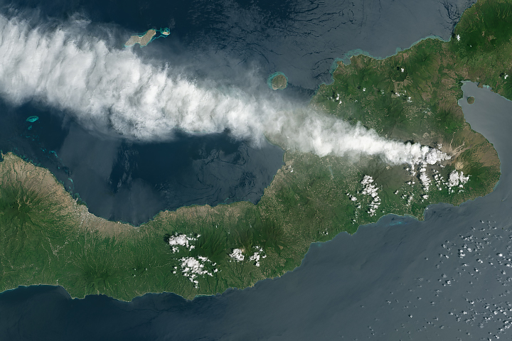
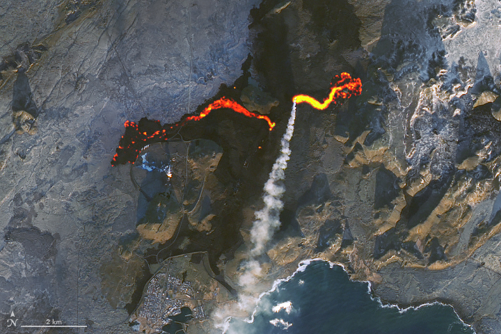
A series of explosive eruptions from Mount Lewotobi lofted ash to the cruising altitudes of jets.
Published Nov 14, 2024
NASA satellites document how our world—forests, oceans, human landscapes, even the Sun—changes over months, seasons, and years.
Published Apr 29, 2009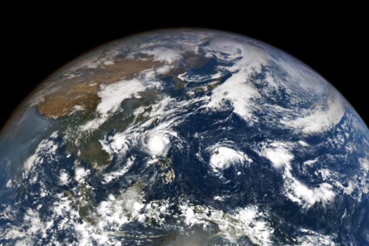
Four storms swirled in the basin, many of which set their sights on the storm-ravaged Philippines.
Published Nov 13, 2024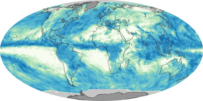
These maps depict monthly total rainfall around the world. Rainfall is the primary source of fresh water for humans, plants, and animals. Rain also moves heat between the atmosphere, oceans, and land.

What do you do when presented with a new satellite image? Here's what the Earth Observatory team does to understand the view.
Published Nov 18, 2013
Scientists “fueled the love for science” among students during a field campaign for NASA’s plankton and aerosol observing satellite.
Published Oct 31, 2024

Satellite images of Earth at night have been a curiosity for the public and a tool of fundamental research for at least 25 years. They have provided a broad, beautiful picture, showing how humans have shaped the planet and lit up the darkness.
Published Apr 12, 2017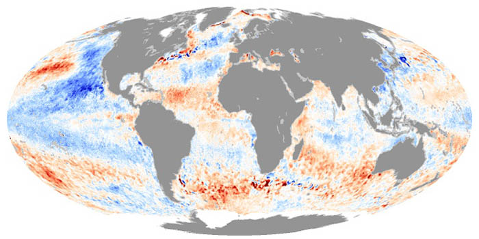
These maps depict how much hotter or cooler an ocean basin was compared to the long-term average. Temperature anomalies can indicate changes in ocean circulation or the arrival of patterns like El Niño and La Niña.
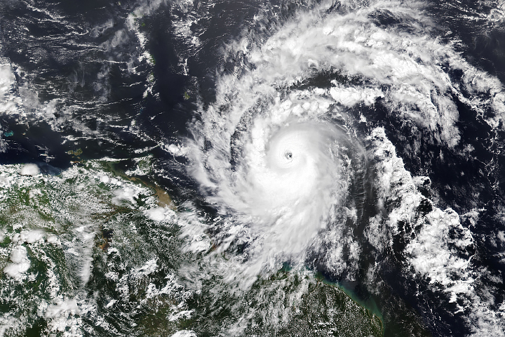
Hurricane season in the basin runs from June 1 to November 30.
Published Jul 1, 2024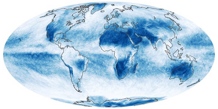
In addition to making rain and snow, clouds can have a warming or cooling influence depending on their altitude, type, and when they form. These maps show what fraction of an area was cloudy each month.
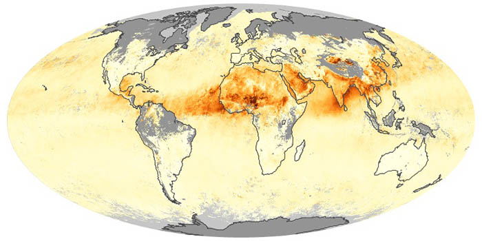
Airborne aerosols can cause or prevent cloud formation and harm human health. These maps depict aerosol concentrations in the air based on how the tiny particles reflect or absorb visible and infrared light.
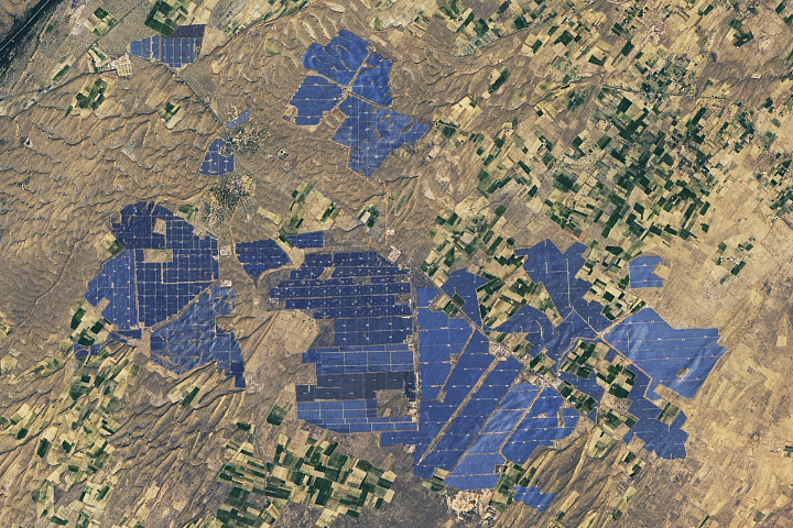
People have developed systems to harvest and store energy from sources such as wind, sunlight, and tidal action. Many of these installations are visible from orbit.
Published May 10, 2024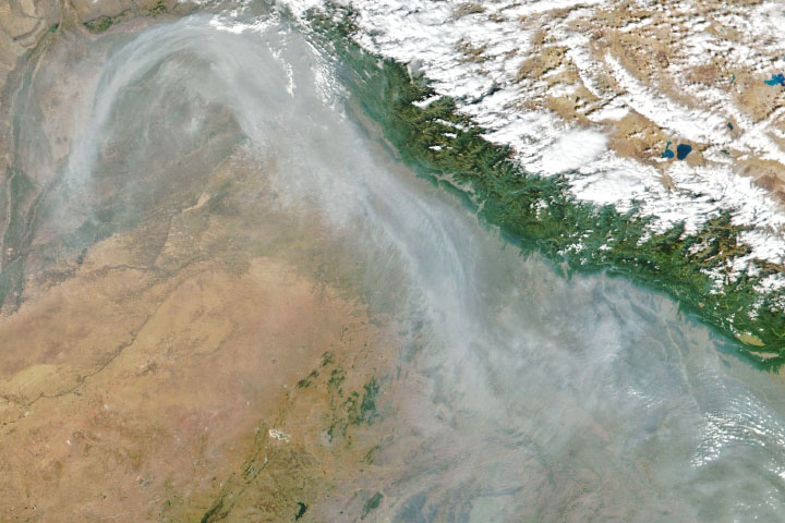
From ground-level ozone to particulate matter to nitrogen dioxide, an array of gasses and particles can affect the air people breathe, with implications for human health.
Published Apr 8, 2024Have you ever wondered what it would be like to live in a different part of the world? What would the weather be like? What kinds of animals would you see? Which plants live there? By investigating these questions, you are learning about biomes.
Published Aug 28, 2020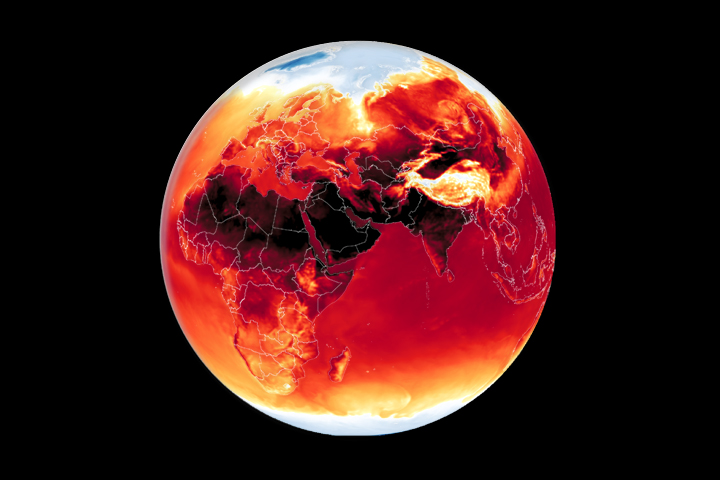
Warmer-than-average temperatures are showing up locally and globally, with consequences for people, landscapes, and ecosystems.
Published Mar 26, 2024
Whether sparked by lightning, intentional land-clearing, or human-caused accidents, wildland fires are burning longer and more often in some areas as the world warms.
Published Feb 27, 2024
12 months of high-resolution global true color satellite imagery.
Published Oct 13, 2005
Warmer-than-average temperatures are showing up locally and globally, with consequences for people, landscapes, and ecosystems.
Published Aug 15, 2023