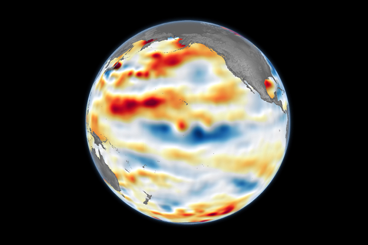
Cool water has welled up in the tropical Pacific in winter 2024–2025. But it may not stick around for long.
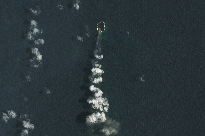
A small island in Tonga built by an underwater volcano in 2022 has grown larger.
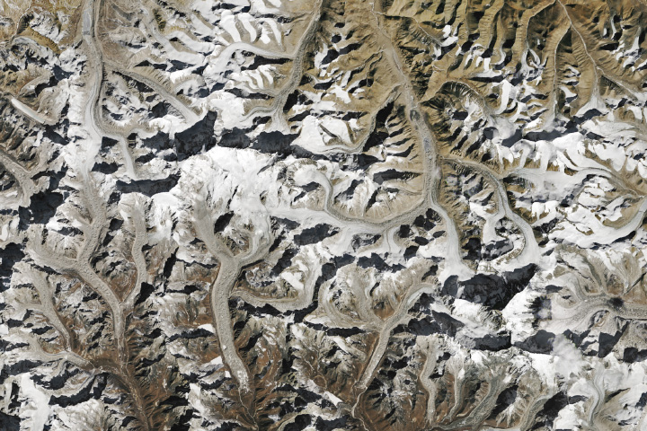
More and more, mountain snow in the Mount Everest region is vanishing into thin air.
Published Feb 15, 2025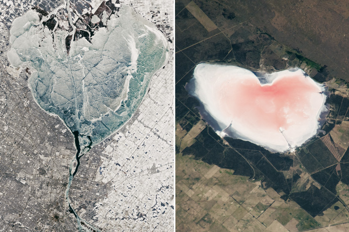
One frozen, one salty, and hemispheres apart, two very different lakes share a Valentine shape.
Published Feb 14, 2025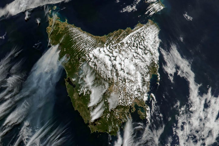
Warm, dry conditions in February 2025 fueled fast-burning fires in the northwestern part of the Australian state.
Published Feb 12, 2025
Strong winds and high temperatures fueled summer fires in Argentina.
Published Feb 11, 2025
Fieldwork in Panama is underway, as scientists began collecting airborne and ground-based data to aid studies of the region’s tropical ecosystems.
Published Feb 11, 2025
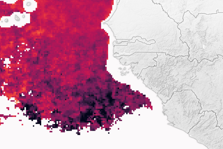
Scientists are using the DSCOVR satellite to make more frequent measurements of the height of dust over the Atlantic Ocean.
Published Feb 11, 2025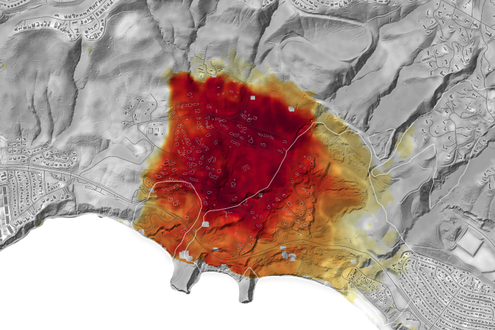
NASA radar imagery revealed that the active area of a decades-old landslide has grown following periods of heavy rainfall in 2023 and early 2024.
Published Feb 10, 2025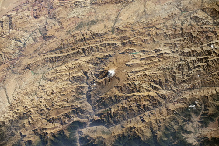
The dormant volcano in northern Iran lies in the Alborz Mountains, which separate the region’s wet coastal lowlands from the deserts toward the south.
Published Feb 9, 2025
12 months of high-resolution global true color satellite imagery.
Published Oct 13, 2005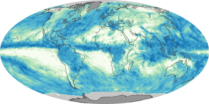
These maps depict monthly total rainfall around the world. Rainfall is the primary source of fresh water for humans, plants, and animals. Rain also moves heat between the atmosphere, oceans, and land.
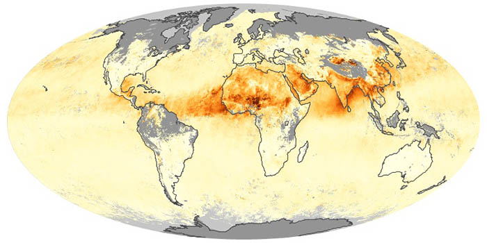
Airborne aerosols can cause or prevent cloud formation and harm human health. These maps depict aerosol concentrations in the air based on how the tiny particles reflect or absorb visible and infrared light.
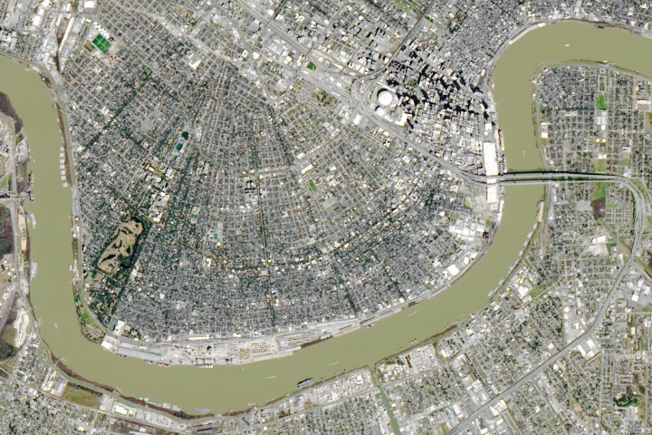
The white roof of the Superdome stands out against the surrounding neighborhoods in this satellite image of New Orleans.
Published Feb 8, 2025
NASA satellites document how our world—forests, oceans, human landscapes, even the Sun—changes over months, seasons, and years.
Published Apr 29, 2009
A slow-moving storm dropped unusually large amounts of rain on the Australian state in summer 2025.
Published Feb 5, 2025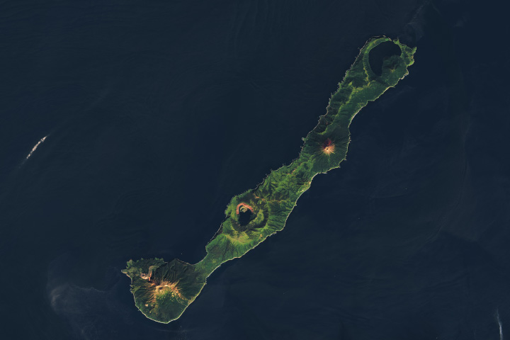
Tucked away on a remote island in the Pacific, the volcano has recently been pinpointed as the likely source of a sunlight-dimming eruption.
Published Feb 5, 2025
What do you do when presented with a new satellite image? Here's what the Earth Observatory team does to understand the view.
Published Nov 18, 2013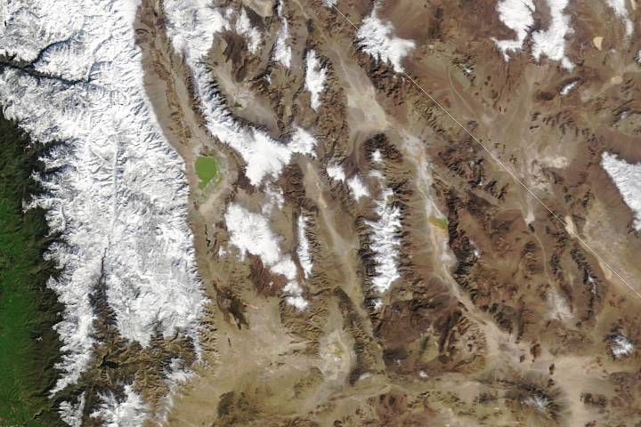
Water levels—and the compositions of brines—have varied over time at Searles Lake and the adjacent lakes.
Published Feb 4, 2025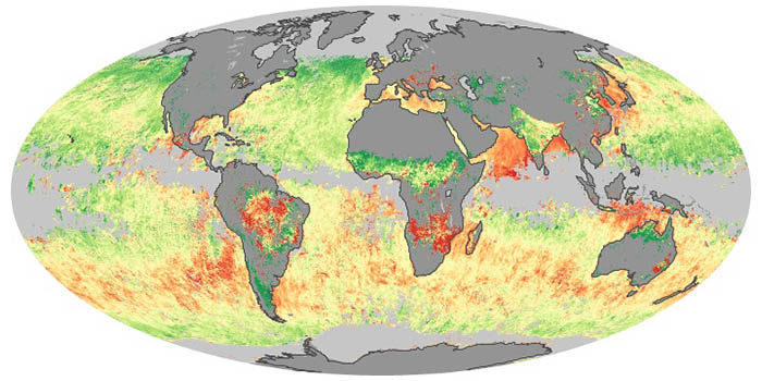
Sea salt, volcanic ash, dust, wildfire smoke, and industrial pollution are types of airborne aerosols. Natural aerosols tend to be larger than human-made aerosols. These maps show when and where aerosols come from nature, humans, or both.

Your challenge is to tell us the location of the satellite image and why it is interesting.
Published Jan 28, 2025
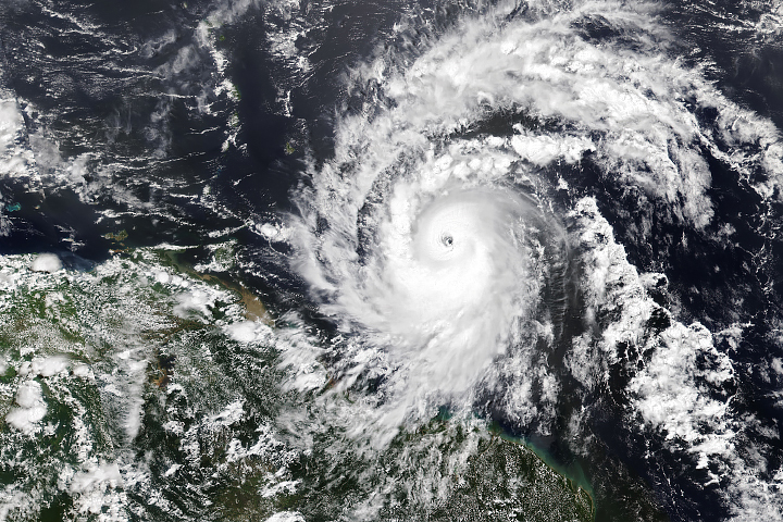
Hurricane season in the basin runs from June 1 to November 30.
Published Jul 1, 2024Have you ever wondered what it would be like to live in a different part of the world? What would the weather be like? What kinds of animals would you see? Which plants live there? By investigating these questions, you are learning about biomes.
Published Aug 28, 2020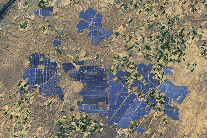
People have developed systems to harvest and store energy from sources such as wind, sunlight, and tidal action. Many of these installations are visible from orbit.
Published May 10, 2024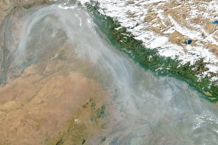
From ground-level ozone to particulate matter to nitrogen dioxide, an array of gasses and particles can affect the air people breathe, with implications for human health.
Published Apr 8, 2024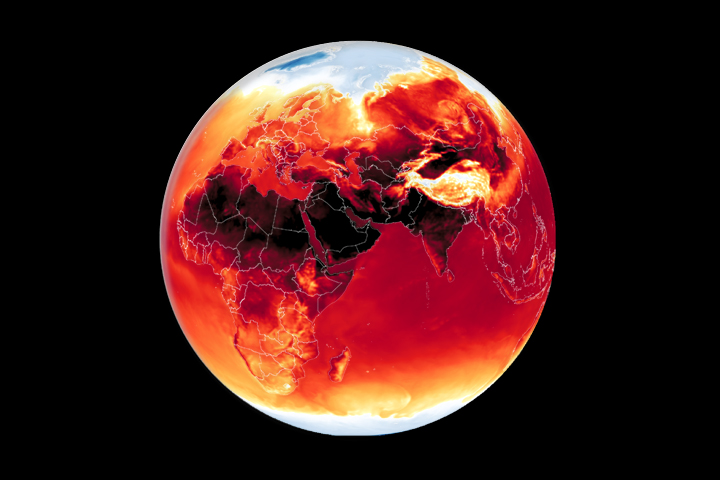
Warmer-than-average temperatures are showing up locally and globally, with consequences for people, landscapes, and ecosystems.
Published Mar 26, 2024
Whether sparked by lightning, intentional land-clearing, or human-caused accidents, wildland fires are burning longer and more often in some areas as the world warms.
Published Feb 27, 2024
Warmer-than-average temperatures are showing up locally and globally, with consequences for people, landscapes, and ecosystems.
Published Aug 15, 2023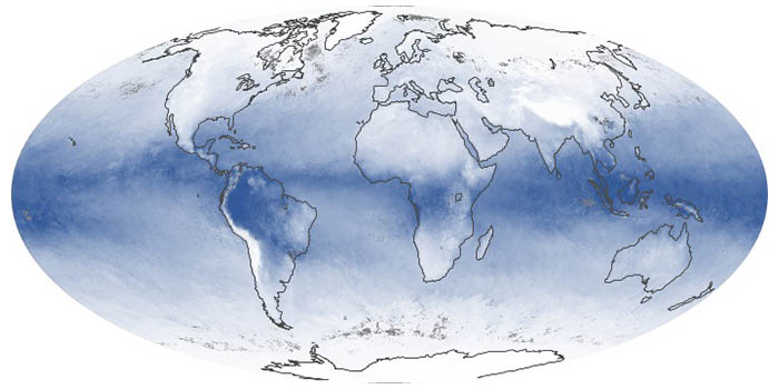
These maps show the average amount of water vapor in a column of atmosphere by month. Water vapor is the key precursor for rain and snow and one of the most important greenhouse gases in the atmosphere.

Satellite images of Earth at night have been a curiosity for the public and a tool of fundamental research for at least 25 years. They have provided a broad, beautiful picture, showing how humans have shaped the planet and lit up the darkness.
Published Apr 12, 2017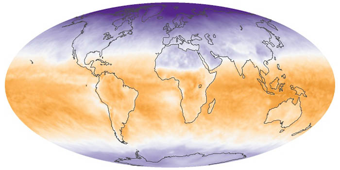
Net radiation is the balance between incoming and outgoing energy at the top of the atmosphere. It is the total energy available to influence climate after light and heat are reflected, absorbed, or emitted by clouds and land.
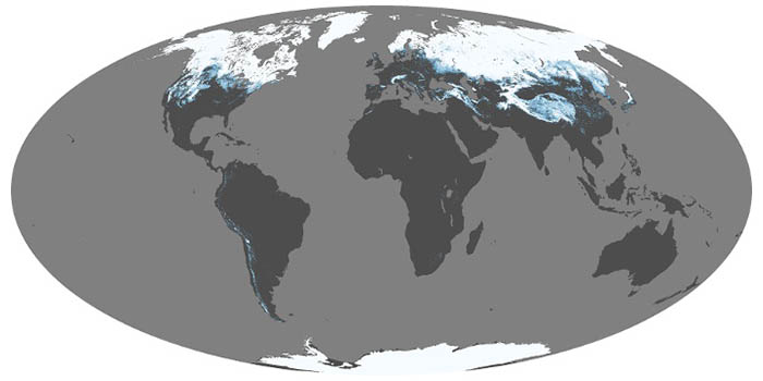
Snow and ice influence climate by reflecting sunlight back into space. When it melts, snow is a source of water for drinking and vegetation; too much snowmelt can lead to floods. These maps show average snow cover by month.