Images related to Death Valley

Prospecting from Space Using ASTER
Image

Prospecting from Space Using ASTER

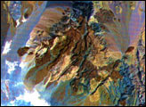
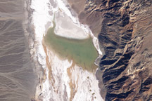
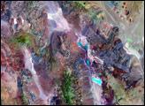
These images of the Saline Valley area, California, were acquired March 30, 2000, by the Advanced Spaceborne Thermal Emission and Reflection Radiometer (ASTER).

Published Sep 8, 2000

Image of the Day Land

Fires in Southern California
Image

Fires in Southern California

Published Nov 18, 2003

Fires

Clearcuts in Oregon
Image

Clearcuts in Oregon

Published Oct 16, 2000

Image of the Day Land Life

ASTER First Light Image
Image

ASTER First Light Image

Published Mar 13, 2000

Image of the Day Land

The Netherlands
Image

The Netherlands

Published Jun 13, 2004

Image of the Day Land Life

Lake Badwater, Death Valley
Image

Lake Badwater, Death Valley

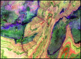
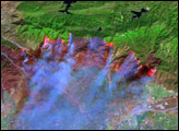
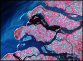
This pair of images from NASA’s Landsat 5 satellite documents the short history of Death Valley’s Lake Badwater: formed in February 2005 and long gone by February 2007.

Published Mar 17, 2009

Image of the Day Land

Sharm El Sheik, Egypt
Image

Sharm El Sheik, Egypt

Published Oct 24, 2000

Image of the Day

Death Valley National Park
Image

Death Valley National Park

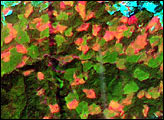
At 86 meters (282 feet) below sea level, Death Valley, California, is one of the hottest, driest places on the planet.

Published Apr 16, 2006

Image of the Day Land