
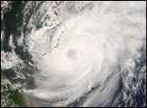
Super Typhoon Wipha was approaching the coast of China on the afternoon of September 18, 2007. At that time, Wipha had winds between 240 and 250 kilometers per hour, making it a strong Category 4 storm and a Super Typhoon (a typhoon with winds of at least 130 knots).
Published Sep 20, 2007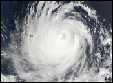
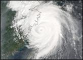
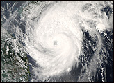
Typhoon Neoguri was nearing its peak strength on April 17, 2008, when the Moderate Resolution Imaging Spectroradiometer (MODIS) on NASA’s Aqua satellite captured this image at 1:30 p.m. local time (05:50 UTC). The first typhoon of the 2008 season in the western Pacific, Neoguri was a relatively weak Category 2 storm.
Published Apr 17, 2008
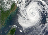
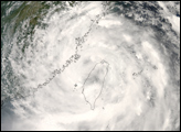
Acquired August 6, 2012, this image shows Haikui approaching the China coast, just a few days after two other severe storms made landfall.
Published Aug 6, 2012