
This satellite map of snow cover shows that every state in the contiguous U.S., except for Florida, received snow in January 2011.
Published Feb 25, 2011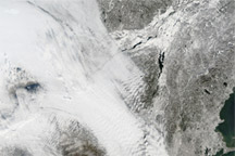
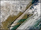
Acquired December 28, 2010, this natural-color image shows a combination of clouds and snow over the northeastern United States.
Published Dec 30, 2010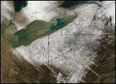
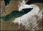
On December 9, 2006, the southeastern shores of the Great Lakes were lined with streamers of lake-effect snow.
Published Dec 12, 2006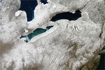
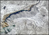
Acquired March 6, 2010, this true-color image shows snow cover over the eastern reaches of Canada and the United States. Snow cover appears the most opaque in Ohio, central New York, and between Lake Huron and its neighboring lakes to the east.
Published Mar 8, 2010
A cold air mass brought more snow across the Upper Midwest.
Published Dec 15, 2016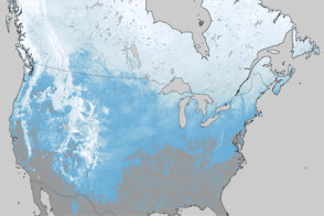
What a difference one year has made in the snow cover over North America.
Published Mar 30, 2012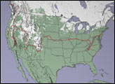
The snowpack near Boston is greater than in all but two reported locations in Alaska.
Published Feb 18, 2015