Acquired in March 2011 and February 2012, these images document the recession of flood waters after the Tohoku tsunami.
Published Mar 13, 2012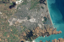
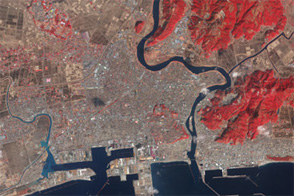
This natural color image of Christchurch, New Zealand, is overlain with a measure of the ground shaking in the area during the February 2011 earthquake.
Published Mar 9, 2011
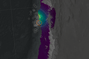
Scientists have projected the size and location of changes in Earth’s surface following the September 2015 earthquake and tsunami off Chile.
Published Oct 1, 2015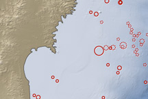
On March 11, 2011, a magnitude 8.9 earthquake struck off the east coast of Honshu, Japan, about 130 kilometers (80 miles) east of Sendai. If the initial estimate is confirmed, it will be the fifth largest earthquake in recorded history.
Published Mar 12, 2011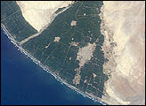
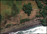
A tsunami washed over the low-lying coastal resort region near Camaná,southern Peru, following a strong earthquake on June 23, 2001. The earthquake was one of the most powerful of the last 35 years and had a magnitude of 8.4. After the initial quake, coastal residents witnessed a sudden draw-down of the ocean and knew a tsunami was imminent. They had less than 20 minutes to reach higher ground before the tsunami hit. Waves as high as 8 meters came in four destructive surges reaching as far as 1.2 kilometers inland. Thousands of buildings were destroyed, and the combined earthquake and tsunami killed as many as 139 people.
Published Mar 17, 2002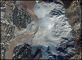
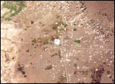
The magnitude 7.6 earthquake that shattered Pakistan on October 8, 2005, caused the most damage in the region surrounding the city of Muzaffarabad, about 10 kilometers southwest of the earthquake’s epicenter. The Ikonos satellite captured an image of a landslide in Makhri, a village on the northern outskirts of Muzzaffarabad, on October 9, 2005. The western face of the mountain has collapsed, sending a cascade of white-grey rock into the Neelum River. The landslide is likely only one of many to occur along the river, which is almost unrecognizable after the earthquake.
Published Oct 23, 2005