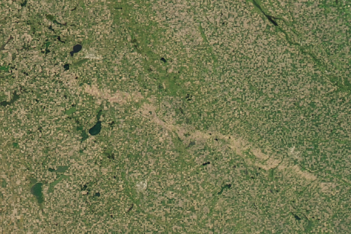
Hail pummeled a long stretch of crops in South Dakota in June.
Published Jul 19, 2017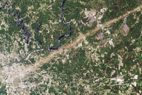
Scientists at Marshall Space Flight Center use satellite imagery to help meteorologists assess the scope of damage caused by tornadoes.
Published May 6, 2016Image of the Day Land Severe Storms Human Presence Remote Sensing
A line of thunderstorms with hurricane-force winds caused widespread damage to crops.
Published Aug 20, 2020Image of the Day Atmosphere Land Life Severe Storms Human Presence
Powerful thunderstorms moving through eastern Texas and western Louisiana spawned several tornadoes, including some that caused major damage.
Published Apr 27, 2020Image of the Day Atmosphere Land Severe Storms Human Presence
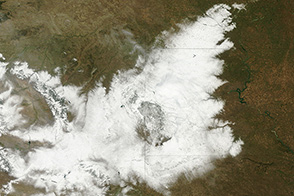
In early October, a freak snowstorm killed thousands of cattle in South Dakota. Warm and soggy weather following the storm made the cleanup a muddy mess.
Published Oct 19, 2013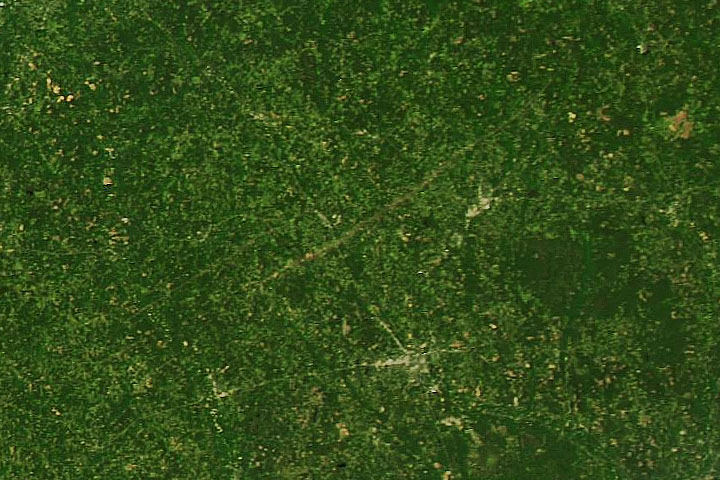
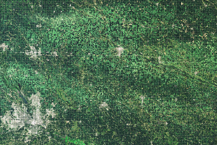
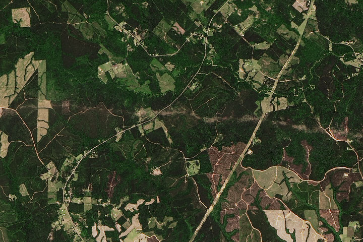
One of the more intense tornados to raze the ground in April 2020 left a scar visible from space.
Published Apr 15, 2020Image of the Day Atmosphere Land Severe Storms Human Presence Remote Sensing

Taken June 29, 2012, this photograph shows a shelf cloud on the leading edge of a violent storm system that blew across the eastern United States.
Published Jul 3, 2012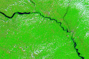
Acquired July 25, 2011, and July 17, 2010, these false-color images compare conditions along the Missouri River, which flooded in 2011.
Published Jul 26, 2011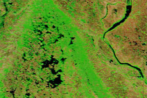
Acquired June 1, 2011, and May 29, 2010, these false-color images compare parts of the James and Little Minnesota Rivers.
Published Jun 2, 2011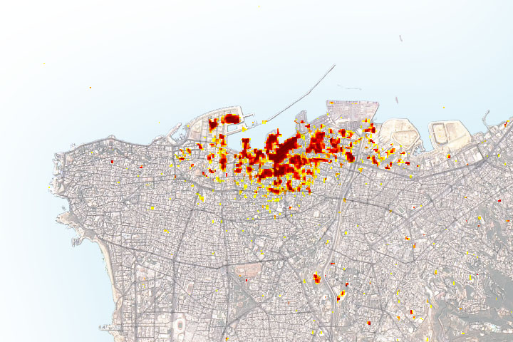
Radar imagery of ground surface changes could help with efforts at disaster relief and recovery after the explosion.
Published Aug 11, 2020
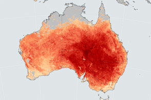
Temperatures soared in South Australia, Victoria, New South Wales, and Queensland.
Published Feb 21, 2017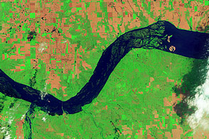
Acquired June 5, 2011, and May 19, 2005, these false-color images compare conditions around Lewis and Clark Lake in South Dakota.
Published Jun 7, 2011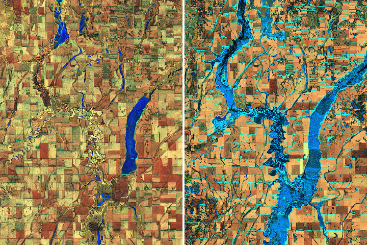
High water on the James River in South Dakota has persisted for more than a year.
Published Mar 31, 2020Image of the Day Land Water Floods Severe Storms Human Presence Remote Sensing
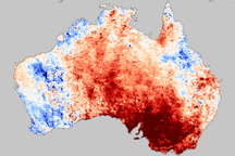
Land surface temperatures were far above average in southeastern Australia during a springtime heatwave in November 2009.
Published Dec 1, 2009