
The blaze is the largest in Arizona this year and the largest in the United States right now.
Published Jun 16, 2020Image of the Day Heat Land Fires Human Presence Remote Sensing

A wildfire in Fresno County, California has burned more than 28,000 acres.
Published Jul 20, 2020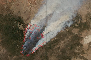
Smoke billows from the Wallow Fire in this natural color image taken on June 8, 2011.
Published Jun 9, 2011
This image from June 9, 2011, shows Arizona’s Wallow Fire in the White Mountains near the border with New Mexico.
Published Jun 10, 2011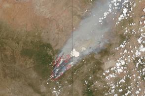
This pair of images shows the vast extent of the Wallow Fire, burning in eastern Arizona, on June 6, 2011.
Published Jun 6, 2011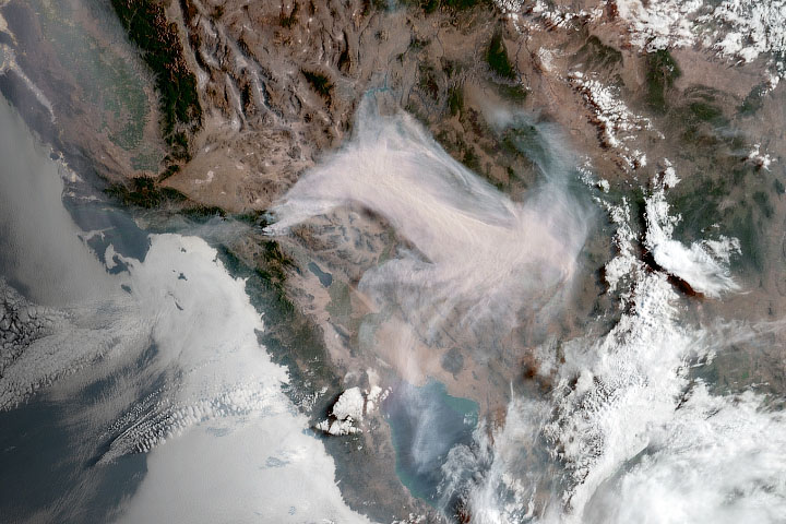
Wildfire smoke from California traveled hundreds to miles and obscured skies in central Arizona.
Published Aug 3, 2020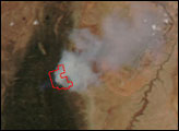
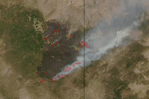
Only 10 percent contained, Arizona’s Wallow Fire became the largest fire in the state history on June 13 when this image was taken.
Published Jun 14, 2011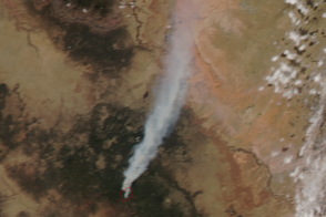
The Slide fire ignited in Oak Creek Canyon south of Flagstaff, Arizona, late in the afternoon of May 20, 2014.
Published May 22, 2014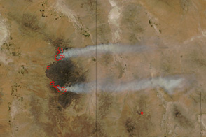
Arizona’s Horseshoe Two Fire burns along two fronts in this image from June 14, 2011.
Published Jun 15, 2011
A wildfire burning in Los Padres National Park charred more than 500 acres—including the home of Big Sur’s fire chief.
Published Dec 17, 2013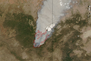
Dense smoke billows from a massive wildfire—the Wallow Fire—in eastern Arizona in this photo-like image from June 4, 2011.
Published Jun 6, 2011
An expansive, destructive wildfire north of Los Angeles is visible from space by day and night.
Published Jun 28, 2016