
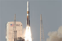
This photo shows the GOES-P satellite launching from Cape Canaveral, Florida, on March 4, 2010.
Published Mar 6, 2010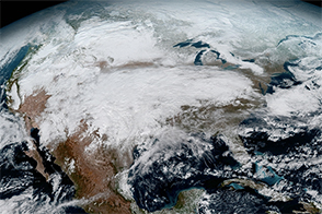
The future of weather monitoring and forecasting just got more colorful and a whole lot clearer.
Published Jan 26, 2017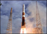
This ground-based photograph shows the GOES-O-bearing Delta IV rocket lifting off from Launch Complex 27 at Cape Canaveral Air Force Station on June 27, 2009.
Published Jul 8, 2009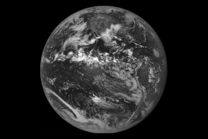
When the GOES-East weather satellite went dark in September 2012, a back-up satellite orbiting nearby sprang into action.
Published Oct 12, 2012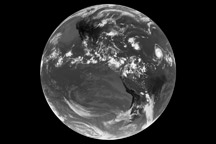
The first full-disk thermal image from the newest NASA/NOAA weather satellite shows the remnants of Tropical Storm Claudette and Tropical Depression Ana, as well as Hurricane Bill on August 17, 2009.
Published Aug 19, 2009
Coastal fog snakes its way into the channel between Washington state and Vancouver Island.
Published Jun 14, 2017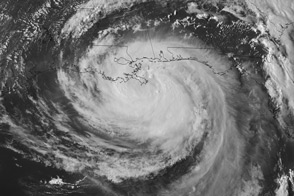
Super rapid scan images of Hurricane Isaac taken from geostationary orbit reveal the movement of clouds at different altitudes.
Published Aug 29, 2012
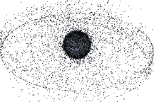
Approximately 19,000 manmade objects larger than 10 centimeters orbit the Earth. These images, based on models, show the distribution of orbital debris around Earth.
Published Sep 12, 2009