The Ebro River Delta, located along the eastern coast of Spain, is one of the largest wetland areas in the western Mediterranean region.
Published Jul 26, 2004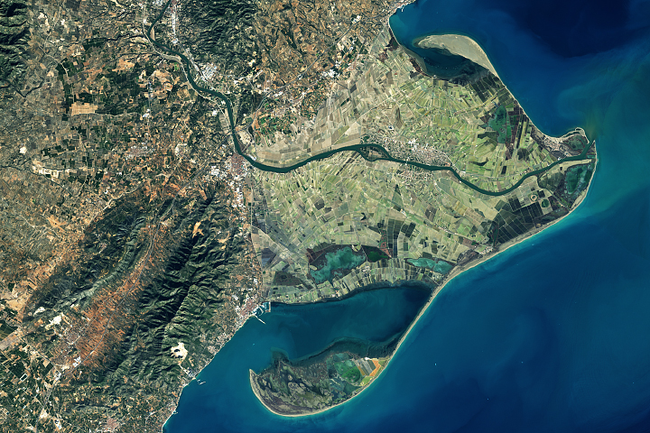
Spain's Ebro Delta has recently experienced tremendous shape-shifting.
Published Mar 13, 2018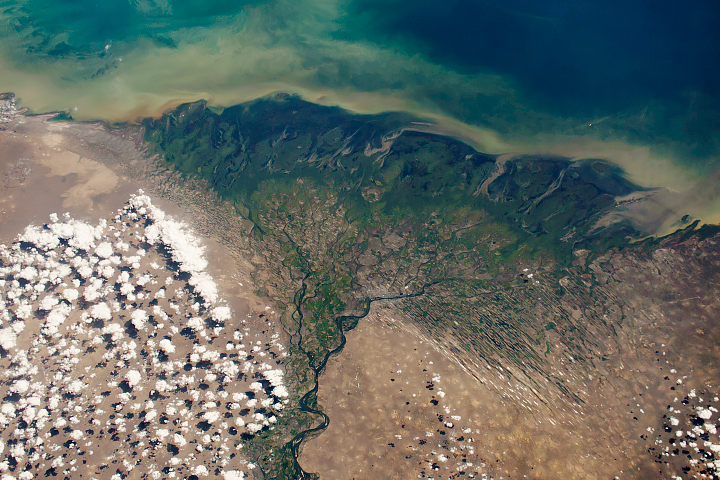
The Volga Delta has grown significantly over the past 130 years.
Published Nov 12, 2018
In the past few centuries, a river in northwestern Canada stopped wandering and assumed a more direct route to the sea.
Published Sep 4, 2012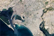
Acquired January 8, 2010, this true-color image shows part of Karachi, Pakistan, a city of over 12 million residents. Heavily urbanized areas mix with rivers and mangroves, especially near the Port of Karachi.
Published Feb 5, 2010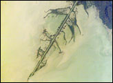
The Ural River is one of the two major rivers (the other is the Volga) that empty into the northern coast of the Caspian Sea, creating extensive wetlands. This image shows details of the Ural’s tree-like (or “digitate”) delta. This type of delta forms naturally when wave action is low, and sediment content in the river is high. New distributary channels form in the delta when the river breaches natural levees created by sediment deposition. The long main channel of the river in this image and several of the distibutary channels are too regular to be entirely natural, however. Like the famous Mississippi River delta in the United States, the Ural River delta has been significantly modified to reduce flooding and divert water.
Published Jun 6, 2005
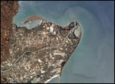
The roofs of Barcelona’s buildings appear as a widespread pink swath on the Mediterranean coastal plain, between forested hills (dark green, top) and the sea. The Llobregat River enters the view top center, cuts through a canyon in the hills and historically constructed a broad, convex delta south of the forested hills. Channelization of the Llobregat River to control flooding has encouraged development of the delta for a variety of urban and agricultural land uses. Barcelona’s airport is located in the central portion of the delta, while the western portion is used for intensive agriculture (light green areas).
Published Jul 5, 2004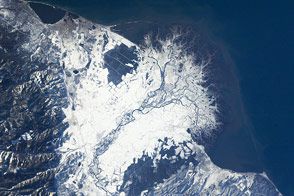
The Selenga River Delta, which stretches out into Russia’s Lake Baikal, is carved by an intricate network of channels and levees and surrounded by marshlands.
Published Nov 28, 2011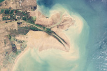
Chinese engineers changed the main channel through the delta, changing the shape of the land at the river’s mouth.
Published Jan 27, 2010
The Colorado River is the largest watershed in the southwestern US, emptying into the Salton Trough before reaching the Sea of Cortez. Over the past 2-3 million years, river sediments built a delta that extends from the US-Mexico border for a distance of 87 miles (140 kilometers). However, today the Colorado River delta is undergoing significant erosion and diminishing in size due to the lack of sediment replenishment from upstream sources.
Published Jun 28, 2004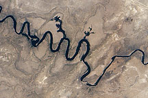
In September 2010, water again flowed through this riverbed after several dry years.
Published Oct 8, 2010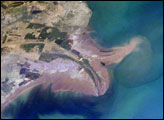
The Yellow River Delta coastline along the Gulf of Bohai has always experienced dramatic changes, and those changes continue today. This mosaic of images taken by astronauts aboard the International Space Station shows several things. First, the image shows today’s configuration of the delta of China’s Yellow River, which is one of the most dynamic coastlines on Earth. Second, the scene allows mapping of land use along the coastal plain, including the boundaries of the Shengli Oil Field, China’s second largest oil field. But perhaps the most interesting aspect of this image is the large patch of green water off the northern coast of the delta—a presumed plankton bloom.
Published Aug 23, 2004