
By changing a percentage, institutions can take some forested lands off the map.
Published Dec 18, 2015
Differences in how international and national institutions classify forests can lead to large discrepancies in measurements of land cover.
Published Nov 17, 2015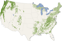
From the Pacific Northwest—home of the towering redwoods&mdash to the Southern Appalachians, this map shows forest canopy heights across the United States.
Published Jul 22, 2010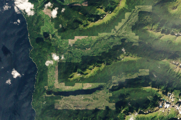
Brown bears abound on this Alaskan island, parts of which have seen both widespread clear-cutting and forest regrowth in recent decades.
Published Apr 24, 2020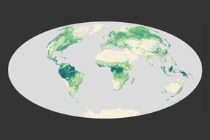
A high-resolution map offers a global view of forest canopy heights.
Published Apr 13, 2012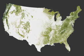
The National Biomass and Carbon Dataset reveals the location and the carbon storage of forests in the United States.
Published Jan 11, 2012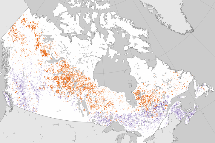
Researchers analyzed 25 years of Landsat data to establish where forests had burned or been cut.
Published Jun 27, 2017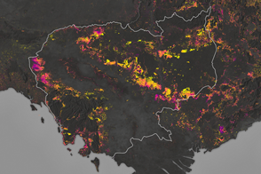
Forests are being turned into rubber plantations, farmland, and timber at a rapid rate.
Published Jan 10, 2017
The opening of the Landsat data archive and a partnership with Google has allowed researchers to track the fine details of forest change around the world.
Published May 7, 2015
Since the mid-1200s, the state has controlled Niepołomice Forest, which contains some of the last pockets of old-growth forest in Poland.
Published Nov 29, 2013
Dry weather in the Northeast has triggered an explosion in the populations of gypsy moth caterpillars, which are voracious eaters of forest canopies.
Published Jul 15, 2016