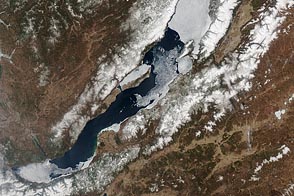
People and satellites keep an eye on when ice on the world’s deepest lake melts each year.
Published May 10, 2012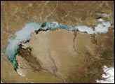
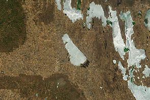
A combination of winds and thawing ice created an ice shove on Dauphin Lake that damaged numerous homes.
Published May 15, 2013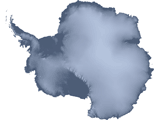
To the untrained eye, Antarctica may look like a giant piece of solid ice that rarely changes, but scientists studying the continent have long known better. The icy surface is dynamic, with glaciers and "streams" of ice flowing toward the ocean.
Published Apr 27, 2007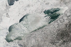
Nearly 90 percent of the lake was ice-covered on January 9, 2014.
Published Jan 15, 2014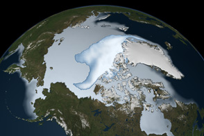
Thick ice that used to last through multiple summers has been in steep decline for three decades.
Published Mar 1, 2012
The window of time available to make and use ice roads is closing.
Published Feb 19, 2020
Throughout Antarctica, broad ribbons of ice known as ice streams shed large quantities of ice into the ocean.
Published Apr 24, 2007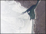
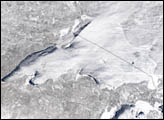
The eastern end of Lake Erie is clogged with ice that is pushed against the shoreline by the prevailing westerly wind. The ice collects in Lake Erie, and the Lake Erie-Niagara River Ice Boom prevents it from flowing down the Niagara River, which is the international boundary between the Canadian Province of Ontario, and New York State. A boom is deployed each December. Operational since 1964, the boom serves several functions: it protects the water intakes for the Niagara River power plants, and it minimizes ice runs (large blocks of ice flowing downstream as ice breaks up in the spring) and blockages that can create damage and flooding along the river.
Published May 21, 2007