The mangroves in Pongara National Park are among the tallest in the world, towering up to 60 meters.
Published May 19, 2017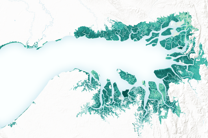
Mangrove forests are among the planet’s best carbon scrubbers.
Published Feb 27, 2019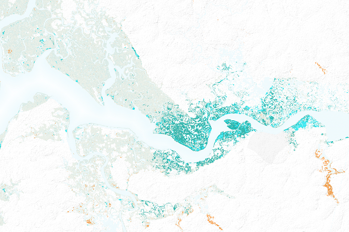
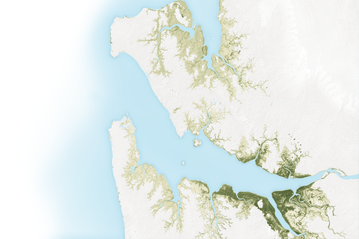
After decades of decline, satellites show mangrove forests are covering more area and growing more densely in this West African country.
Published Mar 21, 2018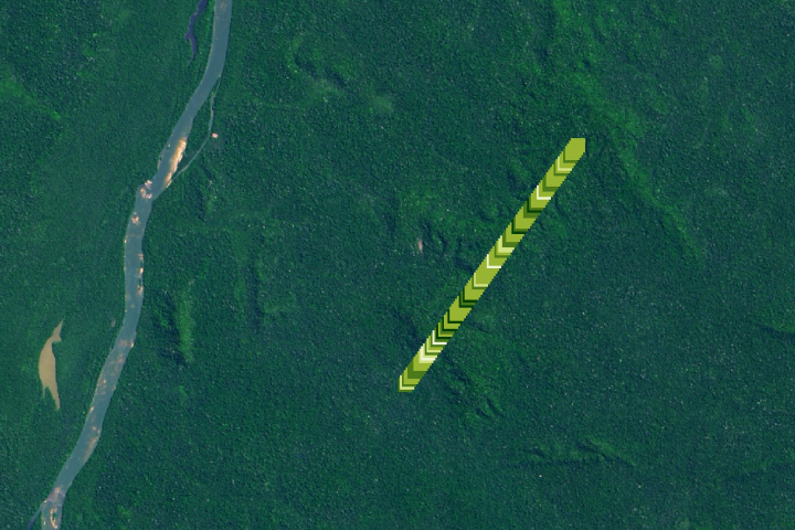
The amount of carbon that is being stored by trees and how it has changed over time is the least understood aspect of the global carbon cycle.
Published Jan 27, 2020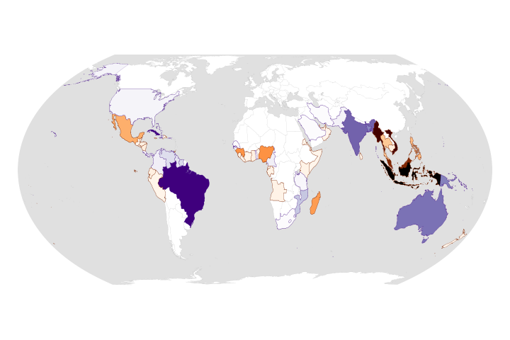
While the rate of losses has declined, the ecosystems are still threatened and are facing more environmental stress.
Published Aug 25, 2020Image of the Day Land Life Water Human Presence Remote Sensing
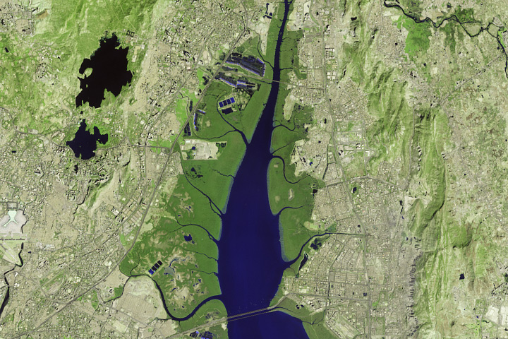
Satellites offer some needed perspective on the status of vulnerable mangrove forests along the Indian city’s many waterways.
Published Nov 30, 2017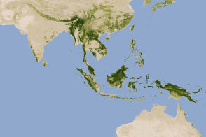
New maps show an estimate of the carbon stored in tropical forests and how sure scientists are about those estimates.
Published Jan 18, 2012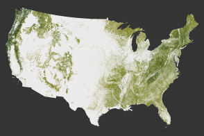
The National Biomass and Carbon Dataset reveals the location and the carbon storage of forests in the United States.
Published Jan 11, 2012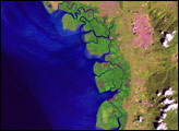
A new map of the biomass in the United States allows scientists and land managers to see tree cover down to the scale of individual plots of land.
Published Feb 17, 2012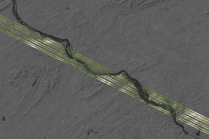
Spaceborne laser observations show fine details of forests and land topography.
Published Apr 15, 2019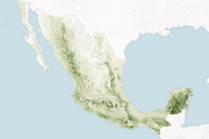
Mapping the density and location of tree cover can help the nation reduce deforestation and offset carbon emissions.
Published Nov 5, 2015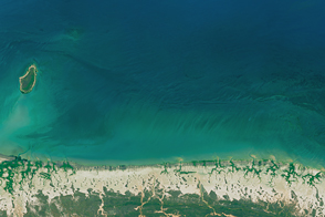
Record-high temperatures and reduced rainfall have decimated the trees and shrubs along the northern coast.
Published Aug 10, 2016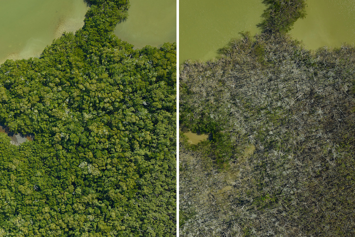
A research team flew over the Everglades and found that an estimated 60 percent of their mangrove study areas were heavily or severely damaged by hurricanes in 2017.
Published Apr 19, 2018
Differences in how international and national institutions classify forests can lead to large discrepancies in measurements of land cover.
Published Nov 17, 2015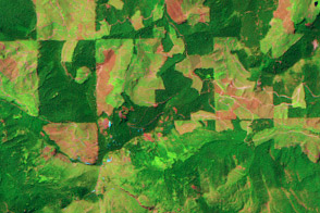
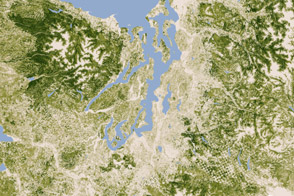
This pair of images show patterns of forest clearing and regrowth in Wasghington state over 26 years. Such images help scientists understand how human decisions impact the carbon cycle and Earth’s climate.
Published Jul 5, 2011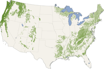
From the Pacific Northwest—home of the towering redwoods&mdash to the Southern Appalachians, this map shows forest canopy heights across the United States.
Published Jul 22, 2010