Parts of the Mississippi are swollen and spilling over its banks due to late December rains that are now flowing downstream.
Published Jan 5, 2016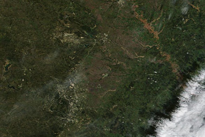
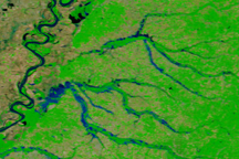
Muddy and swollen rivers are visible around Austin, Texas in the wake of flash floods.
Published Nov 1, 2013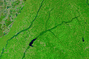
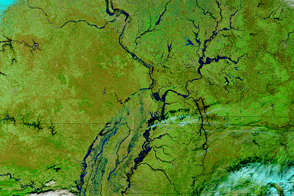
The Terra satellite acquired this false-color image of the swollen Pearl and Big Black rivers after passing storms triggered flooding.
Published Apr 11, 2014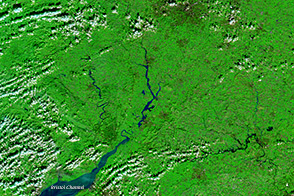
A series of rainstorms pushed rivers in southern Great Britain to flood stage in February 2014.
Published Feb 17, 2014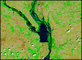
The landscape of Tennessee is marbled blue in this false-color satellite image from May 4, 2010, revealing extensive flooding.
Published May 6, 2010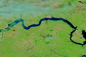
Acquired June 1, 2011, and June 4, 2010, these false-color images compare parts of the Missouri and Souris Rivers.
Published Jun 2, 2011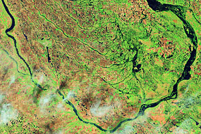
Acquired June 1, 2011, and July 2, 2002, these false-color images compare conditions along the Souris River in North Dakota.
Published Jun 6, 2011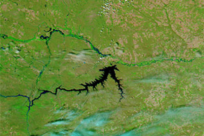
Acquired June 5, 2011, and June 16, 2010, these false-color images compare conditions along the Milk, Souris, and Missouri Rivers in Montana and North Dakota.
Published Jun 6, 2011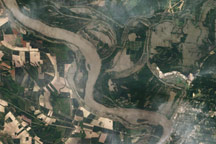
Acquired May 18, 2011, this natural-color image shows flooding along the Mississippi and Yazoo Rivers near Vicksburg, Mississippi.
Published May 19, 2011