Satellite data shows that water levels in Iraq’s largest reservoir have reached heights not seen in more than a decade.
Published May 8, 2019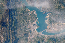
This image from April 15, 2009, is one of the first images that astronauts on the International Space Station have been able to capture of the flooding behind the Three Gorges Dam in China.
Published Jun 8, 2009
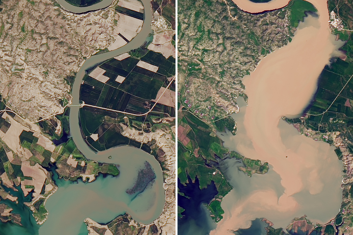
A series of winter storms have pushed reservoirs in the Sacramento Valley to the brim—and one dam to the breaking point.
Published Feb 14, 2017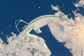
The vast dam in southern Egypt is one of the largest earthen embankment dams in the world.
Published Jun 8, 2015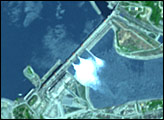
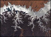
One of the world’s largest artificial lakes, Lake Nasser is named after the Egyptian President Gamal Abdul Nasser, who is largely responsible for the lake’s creation. President Nasser decided to build the Aswan High Dam across the Nile, forming a lake approximately 550 kilometers (340 miles) long.
Published Nov 3, 2005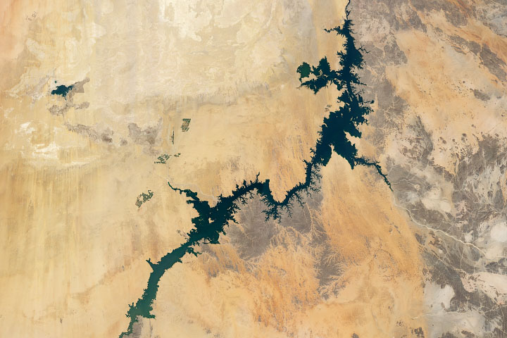
Irrigation from Lake Nasser, one of the world’s largest man-made lakes, has increased the amount of arable land and crop production in Egypt.
Published Jul 8, 2020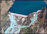
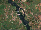
The Indus River basin extends from the Himalaya Mountains that form the northeastern boundary of Pakistan to the alluvial plains of Sindh near the Arabian Sea coastline. Tarbela Dam is part of the Indus Basin Project, which resulted from a water treaty signed in 1960 between India and Pakistan. This treaty guaranteed Pakistan water supplies independent of upstream control by India. Designed primarily for water storage rather than power generation, the dam was completed in 1977. Turquoise waters of the Indus River (to the south of the dam) reflect the high proportion of silt and clay suspended in waters released by the spillways.
Published May 30, 2005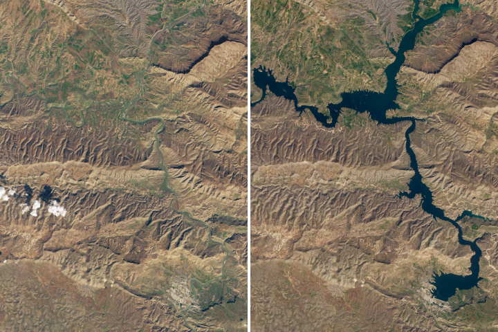
The 12,000-year old town of Hasankeyf could soon be underwater due to the construction of a new dam.
Published Mar 17, 2020