The Golden State’s largest reservoir has warmed and become depleted over the past decade.
Published Jun 26, 2015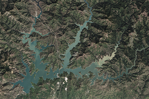
After four years of shrinking due to drought, the largest reservoir in California got a much-needed boost from El Niño-fueled winter precipitation.
Published Apr 7, 2016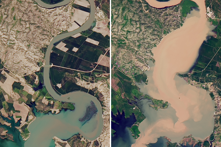
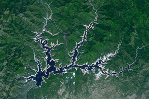
Satellite data shows that water levels in Iraq’s largest reservoir have reached heights not seen in more than a decade.
Published May 8, 2019
Reservoirs, lakes, and mountainsides are brimming with water and snow, though scientists caution that underground aquifers are a long way from having the same bounty.
Published Apr 21, 2017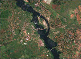

Ongoing drought and diminished snowpack in the Rockies have combined with increasing demands downstream to cause the great reservoir to drop to historically low levels.
Published Aug 1, 2014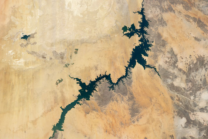
Irrigation from Lake Nasser, one of the world’s largest man-made lakes, has increased the amount of arable land and crop production in Egypt.
Published Jul 8, 2020
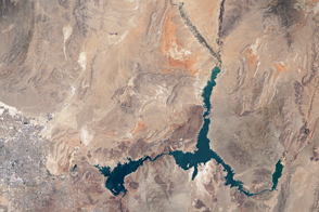
In May 2016, the reservoir behind Hoover Dam reached its lowest level since the 1930s.
Published May 27, 2016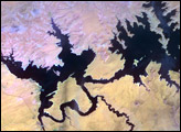
In the 1950s, construction began on the Glen Canyon Dam on the Colorado River in northern Arizona. The dam created Lake Powell: a long, skinny, meandering reservoir straddling the Arizona-Utah border. Ingenuity of human design, however, did not protect this massive reservoir from the drought that struck much of the southwestern United States between 2000 and 2007.
Published Oct 17, 2007
The water within a large, key reservoir in the southwestern United States has fallen to levels not seen since the 1930s.
Published Aug 18, 2015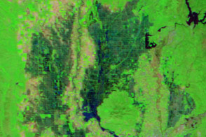
Water flowed into Yolo Bypass, a floodway between Davis and Sacramento, for the first time in three years.
Published Mar 19, 2016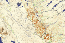
Dark brown squares mark fields that would ordinarily support irrigated crops in California’s Central Valley in this vegetation image. In 2009, a lack of water meant that the crops were not growing well or the fields lay fallow.
Published Aug 16, 2009