Thick ice that used to last through multiple summers has been in steep decline for three decades.
Published Mar 1, 2012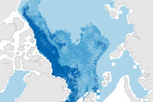
This pair of maps shows how the sea ice covering the Arctic at winter maximum in 2009 is younger than it was in the past.
Published Apr 10, 2009
The amount of Arctic Ocean covered by ice was significantly more than the record low of 2012, but still well below the long-term average.
Published Sep 21, 2013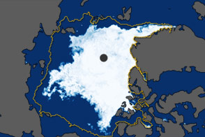
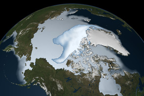
In September 2011, the extent of sea ice covering the Arctic Ocean declined to the second-lowest extent on record.
Published Oct 5, 2011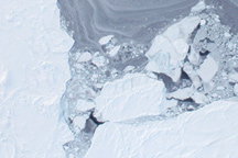
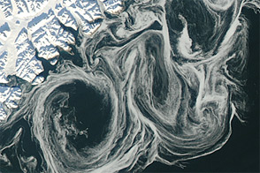
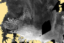
Taken from a low-flying airplane on March 26, 2011, these detailed photos of Arctic sea ice show the richly varied texture in the ice floe.
Published Apr 1, 2011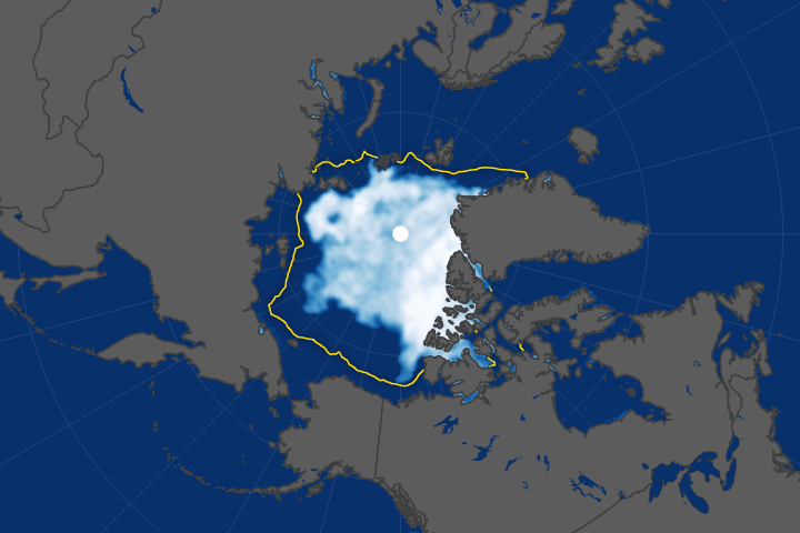
Arctic sea ice has been retreating the fastest in the Beaufort Sea.
Published Oct 18, 2017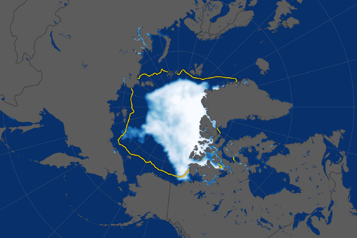
The ice cap tied for the sixth lowest extent on record, continuing a long-term decline.
Published Sep 28, 2018Image of the Day Water Snow and Ice Remote Sensing Sea and Lake Ice
Thin sea ice swirled along the east coast of Greenland in October 2012, against a backdrop of overall thinning sea ice.
Published Oct 27, 2012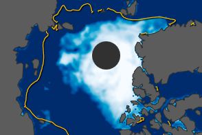
On August 26, 2012, Arctic sea ice broke all previous records weeks ahead of the end of melt season.
Published Aug 28, 2012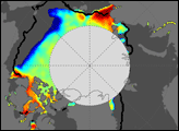
A new NASA analysis has quantified for the first time the amount of “multi-year” ice that is being lost from the Arctic Ocean due to melting as opposed to export.
Published Nov 10, 2010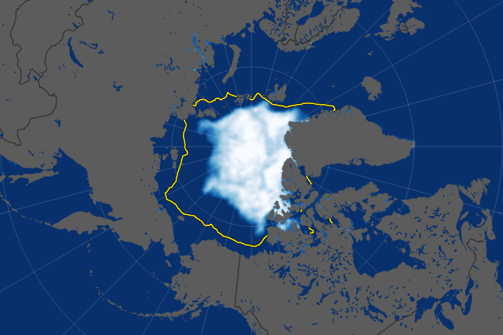
The long-term trend for Arctic sea ice extent has been definitively downward.
Published Sep 23, 2019Image of the Day Heat Water Snow and Ice Remote Sensing Sea and Lake Ice

The 2014 arctic sea ice minimum is the sixth lowest on record, while antarctic sea ice continues to exceed the record maximum extent.
Published Sep 24, 2014