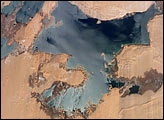
Nearly six years of regional drought and rapidly increasing demand for water have resulted in decreasing water levels in lakes throughout East Africa. The flooded regions of the Toshka Lakes west of Lake Nasser have decreased greatly over the years, exposing the former dune fields, and leaving a “bath-tub ring” of wetlands (dark region) surrounding the lake shorelines.
Published Jan 9, 2006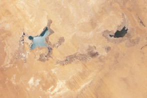
Between 2002 and 2012, water levels dropped significantly in these manmade lakes in the Sahara.
Published Jul 16, 2012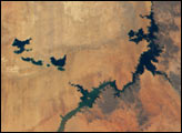
This astronaut photograph features one of the largest of a series of ten mostly fresh water lakes in the Ounianga Basin in the heart of the Sahara Desert of northeastern Chad.
Published Nov 30, 2009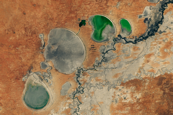
The Menindee Lakes in New South Wales are facing extremely low water levels.
Published Feb 26, 2019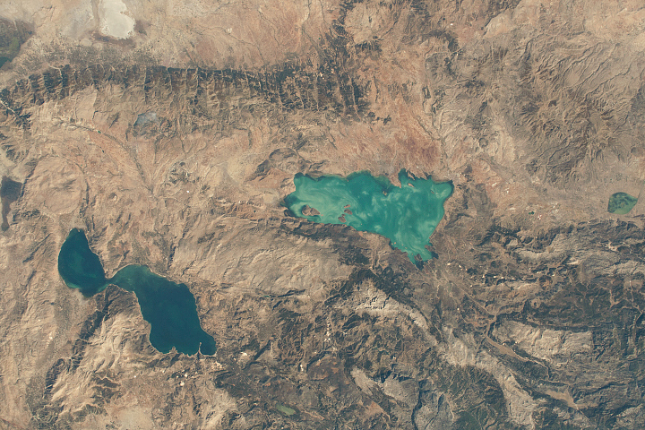
Two of the largest freshwater lakes in Turkey sit on the Anatolia Plateau.
Published Jan 26, 2020
Researchers are using satellite data to measure lake water quality and clarity of the lakes in the Upper Midwest.
Published Mar 16, 2002
Fine particles of pulverized rock absorb and scatter sunlight in ways that can give water a striking blue-green color.
Published May 20, 2019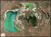
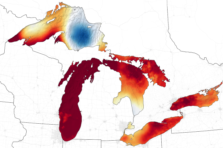
Just a few months after an unusually warm winter with minimal ice, the surface temperatures of the lakes are now near or above records.
Published Jul 16, 2020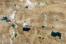
Acquired November 10, 2010, this natural-color image shows assorted lakes of the Qinghai-Tibet Plateau in iridescent hues of blue, green, and teal.
Published Nov 26, 2010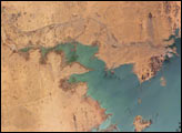
Heavy rains in the source regions of the Nile in the 1990s resulted in record water levels in Lake Nasser. In 1997, Lake Nasser began flooding westward down a spillway into the Toshka depression in southern Egypt, creating four new lakes over the next few years.
Published Jan 2, 2006
Bosten Lake, one of the largest inland lakes in China, and the Kaidu River have made this dry landscape habitable.
Published Aug 22, 2016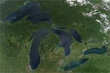
Late August 2010 provided a rare satellite view of a cloudless summer day over the entire Great Lakes region of North America.
Published Sep 7, 2010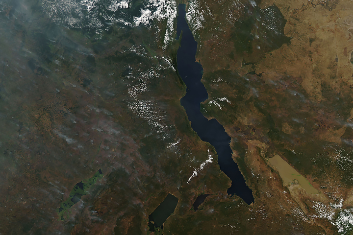
Long and short. Deep and shallow. Salty and fresh. Blue and brown. These are Africa’s Lake Tanganyika and Lake Rukwa.
Published Jun 20, 2019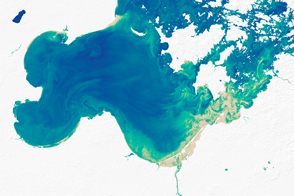
When leaves, roots, or bark disintegrates in water, that changes the color of a river or lake, much like a adding a teabag to hot water.
Published Oct 25, 2016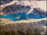
Har Nuur (“Black Lake”) is located in western Mongolia’s Valley of Lakes, part of a system of closed basins stretching across central Asia. These basins are the remnants of larger paleolakes (paleo- means “ancient”) that began to shrink approximately five thousand years ago as regional climate became drier. This oblique (looking at an angle) astronaut photograph captures the dynamic nature of the landscape of Har Nuur. The lake is encircled by sand dune fields that encroach on the lower slopes of the Tobhata Mountains to the west and south. Gaps in the mountains have been exploited by sand dunes moving eastward, indicating westerly winds. The most striking example is a series of dunes entering Har Nuur along its southwestern shoreline.
Published Oct 16, 2006