False-color images reveal the hot spots and charred land left behind by the fire.
Published Jul 25, 2016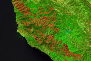
Burning since late July, the Soberanes fire in California has left an extensive mark on the landscape.
Published Sep 21, 2016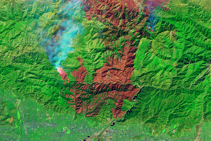
The fire is among the largest Los Angeles County has ever faced.
Published Sep 23, 2020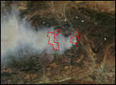
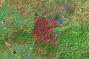
This false-color image illustrates the extent of the Station Fire in southern California.
Published Sep 15, 2009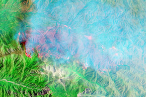
California’s Lake fire spread across a part of the national forest that rarely burns.
Published Jun 23, 2015
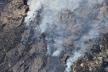
A wildfire burning in Los Padres National Park charred more than 500 acres—including the home of Big Sur’s fire chief.
Published Dec 17, 2013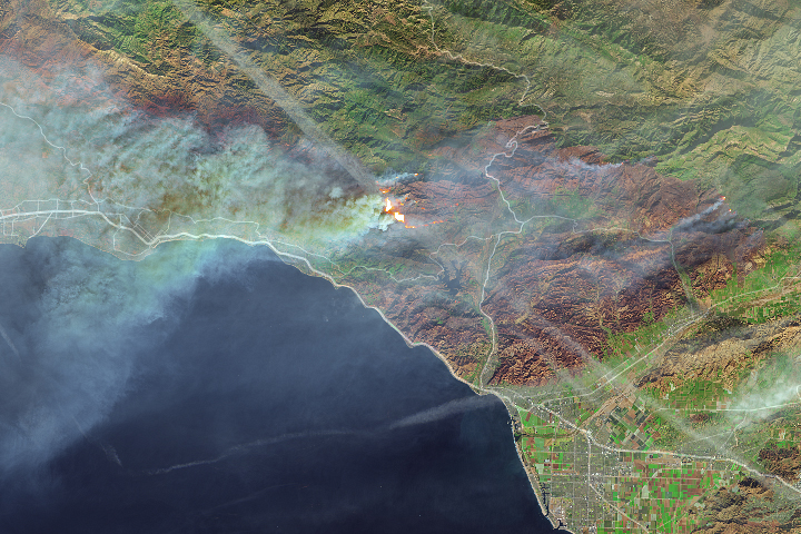
Thick smoke from the blaze blanketed Santa Barbara.
Published Dec 11, 2017
An expansive, destructive wildfire north of Los Angeles is visible from space by day and night.
Published Jun 28, 2016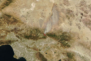
Dry, windy weather intensified the blaze near San Bernardino.
Published Aug 17, 2016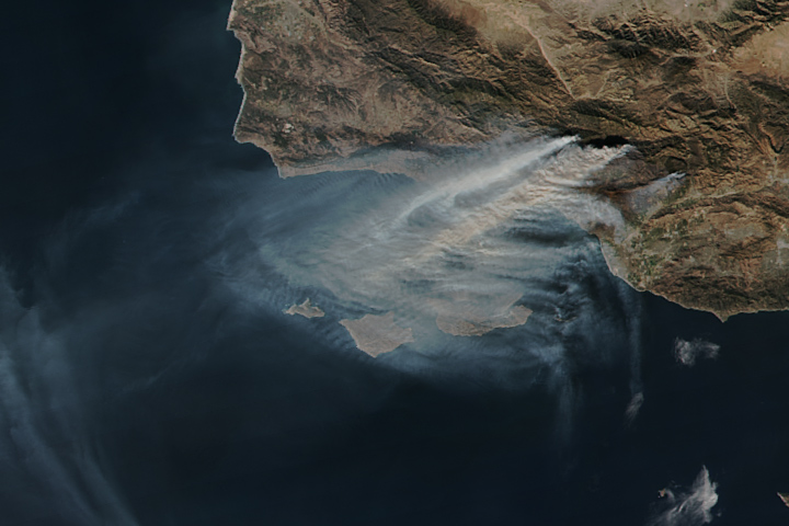
The Thomas fire is now the fourth largest wildfire on record in California.
Published Dec 15, 2017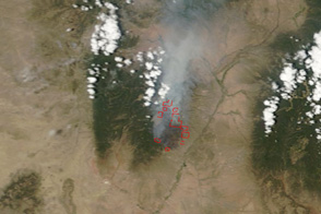
This pair of images shows the Las Conchas Fire burning near the western edge of Los Alamos National Laboratory on June 29, 2011.
Published Jun 30, 2011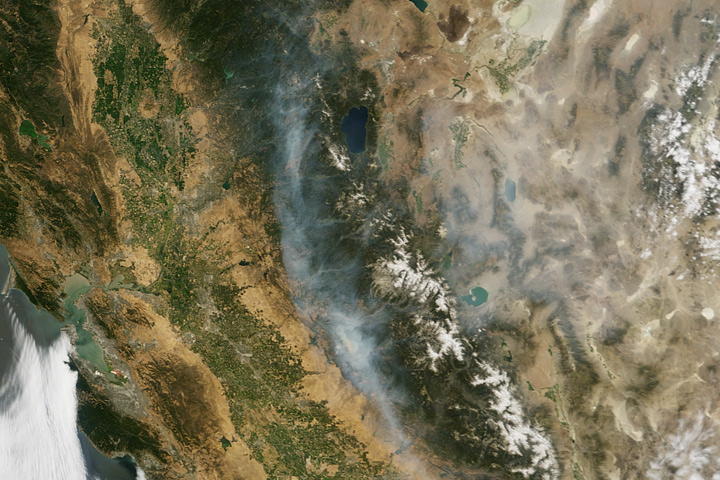
Wildfire struck rugged woodlands near Yosemite, causing sporadic evacuations of nearby towns and spreading smoke as far as Idaho.
Published Jul 22, 2017
The Thomas fire has set new records while ravaging several communities.
Published Dec 24, 2017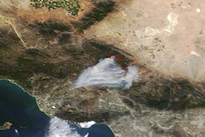
A wildfire burned in steep terrain north of Los Angeles near Palmdale on May 31, 2013.
Published Jun 3, 2013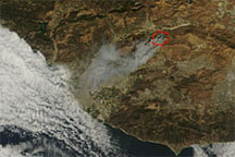
Acquired shortly before noon local time on September 22, 2009, this true-color image shows smoke from the Guiberson Fire blowing southwestward toward the Pacific coastline. A red outline gives the rough perimeter of the fire.
Published Sep 23, 2009