The old river has cut compelling patterns and formations into the red rocks of Utah.
Published Sep 18, 2018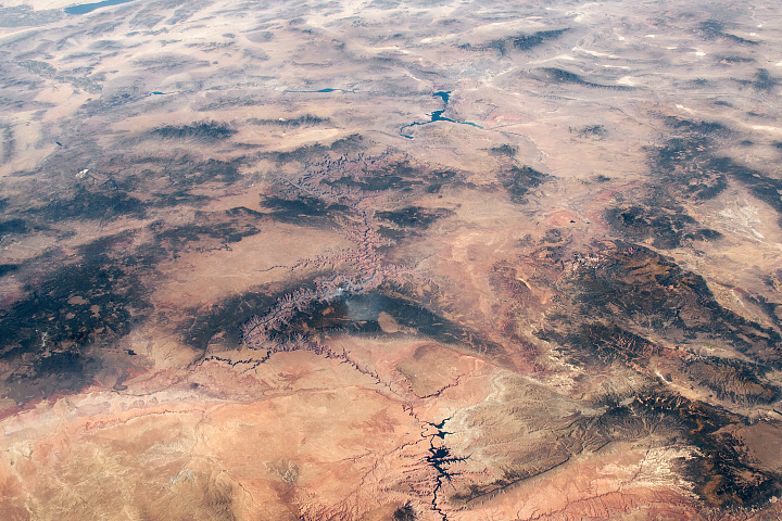
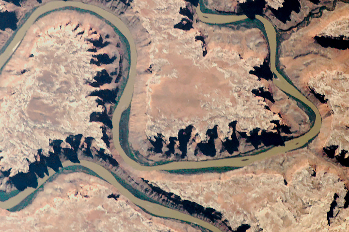
Ancient geologic features and modern creations share the spotlight in this photo of southeastern Utah and northern Arizona taken from the ISS.
Published Feb 23, 2020
Man and nature have both altered the course of a southwestern U.S. river.
Published May 21, 2012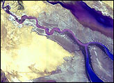
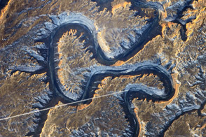
The Green River in eastern Utah once carved soft sediment into meanders on a floodplain. Then the land and mountains rose and the river dug deep, preserving those meanders in stone.
Published Mar 17, 2014
The geology of the Grand Canyon has amazed visitors since John Wesley Powell first navigated the Colorado River in 1869. Now the Landsat Data Continuity Mission (LDCM) offers a new view of the gorge.
Published Apr 20, 2013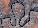
The image shows Goosenecks State Park, where the river is surrounded by canyon walls more than 1,000 feet high.
Published May 13, 2005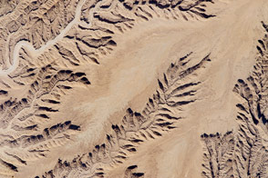
A low sun angle add three-dimensional relief to a flat landscape in the desert.
Published Dec 14, 2015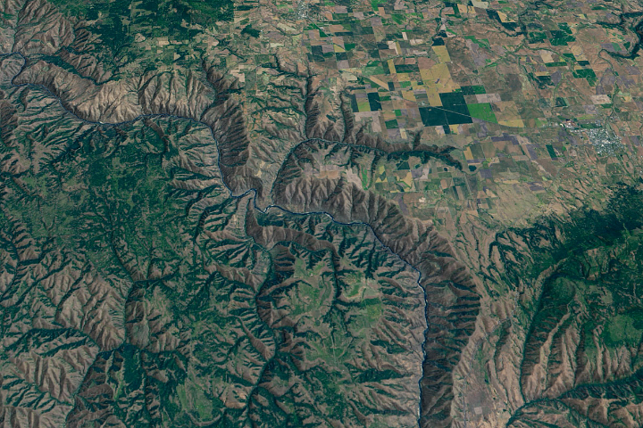
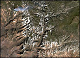
The Salmon River in Idaho, one of the longest free-flowing rivers in the United States, rushes through a geologic wonderland of wooded ridges, eroded bluffs, and stone towers and crags.
Published Jul 22, 2020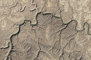
The eastern section of the Rio Grande Wild and Scenic River runs deep through the desert wilderness.
Published Jun 11, 2016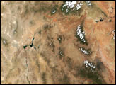

Parts of the Glen Canyon that John Wesley Powell explored in 1869 have been submerged by Lake Powell.
Published Oct 16, 2016
Floods and new infrastructure have long since separated the distinctive bend in the river that was portrayed by landscape painter Thomas Cole in 1836.
Published Oct 15, 2017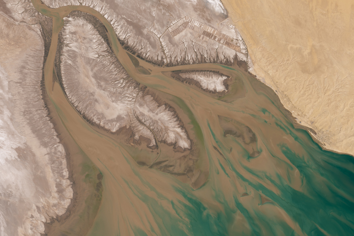
With so much of its water diverted, the Colorado River Delta has dried out and lost much of its vegetation and wildlife.
Published Jun 18, 2020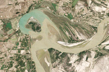
Between 1992 and 2009, a section of the lower Indus River changes course following the formation of an oxbow lake.
Published May 9, 2010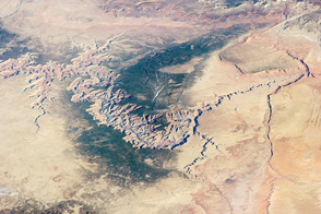
You can almost sense the invisible tectonic forces within the Earth when you look at this geological icon from space.
Published Apr 14, 2014

A satellite image offers inky evidence of the organic-rich freshwater that the Suwannee River delivers to the Gulf of Mexico.
Published Oct 27, 2018
Black Canyon of the Gunnison National Park is a small park that encompasses the steep-walled canyons of the Gunnison River, which drains snowmelt from the Rocky Mountains in western Colorado.
Published Oct 2, 2005
Acquired May 1, 2011, this natural-color image shows the James River completely filling the river valley near Jamesville, South Dakota.
Published May 3, 2011