After decades of decline, satellites show mangrove forests are covering more area and growing more densely in this West African country.
Published Mar 21, 2018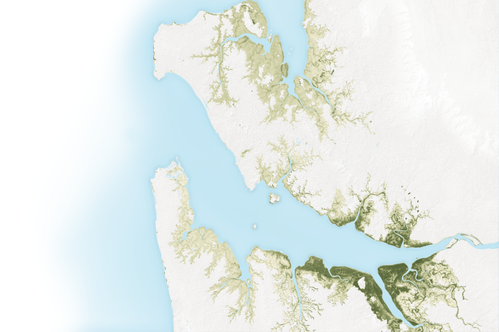
The mangroves in Pongara National Park are among the tallest in the world, towering up to 60 meters.
Published May 19, 2017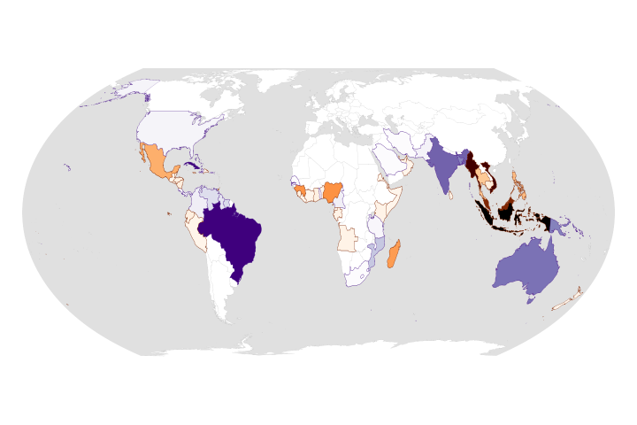
While the rate of losses has declined, the ecosystems are still threatened and are facing more environmental stress.
Published Aug 25, 2020Image of the Day Land Life Water Human Presence Remote Sensing
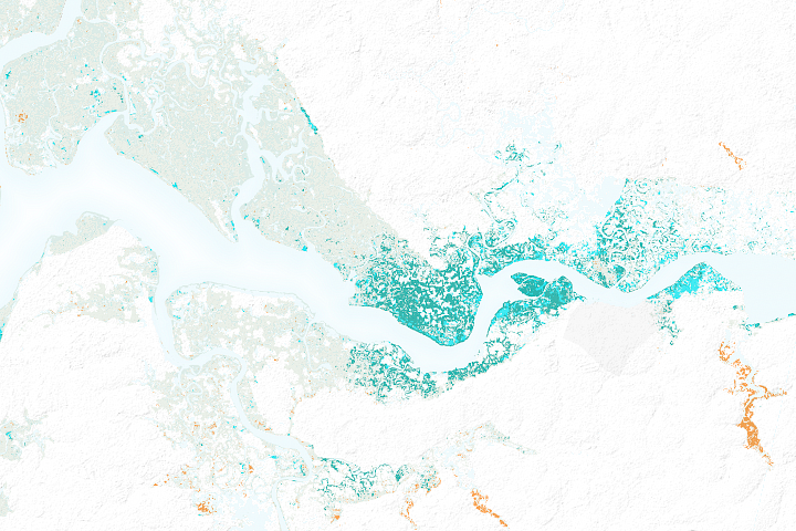
Satellites offer some needed perspective on the status of vulnerable mangrove forests along the Indian city’s many waterways.
Published Nov 30, 2017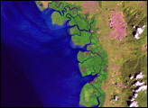
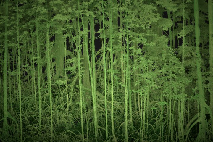
Scientists use lasers and cameras to characterize the 3D structure of mangrove forests in Gabon.
Published Jun 1, 2017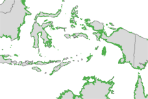
Mangroves are among the most biologically important ecosystems on the planet and a common feature of tropical and sub-tropical coastlines. Scientists have used satellite imaging to compile the most detailed map of the extent of mangroves worldwide.
Published Nov 30, 2010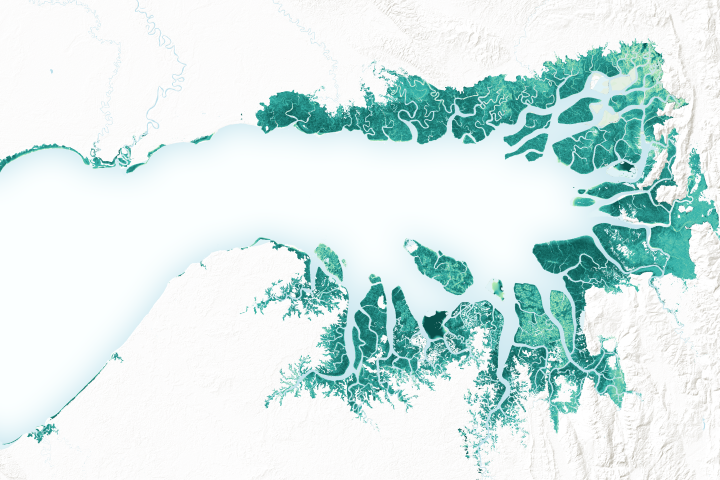
Mangrove forests are among the planet’s best carbon scrubbers.
Published Feb 27, 2019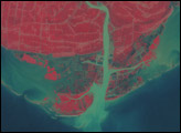
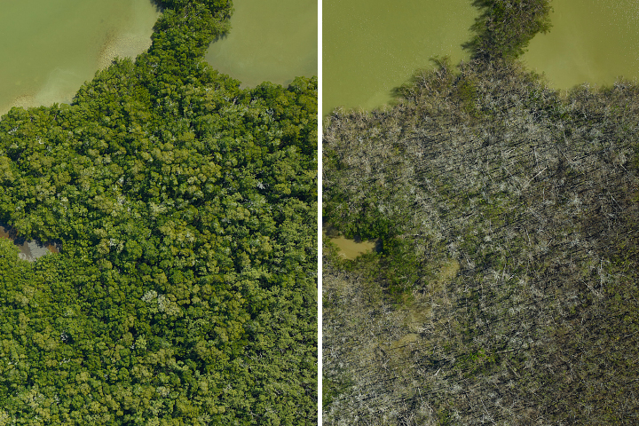
A research team flew over the Everglades and found that an estimated 60 percent of their mangrove study areas were heavily or severely damaged by hurricanes in 2017.
Published Apr 19, 2018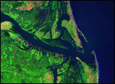

By changing a percentage, institutions can take some forested lands off the map.
Published Dec 18, 2015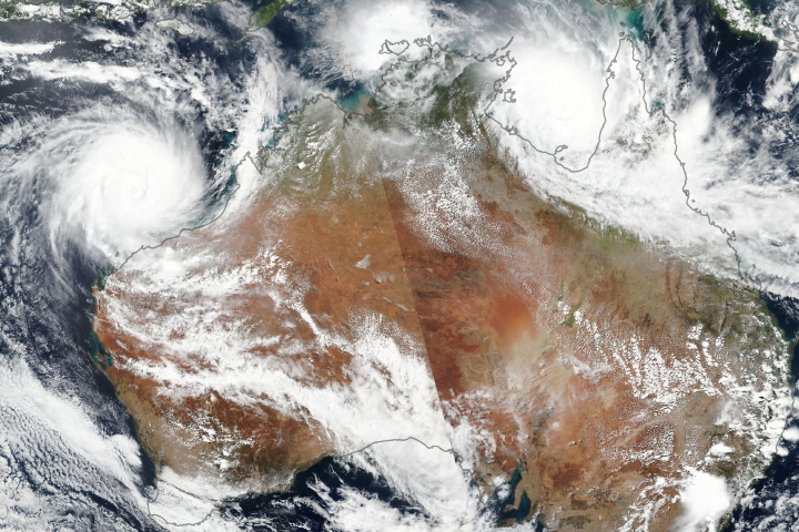
Evacuations have been made in Northern Territory as residents brace for fierce winds and flooding rain.
Published Mar 23, 2019
Climate change could lead to a net loss of plant life in some regions, and also could change the ratio of species that grow in them.
Published Oct 17, 2019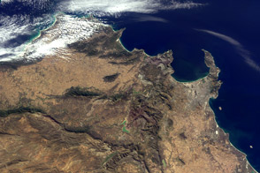
Play geographical detective: Where on Earth is this image?
Published Jul 29, 2011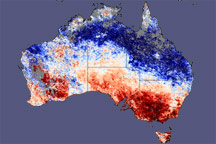
A broad swath of above-average land surface temperatures stretched across southern Australia in late January and early February 2009.
Published Feb 5, 2009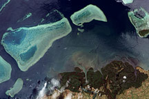
Deep green forest on land and the delicate turquoise coral reef in the ocean mirror each other in this true-color image of Viti Levu, Fiji, from December 18, 2009.
Published Dec 26, 2009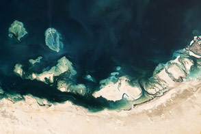
The United Arab Emirates coast is home to complex assortment of natural features.
Published Apr 13, 2013