A new NASA project improves landslide inventories with data from the public.
Published Jul 11, 2019
In parts of Africa and South America, landslides are happening even if you rarely hear of them.
Published Apr 6, 2017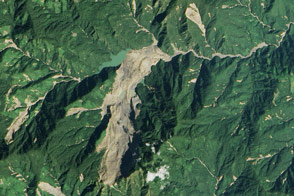
Heavy rainfall from tropical storm Komen triggered a large landslide in Myanmar (Burma).
Published Nov 8, 2015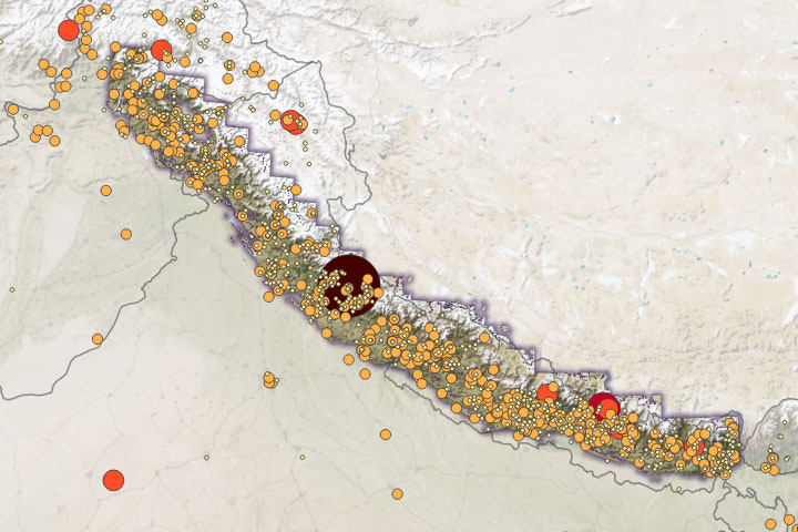
Warming temperatures will likely cause more intense rainfall, leading to increased landslide activity.
Published Feb 12, 2020Image of the Day Atmosphere Land Water Human Presence Snow and Ice Remote Sensing
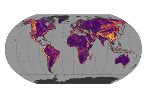
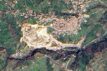
Steep slopes, roads, underlying geology, and forest loss can all make landslides more likely.
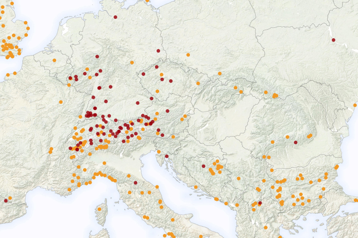
Published Mar 30, 2017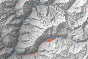
A multinational team is trying to map landslide hazards in Nepal before the summer monsoon adds to the region’s misery.
Published Jun 4, 2015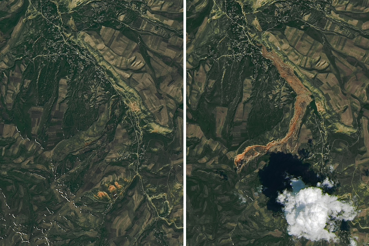
Debris spread more than 3 kilometers (2 miles) from the source to the toe of the landslide.
Published May 22, 2017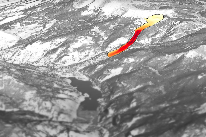
Through the study of an unusual, long-lasting slide, has developed a new technique to make prediction easier and more accurate.
Published Jun 5, 2020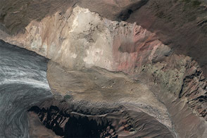
A combination of seismographic data and satellite imagery is making it easier for scientists to locate elusive landslides. In summer 2013, Landsat 8 helped pinpoint a slide in eastern Alaska.
Published Aug 30, 2013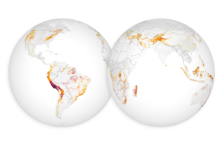
For the first time, scientists can examine rain–induced landslide threats anywhere around the world every 30 minutes.
Published Apr 18, 2018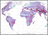
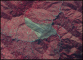
A pale tan scar in this natural-color image from March 14, 2010, marks the location of a landslide outside the southern Italian town of Maierato.
Published Mar 17, 2010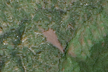
Freshly exposed earth traces down the slope of Mount Elgon in Uganda where a large landslide buried three villages on March 2, 2010. This cloud-free, natural color image is from March 11.
Published Mar 13, 2010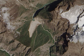
Debris from an earthquake-induced landslide has dammed a river in Nepal.
Published May 7, 2015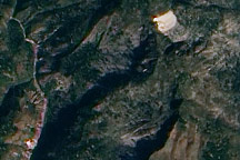
This true-color image from January 15, 2010, highlights potential new landslides near the epicenter of Haiti’s massive 7.0 earthquake.
Published Jan 19, 2010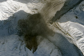
Using seismometers and satellites, scientists identified a large landslide in southwestern Yukon.
Published Oct 20, 2015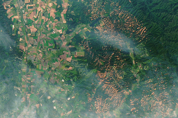
A powerful earthquake triggered hundreds of landslides on the Japanese island.
Published Oct 2, 2018