
Natural vegetation and irrigated farmland along the Snake River Plain in Idaho use dramatically different amounts of water during the growing season.
Published Jan 26, 2010
An arid region grew even drier between 2003 and 2009 due to human consumption of water for drinking and agriculture.
Published Mar 13, 2013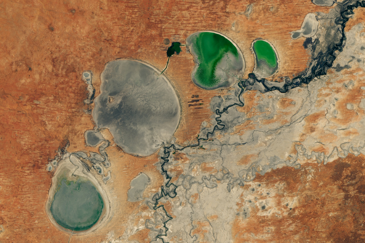
The Menindee Lakes in New South Wales are facing extremely low water levels.
Published Feb 26, 2019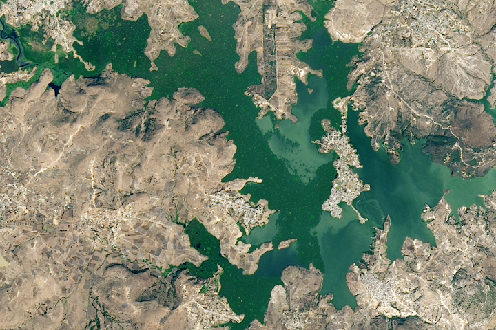
A new study found that the abundance of these floating plants has increased due to urbanization.
Published Sep 2, 2020

For more than 100 years, groups in the western United States have fought over water. During the 1880s, sheep ranchers and cattle ranchers argued over drinking water for their livestock on the high plains. In 1913, the city of Los Angeles began to draw water away from small agricultural communities in Owen Valley, leaving a dusty dry lake bed. In the late 1950s, construction of the Glen Canyon Dam catalyzed the American environmental movement. Today, farmers are fighting fishermen, environmentalists, and Native American tribes over the water in the Upper Klamath River Basin. The Landsat 7 satellite, launched by NASA and operated by the U.S. Geological Survey, documented an extreme drought in the area along the California/Oregon border in the spring of 2001.
Published Sep 8, 2001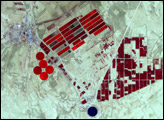
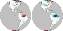
In much of the world, differences in seasonal precipitation—and in how that water gets stored on land—are big enough to affect Earth’s gravity field.
Published Oct 22, 2010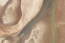
Acquired on April 10, 2010, and and March 7, 2009, these natural-color images show changes in a central Australian saltpan, Lake Frome. In 2010, water has seeped into the salt lake, leaving standing water in some areas and muddying much of the ground surface.
Published Apr 14, 2010
Groundwater supplies are decreasing across much of the world.
Published Nov 1, 2013
The fast-growing city has polluted waterways and a growing demand for clean tap water.
Published Apr 11, 2017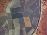
Sections of Australia have been experiencing their worst drought in 100 years. Astronauts aboard the International Space Station documented conditions in Australia in 2002, including these images of Lake Tandou in the Menindee Lake system along the Darling River. The Menindee Lakes are part of an innovative water conservation project. This lakebed is protected from flooding and is used for agriculture—primarily cotton, sunflower and grains. It is one of several interconnected lakes that sit along the lower Darling River like a string of pearls. Other lakes function as water capture reservoirs to support controlled water flow for environmental and agricultural needs down river, and to provide flood mitigation.
Published Dec 1, 2002