Measurements from OCO-2 will provide a baseline for monitoring changes in emissions.
Published Nov 17, 2016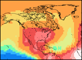
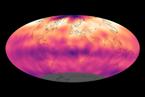
Atmospheric carbon dioxide concentrations reached record levels in 2013.
Published Sep 27, 2013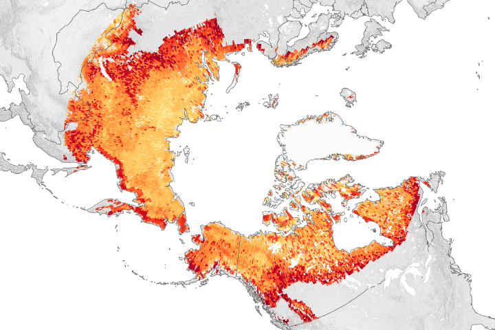
As global and regional warming continues, winter emissions of carbon dioxide from Arctic lands are offsetting what plants absorb in the summer.
Published Nov 19, 2019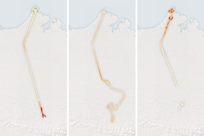
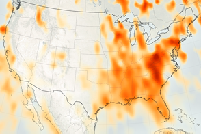
NASA aerial campaigns monitor the gases leaking from Alaskan permafrost for signs of change.
Published Apr 12, 2016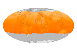
NASA’s Orbiting Carbon Observatory-2 has compiled its first year of data and started quantifying the cycles of emission and absorption of the greenhouse gas.
Published Dec 12, 2015
Fires in Alaska, Siberia, and Greenland have emitted large amounts of black carbon this summer.
Published Jul 31, 2019
The Orbiting Carbon Observatory (OCO-2) may help scientists answer key questions about how carbon cycles between Earth’s atmosphere, ocean, and land.
Published Jul 3, 2014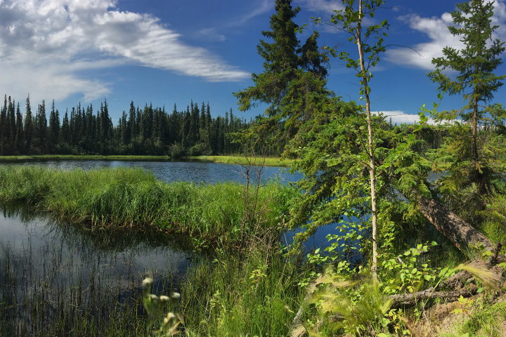
Rapid growth from 2008–2017 built upon the rise in the atmospheric concentration of the gas that has been happening for more than a century.
Published Jul 15, 2020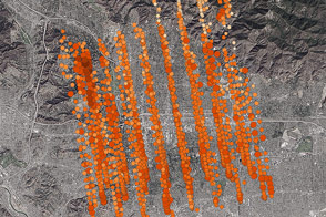
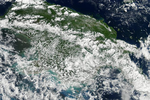
NASA’s new Orbiting Carbon Observatory-2 calibrated its sensors by taking data from an area where ground stations could provide ground truth.
Published Nov 7, 2014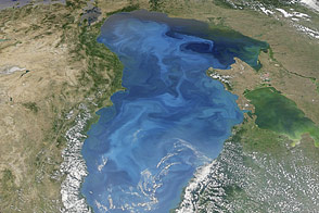
Satellites observe a massive bloom of coccolithophore plankton in July 2012.
Published Jul 31, 2012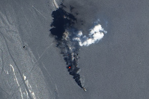
Daytime and nighttime satellite imagery shows the burning of methane that goes together with the oil extraction process.
Published Sep 14, 2012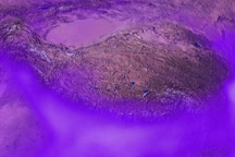
Model simulations track the movement of black soot pollution over the Tibetan Plateau from August–November 2009. This image shows haze on September 26, 2009.
Published Dec 15, 2009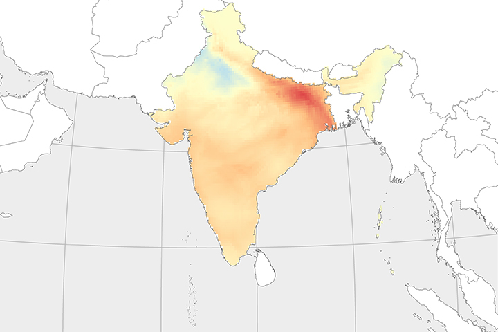
Wind patterns in October and November each year carry air pollution from northern India to central parts of the country.
Published Jun 29, 2018Image of the Day Atmosphere Land Human Presence Remote Sensing
The Orbiting Carbon Observatory-2 will help scientists quantify the levels of carbon dioxide in the atmosphere.
Published Aug 12, 2014