
Reservoirs, lakes, and mountainsides are brimming with water and snow, though scientists caution that underground aquifers are a long way from having the same bounty.
Published Apr 21, 2017
In May 2016, the reservoir behind Hoover Dam reached its lowest level since the 1930s.
Published May 27, 2016
Ongoing drought and diminished snowpack in the Rockies have combined with increasing demands downstream to cause the great reservoir to drop to historically low levels.
Published Aug 1, 2014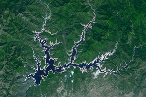
The Golden State’s largest reservoir has warmed and become depleted over the past decade.
Published Jun 26, 2015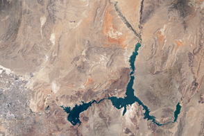
The water within a large, key reservoir in the southwestern United States has fallen to levels not seen since the 1930s.
Published Aug 18, 2015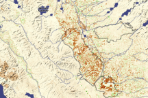
Dark brown squares mark fields that would ordinarily support irrigated crops in California’s Central Valley in this vegetation image. In 2009, a lack of water meant that the crops were not growing well or the fields lay fallow.
Published Aug 16, 2009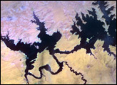
In the 1950s, construction began on the Glen Canyon Dam on the Colorado River in northern Arizona. The dam created Lake Powell: a long, skinny, meandering reservoir straddling the Arizona-Utah border. Ingenuity of human design, however, did not protect this massive reservoir from the drought that struck much of the southwestern United States between 2000 and 2007.
Published Oct 17, 2007
For more than 100 years, groups in the western United States have fought over water. During the 1880s, sheep ranchers and cattle ranchers argued over drinking water for their livestock on the high plains. In 1913, the city of Los Angeles began to draw water away from small agricultural communities in Owen Valley, leaving a dusty dry lake bed. In the late 1950s, construction of the Glen Canyon Dam catalyzed the American environmental movement. Today, farmers are fighting fishermen, environmentalists, and Native American tribes over the water in the Upper Klamath River Basin. The Landsat 7 satellite, launched by NASA and operated by the U.S. Geological Survey, documented an extreme drought in the area along the California/Oregon border in the spring of 2001.
Published Sep 8, 2001
Surging with fresh water from heavy winter snow melt, Lake Powell rose significantly in the summer of 2011 after many years of low levels.
Published Aug 12, 2011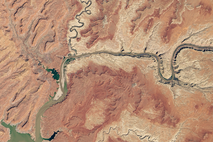
Heavy winter and spring snowfall provided much-needed meltwater, but the effects of long-term drought mean the lake is nowhere near its highs from the 1980s and 90s.
Published Oct 1, 2019
In August 2010, Lake Mead reached its lowest level since 1956, the result of a persistent drought and increasing human demand.
Published Sep 23, 2010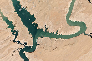
In spring 2014, visitors to Lake Powell will find beaches and rock formations that are usually underwater. After several years of drought, the reservoir has dropped below 50 percent capacity.
Published May 22, 2014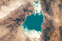
Pyramid Lake, in western Nevada, is a remnant of the ancient and much larger Lake Lahontan that formed during the last Ice Age.
Published Oct 18, 2010